
Colac is a small city in the Western District of Victoria, Australia, approximately 150 kilometres south-west of Melbourne on the southern shore of Lake Colac.

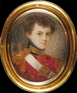
George Augustus Robinson was a British-born colonial official and self-trained preacher in colonial Australia. In 1824, Robinson travelled to Hobart, Van Diemen’s Land, where he attempted to negotiate a peace between European settlers and Aboriginal Tasmanians prior to the outbreak of the Black War. He was appointed Chief Protector of Aborigines by the Aboriginal Protection Board in Port Phillip District, New South Wales in 1839, a position he held until 1849.
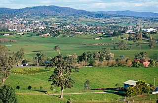
The Western District comprises western regions of the Australian state of Victoria. It is said to be an ill–defined district, sometimes incorrectly referred to as an economic region,. The district is located within parts of the Barwon South West and the Grampians regions; extending from the south-west corner of the state to Ballarat in the east and as far north as Ararat. The district is bounded by the Wimmera district in the north, by the Goldfields district in the east, by Bass Strait and the Southern Ocean in the south, and by the South Australian border in the west. The district is well known for the production of wool. The most populated city in the Western District is the Ballarat region, with 96,940 inhabitants.
Penshurst is a town in Victoria, Australia. It is in the Shire of Southern Grampians local government area and is located at the foot of Mount Rouse, an extinct volcano. At the 2006 census, Penshurst had a population of 461. Basic facilities include a hospital with an aged care residency and doctor's surgery, a pub, a hall and two schools – one a State school, the other a Catholic school – the State school has 10 students(2020), the Catholic school 26.

Port Fairy is a coastal town in south-western Victoria, Australia. It lies on the Princes Highway in the Shire of Moyne, 28 kilometres (17 mi) west of Warrnambool and 290 kilometres (180 mi) west of Melbourne, at the point where the Moyne River enters the Great Australian Bight.
Bega is a town in the south-east of New South Wales, Australia, in the Bega Valley Shire. It is the economic centre for the Bega Valley.

Lake Bolac is a town in the Western District region of Victoria, Australia. The town is on the shores of Lake Bolac, and the Glenelg Highway passes through the town. At the 2016 census, Lake Bolac and the surrounding area had a population of 330.
The office of the Protector of Aborigines was established pursuant to a recommendation contained in the Report of the Parliamentary Select Committee on Aboriginal Tribes, of the Parliamentary Select Committee on Aboriginal Tribes. On 31 January 1838, Lord Glenelg, Secretary of State for War and the Colonies sent Governor Gipps the report. The office of Chief Protector of Aborigines was established in some states, and in Queensland the title was Protector of Aboriginals.

William Thomas represented Aboriginal people in various roles in the Port Phillip district in Australia.
The Port Phillip Protectorate was created by the British House of Commons at the instigation of Lord Glenelg. The primary directives of the Protectors was to protect the Aboriginal people in their districts and to 'civilise' them, in other words to minimize conflicts between European settlers and Aboriginal people, and to help Aboriginal people take up the European way of life.

Caramut is a town in the Western District of Victoria, Australia on the Hamilton Highway. It is in the Shire of Moyne local government area and the federal Division of Wannon.

Glencoe is a town in South Australia, Australia, located 27 kilometres (17 mi) north-west of Mount Gambier. At June 2016, Glencoe had an estimated population of 661.
The Girai wurrung, also spelt Kirrae Wuurong and Kirrae Whurrung, are an Aboriginal Australian people who traditionally occupied the territory between Mount Emu Creek and the Hopkins River up to Mount Hamilton, and the Western Otways from the Gellibrand River to the Hopkins River. The historian Ian D. Clark has reclassified much of the material regarding them in Norman Tindale's compendium under the Djargurd Wurrung, a term reflecting the assumed pre-eminence of one of their clans, the Jacoort/Djargurd.
Ian D. Clark is an academic historian and Toponymist whose primary work has focused on Victorian Aboriginal history, aboriginal toponymy and the frontier conflict between Indigenous Australians and immigrant settlers during the European settlement of Victoria, Australia.
An Aboriginal reserve, also called simply reserve, was a government-run settlement for Aboriginal Australians, created under various state and federal legislation. Along with missions and other institutions, they were used from the 19th century to the 1960s to keep Aboriginal people separate from the white Australian population, for various reasons perceived by the government of the day. The Aboriginal reserve laws gave governments much power over all aspects of Aboriginal people’s lives.
Stephen George Henty was a farmer and politician in colonial Victoria, a member of the Victorian Legislative Council.

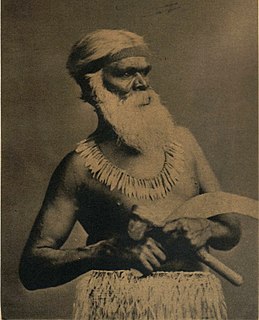
Tunnerminnerwait (c.1812–1842) was an Australian Aboriginal resistance fighter and Parperloihener clansman from Tasmania. He was also known by several other names including Peevay, Jack of Cape Grim, Tunninerpareway and renamed Jack Napoleon Tarraparrura by George Robinson.

Mount Schank is a locality in the Australian state of South Australia located about 385 kilometres south-east of the state capital of Adelaide and 14 kilometres south of the municipal seat of Mount Gambier in the south-east of the state.
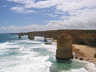
The Eumeralla Wars were the violent encounters over the possession of land between British colonists and Gunditjmara Aboriginal people in what is now called the Western District area of south west Victoria.
Charles Wightman Sievwright was a British army officer before being appointed Assistant Protector of Aborigines in part of the Port Phillip District of the colony of New South Wales, now Victoria, Australia.
