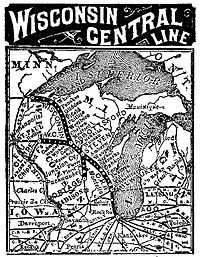
The original Wisconsin Central Railroad Company was a major early railroad of northern Wisconsin, building lines up through the forested wilderness, and opening large tracts to logging and settlement. It established stations which would grow into a string of cities and towns between Stevens Point and Ashland, including Marshfield and Medford, and it connected these places to Chicago and St. Paul. It played a major role in building Chicago's Grand Central Station.
Stevens Point is the county seat of Portage County, Wisconsin, United States. The city was incorporated in 1858.
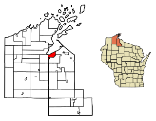
Ashland is a city in Ashland and Bayfield counties in the U.S. state of Wisconsin. The city is a port on Lake Superior, near the head of Chequamegon Bay. The population was 8,216 at the 2010 census, all of which resided in the Ashland County portion of the city. The unpopulated Bayfield County portion is in the city's southwest, bordered by the easternmost part of the town of Eileen.
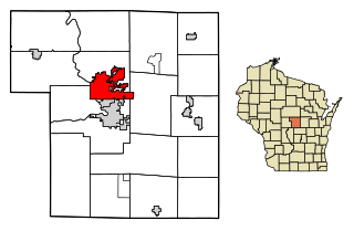
Marshfield is a city in Wood County and Marathon County in the U.S. state of Wisconsin. It is located at the intersection of U.S. Highway 10, Highway 13 and Highway 97. The largest city in Wood County, its population was 19,118 at the 2010 census. Of this, 18,218 were in Wood County, and 900 were in Marathon County. The city is part of the United States Census Bureau's Marshfield-Wisconsin Rapids Micropolitan Statistical Area, which includes all of Wood County. The portion of the city in Marathon County is part of the Wausau Metropolitan Statistical Area.
Despite these successes, it struggled financially from the start and was bankrupt by 1879. It was leased to the Northern Pacific Railway from 1889 to 1893 and was finally reorganized from bankruptcy in 1897 as the Wisconsin Central Railway.
The Northern Pacific Railway was a transcontinental railroad that operated across the northern tier of the western United States, from Minnesota to the Pacific Northwest. It was approved by Congress in 1864 and given nearly forty million acres of land grants, which it used to raise money in Europe for construction.
The US Wisconsin Central Railway Company was created in 1897 when the Wisconsin Central Railroad (1871–99) was reorganized from bankruptcy. In 1954, the name went back to Wisconsin Central Railroad Company. The railroad was merged into the Soo Line Railroad in 1961.
Background
1865 map of Wisconsin
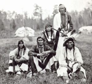
By the time of the Civil War the southern half of Wisconsin was somewhat settled. Much of the north, however, remained wilderness, including swaths of beautiful virgin timber[1] and deposits of iron ore. Treaties with Native Americans had placed most of this land in the hands of the federal government. Logging of the white pine had begun along the rivers, where the product could be floated out, but some stretches of timber stood far from large enough streams for river-logging. One such stretch lay between the Chippewa and Wisconsin Rivers
The American Civil War was a civil war fought in the United States from 1861 to 1865, between the North and the South. The most studied and written about episode in U.S. history, the Civil War began primarily as a result of the long-standing controversy over the enslavement of black people. War broke out in April 1861 when secessionist forces attacked Fort Sumter in South Carolina shortly after Abraham Lincoln had been inaugurated as the President of the United States. The loyalists of the Union in the North proclaimed support for the Constitution. They faced secessionists of the Confederate States in the South, who advocated for states' rights to uphold slavery.
Native Americans, also known as American Indians, Indigenous Americans and other terms, are the indigenous peoples of the United States, except Hawaii. There are over 500 federally recognized tribes within the US, about half of which are associated with Indian reservations. The term "American Indian" excludes Native Hawaiians and some Alaska Natives, while Native Americans are American Indians, plus Alaska Natives of all ethnicities. Native Hawaiians are not counted as Native Americans by the US Census, instead being included in the Census grouping of "Native Hawaiian and other Pacific Islander".
Pinus strobus, commonly denominated the eastern white pine, northern white pine, white pine, Weymouth pine (British), and soft pine is a large pine native to eastern North America. It occurs from Newfoundland, Canada west through the Great Lakes region to southeastern Manitoba and Minnesota, United States, and south along the Appalachian Mountains and upper Piedmont to northernmost Georgia and perhaps very rarely in some of the higher elevations in northeastern Alabama.
At that time, U.S. feelings toward Great Britain were not as warm as today. Britain was officially neutral during the Civil War, but many of the British elites sympathized with the Confederacy. This was only 50 years after the War of 1812, in which Britain had captured Prairie du Chien, among other indignities. And it was less than 100 years after the American Revolution. The British Province of Canada lay just across Lake Superior, and the War Department wanted the ability to move troops and supplies to that border, just in case.[2] Toward that end, the government cut military wagon roads through the northern forest. These were financed in part by land grants, where the government gave the road-builders timber and land close to the roads.[3] But these stump-choked wagon roads would have transported war materials very slowly, so in 1864 the U.S. Congress offered similar land grants to encourage several proposed railroad-building projects from Portage up through the center of the state to Superior.[4] Generally, if a railroad was built of adequate quality, its company received half the land and timber for ten miles on either side of the segments built - the odd-numbered sections.[5]
Great Britain is an island in the North Atlantic Ocean off the northwest coast of continental Europe. With an area of 209,331 km2 (80,823 sq mi), it is the largest of the British Isles, the largest European island, and the ninth-largest island in the world. In 2011, Great Britain had a population of about 61 million people, making it the world's third-most populous island after Java in Indonesia and Honshu in Japan. The island of Ireland is situated to the west of Great Britain, and together these islands, along with over 1,000 smaller surrounding islands, form the British Isles archipelago.
The United Kingdom of Great Britain and Ireland remained officially neutral throughout the American Civil War (1861–1865). It legally recognised the belligerent status of the Confederate States of America (CSA) but never recognised it as a nation and neither signed a treaty with it nor ever exchanged ambassadors. Over 90 percent of Confederate trade with Britain ended, causing a severe shortage of cotton by 1862. Britain financed blockade runners that sent munitions and luxuries to Confederate ports in return for cotton and tobacco. Top British officials debated offering to mediate in the first 18 months, which the Confederacy wanted but the United States strongly rejected.
The Confederate States of America, commonly referred to as the Confederacy, was an unrecognized country in North America that existed from 1861 to 1865. The Confederacy was originally formed by seven secessionist slave-holding states—South Carolina, Mississippi, Florida, Alabama, Georgia, Louisiana, and Texas—in the Lower South region of the United States, whose economy was heavily dependent upon agriculture, particularly cotton, and a plantation system that relied upon the labor of African-American slaves.
Two companies were established in 1866 to take advantage of Congress's offered land grants. The first corporation, the Winnebago and Lake Superior Railroad Company, was chartered to build from Menasha, the manufacturing center on Lake Winnebago, north to Stevens Point, and then onward to Superior. This railroad eventually was headed by Judge George Reed of Manitowoc.[6] The second corporation, the Portage and Superior Railroad Company, intended to build from the city of Portage north to Stevens Point, also to Superior. The two railroads were consolidated in 1869 to become the Portage, Winnebago, and Superior Railroad Company, and this railroad's name was changed to the Wisconsin Central Railroad Company in 1871.[7] The Manitowoc and Minnesota Railroad, which Reed also headed, was consolidated into the Wisconsin Central in July 1871.[8] None of these early railroad companies laid track, but their mergers provided corporate structure to move forward.
George B. Reed was a lawyer, state senator, and judge who was prominent in the early history of Wisconsin.
As corporate consolidation proceeded, Reed planned to build the first leg of the Wisconsin Central from Menasha to Stevens Point. Reed's colleagues included Menasha civic leader (and his brother) Curtis Reed and Matt Wadleigh, a lumber man from Stevens Point.[9] They had the right to the land grant, but it paid only after track was built, so they needed money to get the project rolling.[10] Judge Reed went east looking for financing.[11]
Curtis Reed was an American businessman and politician in Wisconsin.
Gardner Colby of Boston had worked his way up from store clerk to store owner to importer, then bought a textile mill and made his fortune selling clothing to the Union Army during the Civil War. Interested in Wisconsin timber and iron ore, he could arrange the financing that Judge Reed's group needed. But Colby didn't know anything about building a railroad. So he brought in Elijah B. Phillips, president of the Lake Shore and Northern Indiana Railway.[12]
With financial backing secured, Judge Reed went back to Wisconsin to lay more groundwork. He had a civil engineer plan and estimate the first portion of the proposed railroad. That stretch from Menasha to Stevens Point was already somewhat settled, and Reed traveled up and down it raising support from the young towns that stood to profit from a rail connection. The arrangement with Colby was that locally raised money would buy the right of way, clear and grade it, put in culverts and bridges, and provide ties. Then Colby and his associates would provide the rails, stations, and all the equipment to run a railroad. Reed persuaded Menasha, Neenah and Waupaca to each give $50,000 to the project, Stevens Point $30,000, Ashland $20,000, and other towns smaller amounts.[13]
Building the Line North
Construction began June 15, 1871 in West Menasha. Reuben Scott of Menasha oversaw this first 63-mile leg to Stevens Point. Two subcontractors cleared and graded the roadbed, employing as many as 2000 men, 600 horses, and 100 yoke of oxen. Other contractors built bridges, culverts and trestles. The largest such project was the 200-foot bridge across the Wolf River at Gills Landing, with a half mile of trestle approaches. The road bed was formed 16 feet wide at the top, with 9-foot hand-hewn cross ties. Then the steel rails were laid. Given equipment at that time, they made remarkable progress, averaging a mile per day. By October two trains were running daily to Waupaca, and the first train steamed into Stevens Point November 15, an occasion for celebration there. Governor Taylor and other dignitaries rode the new railroad late in the year and were impressed with its smoothness.[14]
Wisconsin Central Railroad Lands 1881
The second construction season in 1872 went pretty well too, though it was a different operation. Beyond Stevens Point the route passed through a wilderness of forests and swamps, with occasional camps of Indians, timber cruisers, and pioneer settlers. This time the Hooper, Boyle and Seymour Construction Company organized the road-building work, beginning March 18. At the Wisconsin River just west of Point, a bridge-building contractor constructed a three-span Howe truss railroad bridge. The railroad also established its operating headquarters in Point, building a six-stall roundhouse and shops there. By September the rails had reached fifty-one miles northwest of Stevens Point, to a place initially called "Section 53." Shortly they named the station Colby, in honor of Gardner Colby's son Charles, a director of the Wisconsin Central and a partner in Phillips and Colby Construction Company. Beyond Colby, they had cleared the roadbed to "Mile Post 101," which would later be renamed Worcester, just south of modern Phillips.[15]
In April of the same year, construction began south from Ashland. The railroad had originally planned for Bayfield, an existing town, to be the terminal on Lake Superior, but then decided Ashland was more suitable. In 1870, when the railroad's civil engineer surveyed Ashland, its population was 5. With news of the railroad's plans, businesses poured in. The Bayfield Press described it as "the Future Iron City of Lake Superior." In 1872 the Wisconsin Central built its dock at Ashland. The general contractor on this stretch was Stoughton Brothers of Winona and supplies had to be shipped in through the Soo Locks to the new dock in Ashland, then up the track as it was built. By late 1872 over a thousand men were working on this northern segment. Progress was slow, and by winter the line had progressed only six miles, to White River where the contractors and the Chicago Bridge Company built a huge bridge 1600 feet long and 110 feet above the water in the ravine below.[16]
Then things came to a halt. One December morning, word came to stop all work on the northern section of the railroad. The Wisconsin Central must have been short on cash. Captain Rich was in charge of this northern division of the railroad and his orders were to pay off the workers and help transport anyone who wanted to leave. Remember: it's December; Lake Superior is freezing over so boats aren't running; there are no railroads or highways out of Ashland yet; the only way out for these men is to walk 80 miles of trails to Superior; there are 1000 men. They were not happy. After some days, when Rich, the pay-master and guards arrived at a place called Kelly's camp to settle up, the workers demanded pay up to that day, instead of the day work was stopped. When Rich refused, the men tried to take the money. Rich pulled his revolver to hold the men back. Then he and his men jumped into their wagon and fled for Ashland, with angry workers in pursuit. Ashland shut down its saloons as the workers arrived to try to keep things under control. The city ended up calling in the Bayfield militia, which marched across the bay on the ice and put Ashland under martial law for ten days. Then the workers were paid and the militia escorted over 1000 men out of Ashland, to walk the 80 miles to Superior, in January. This episode came to be called "the Ashland War."[17]
At the southern construction camp, the year didn't end much better. When work was suspended, the workers waited in the camp at Colby two weeks without pay. Finally, 900 frustrated men commandeered a train and rode it down to Stevens Point, where they smeared tar on the Wisconsin Central's new bridge across the Wisconsin River, and threatened to burn it if they weren't paid. The railroad paid.[18]
By next spring, in early 1873, the railroad had scraped together enough money to resume construction. That year another 24 miles of track was completed south of Ashland, to a place called Penokee Gap, including another huge bridge near the place still called HighBridge.[19] From the south rails were laid from Colby north to Worcester, just south of modern Phillips.[20] Then, with 194 miles of track built, construction stopped again, leaving a 57-mile stretch of wilderness blocking the way to Lake Superior and the land grant money. This time construction didn't resume for three years.[21]
This delay was due largely to the Panic of 1873, an economic crisis which was called "the Great Depression" in the U.S. until the depression of the 1930s took over that name. One of the causes of this economic slump in 1873 was speculation on railroads. Recall that the Wisconsin Central received financial support from towns like Menasha and Stevens Point? By this time they had spent that money, and with the nationwide economic slump, financier Gardner Colby was having trouble raising more money from his investors. They were already behind on payments to subcontractors and for that reason in 1874 the construction contractor on the south end quit.[22]
History
Newspaper advertisement from 1883
The Wisconsin Central's existence as an independent carrier was short-lived. Much of the Wisconsin Central right of way was built over land obtained through a Federal land-grant. It was the only land-grant railroad in Wisconsin. The Wisconsin Central Railway's tracks reached Ashland in 1877, St. Paul in 1884, Chicago in 1886 and Superior in 1908. The line was leased from 1889-1893 by the Northern Pacific Railroad. The lease was terminated when the Northern Pacific declared bankruptcy during the Panic of 1893.
Bayfield County is a county located in the U.S. state of Wisconsin. As of the 2010 census, the population was 15,014. Its county seat is Washburn. The county was created in 1845 and organized in 1850.
The Great Northern Railway was an American Class I railroad. Running from Saint Paul, Minnesota, to Seattle, Washington, it was the creation of 19th-century railroad entrepreneur James J. Hill and was developed from the Saint Paul & Pacific Railroad. The Great Northern's (GN) route was the northernmost transcontinental railroad route in the U.S.
Colby is a city in Clark and Marathon counties in the U.S. state of Wisconsin. It is part of the Wausau, Wisconsin Metropolitan Statistical Area. The population was 1,852 at the 2010 census. Of this, 1,354 were in Clark County, and 498 were in Marathon County. The city is bordered by the Town of Colby, the Town of Hull, and the City of Abbotsford.
The Fox River is a river in eastern Wisconsin in the Great Lakes region of the United States. It is the principal tributary of the Bay of Green Bay, and via the Bay, the largest tributary of Lake Michigan. The well-known city of Green Bay, one of the first European settlements in North America, is on the river at its mouth on lower Green Bay.
The Portage Lake Lift Bridge connects the cities of Hancock and Houghton, in the US state of Michigan. It crosses Portage Lake, a portion of the waterway which cuts across the Keweenaw Peninsula with a canal linking the final several miles to Lake Superior to the northwest. US Highway 41 (US 41) and M-26 are both routed across the bridge. It is the only land-based link between the north and south sections of the Keweenaw peninsula.
The Bad River Lapointe Band of the Lake Superior Tribe of Chippewa Indians are a federally recognized tribe of Ojibwe people. The Bad River Reservation is located on the south shore of Lake Superior and has a land area of 156,000 acres in northern Wisconsin straddling Ashland and Iron counties. The tribe has approximately 7,000 members, of whom about 1,800 lived on the reservation during the 2000 census.
North American telephone area codes 715 and 534 are state of Wisconsin area codes covering most of the northern part of the state.
The Duluth, South Shore and Atlantic Railway (DSS&A) was an American railroad serving the Upper Peninsula of Michigan and the Lake Superior shoreline of Wisconsin. It provided service from Sault Ste. Marie, Michigan, and St. Ignace, Michigan, westward through Marquette, Michigan to Superior, Wisconsin, and Duluth, Minnesota. A branchline stretched northward from Nestoria, Michigan up to the Keweenaw Peninsula and terminating at Houghton, Michigan, with two branches extending further to Calumet, Michigan and Lake Linden, Michigan.
State Trunk Highway 13 is a Wisconsin state highway running north–south across northwest and central Wisconsin. WIS 13 serves as a major north–south route connecting the communities of Wisconsin Dells, Wisconsin Rapids, Marshfield and Ashland. Highway 13 is part of the Lake Superior Circle Tour from its northern/western terminus to Ashland at is eastern junction with U.S. Highway 2. The road also provides access to the Apostle Islands National Lakeshore off the Lake Superior shoreline at Bayfield. The highway is two-lane surface road with the exception of various urban multilane road sections.
The Portage Canal was built to connect the Fox River and Wisconsin River at Portage, Wisconsin along the Fox-Wisconsin Waterway. For a time, it completed a route from the north Atlantic Ocean, through the St. Lawrence Seaway and down the Mississippi River to the Gulf of Mexico, and back to the Atlantic.
The Gogebic Range is an elongated area of iron ore deposits located within a range of hills in northern Michigan and Wisconsin just south of Lake Superior. It extends from Lake Namakagon in Wisconsin eastward to Lake Gogebic in Michigan, or almost 80 miles. Though long, it is only about a half mile wide and forms a crescent concave to the southeast. The Gogebic Range includes the communities of Ironwood in Michigan, plus Mellen and Hurley in Wisconsin.
The Minneapolis, St. Paul and Sault Ste. Marie Railroad was a Class I railroad subsidiary of the Canadian Pacific Railway in the Midwest United States. Commonly known since its opening in 1884 as the Soo Line after the phonetic spelling of Sault, it was merged with several other major CP subsidiaries on January 1, 1961, to form the Soo Line Railroad. As time passes, more and more Soo Line equipment is being repainted into the Canadian Pacific's current paint scheme, slowly erasing the Soo's identity as a subsidiary railroad.
The Grand Portage State Forest is a state forest located near the community of Hovland in Cook County, in extreme northeastern Minnesota. The forest encloses Judge C. R. Magney State Park, Swamp River Wildlife Management Area, Hovland Woods Scientific and Natural Area, and Spring Beauty Hardwoods Scientific and Natural Area. It borders the Grand Portage Indian Reservation to the east, the Superior National Forest to the west, and Ontario to the north. The forest is named after the Grand Portage, a historic trade route between the Great Lakes and the Northwest.
Shanagolden is an unincorporated community located in the town of Shanagolden, Ashland County, Wisconsin, United States. Shanagolden is located on the East Fork Chippewa River 10 miles (16 km) northwest of Butternut.
City of Ashland was a sidewheel paddle steamer that sank in Chequamegon Bay, Lake Superior, off Ashland, Wisconsin. The ship was named for Ashland, a port community. The wreckage remains at the bottom of the bay, close to the ship′s namesake city.
There are a variety of schema for dividing Wisconsin into regions.
References
Gjevre, John A. (2006). Saga of the Soo Vol III: EAST, WEST and to the NORTH. Moorhead, Minn.: Agassiz Publications.
Martin, Roy L. (January 1941). History of the Wisconsin Central (Bulletin No. 54). Boston, Mass.: The Railroad and Locomotive Historical Society, Inc., Baker Library, Harvard Business School.
This page is based on this Wikipedia article Text is available under the CC BY-SA 4.0 license; additional terms may apply. Images, videos and audio are available under their respective licenses.