When complete, the planned nature reserve will offer easy public transport access, family picnic areas, extensive views and bushland, rugged sandstone escarpments with walking tracks, a mixture of parkland, heathland, and woodland forest, and great birdwatching in close proximity to heavily developed residential and industrial landscape.[4]
To get there, visitors can get there by bike or public transport. It is close to Turrella and Bardwell Park stations.[5] Visitors can also go there by:
European settlement alters the ecological balance of the area
In Pre-European times the Wolli Valley was home to the Bidjigal clan who relied on the bushland for food and shelter.[6][7] After European settlement land uses began to effect the ecology of the area by drastically changing the animals and plants found here. Trees were cut down and the cleared land used for orchards, market gardens, dairies, poultry and pig farming.[8] Later European settlement affected the landforms of the area. The land was used for noxious industries such as making tallow from animal carcasses and wool scouring.[6] The construction of the Illawarra railway in 1882 altered the flow of Wolli Creek and caused floodwater to drain into it.[8][9] In 1890 construction of a sewer network began for the drainage of Sydney's suburbs.[8] Small scale stone quarrying on the Earlwood side of Wolli Creek occurred during the 19th and early 20th Century and the sandstone was used for local buildings.[8] The old quarry is located in the bushland below Highcliff Road, east of Turrella Reserve. A dam was built on the Cooks River at Tempe which caused problems in the flow of Cooks River and Wolli Creek.[8][9] These historical land uses have resulted in changes to flow regimes, soils and vegetation within the park.
A regional park in an urban matrix
Wolli Creek regional park is located in an area of medium to low density housing mixed with industrial and commercial landholding. Parts of the park are steep and the land was unsuitable for housing, therefore native bushland was left undisturbed.[6] A rail corridor runs parallel with the Park on the south side of Wolli Creek and Sydney Airport is 1km away with aircraft and train noise affecting the park.[8] Wolli Creek itself is not included in the Regional Park. The surrounding urban land use negatively impacts on the park with weed invasion, stormwater run off, rubbish dumping and the presence of feral and introduced animals.[8][9]
Management of the Park – protecting biodiversity
The Regional Park consists of bushland of varying quality (some of it very high quality), as well as wetlands, open grass, mangroves and endangered saltmarsh communities.[8][9] The native plants here are remnants of the flora that existed in the Sydney region before European settlement.[10] This type of bushland is extremely rare in the inner city areas of Sydney and should be declared an endangered ecological community[11] In order to effectively manage the biodiversity of the Park, it is important know what plants and animal species exist here. In the past only snap shot type surveys have been done.[6][12] Opportunities exist for volunteers to help with surveys of the Park's animal and plant species.
Fragmentation of habitat is the number one threat to biodiversity.[13] Currently this Regional Park is an isolated fragment of habitat amidst the urban matrix. Linking up parks and reserves with habitat corridors is an effective way to help animals move into the area and stop the local extinction of species.[13] It is hoped that as the habitat quality of the Park improves (and habitat corridors increase within urban Sydney), more animal species will be found here. Future planning and management of the Park will focus on ensuring long term maintenance and enhancement (where appropriate) of the Park's biodiversity.[8] It is critical to undertake co-operative vegetation management with adjoining property managers (local council, private landowners, CityRail, Sydney Water) and to establish connections to the wider web of natural environments, especially canopy connections.[8][13]
The National Parks and wildlife service (NPWS) is strongly focussed on the regeneration and enhancement of the Park's natural systems. Management of the Park will consolidate and conserve the existing quality habitats and communities (particularly the bushland) and provide refuges for fauna in undisturbed areas of Park. There is a need to ensure all park management activities minimise the impact on fauna habitat.[8] This regional park is important sanctuary for biodiversity. There is much left to research and discover.
Flora
The flora of the area has around 360 species of native plants identified,[6][14] including Tassell Sedge (Carex fascicularis) which is uncommon in the Sydney basin.[11] There is still much that hasn't been exhaustively searched, in 2015 there was the discovery of a number of regenerating Woody Pear (Xylomelum pyriforme) seedlings with a mature plant nearby.[11]
There are several remnant vegetation communities within the Regional park which are listed below:[8][9][10][15][16]
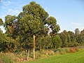
A Eucalypt woodland: Sydney Sandstone Gully Complex community 10ag
Located at Girahween Park. It comprises Smooth-barked Apple (Angophora costata), Blackbutt (Eucalyptus pilularis), Sydney Peppermint (Eucalyptus piperita), Red Bloodwood (Eucalyptus gummifera) and Turpentine (Syncarpia glomulifera). There is a varied understorey with Banksia (Banksia serrata), Teatree (Leptospurmum polygalifolium), Sunshine Wattle (Acacia terminalis). On shallow rock outcrops and ridgelines, thickets of Tick Bush (Kunzea ambigua) are dominant.
Closed-forest community: sub category of the Sydney Sandstone Gully Complex 10ag
Occurs adjacent to Wolli Creek in the western end of the park. Characterised by Coachwood (Ceratopetalum apetalum) and Water Gum (Tristaniopsis laurina).
Mangroves and associated endangered saltmarsh communities: Estuarine Complex 4a
Occur on the banks of Wolli Creek downstream of Turella, at Henderson Weir. Saltmarsh are listed as threatened communities under the Threatened Species Conservation Act 1995 (NSW).
Freshwater wetland
One remnant wetland (offstream) survives upstream of Hartill Law Avenue, although it is threatened by active weed invasion. The remaining creekline vegetation within the freshwater sections of Wolli Creek are dominated by exotic species.
Threats to Native Plants
Within the wetland saltmarsh communities are under pressure from expanding areas of mangrove plants and negative impacts of urban land use.[17] Weed species occupy many areas especially close to Wolli Creek and take over from the native vegetation.[9] Invasive and noxious species include the Wandering Jew (Tradescantia fluminensis), Blackberry (Rubus fruticosus) and Lantana (Lantana Camara), which is listed as a key threatening process in Schedule 3 of the NSW Threatened Species Conservation Act 1995. The main threat from exotic plants is from vine species (because they threaten tree canopies), grasses such as Kikuyu (Pennisetum clandestinum) which can smother saltmarshes, and invasion of saline areas and reed beds by Spiny Rush (Juncus acutus), Alligator Weed (Alternanthera philoxeriodes) and Ludwigia (Ludwigia peruviana).[9] Weed removal continues slowly as part of the bush regeneration work.[6][9]
Caring for the bushland
The vegetation of the park along Wolli Creek is maintained by the Wolli Creek Preservation Society whose volunteers engage in a variety of activities, including bush regeneration.[3][18][19] The park supports a great diversity of native plants and animals, including birds and Grey-headed flying foxes, and provides exceptional recreational opportunities for local residents and visitors.[2]
Fauna
Amphibians
Frogs are under threat worldwide.[20][21] A survey within the area predicted certain common frog species would be present because the area is within their range, however these species were universally absent.[22] Fewer than half of the original frog species remain in the Park and seven species have become locally extinct.[22] One of these locally extinct frogs is the Green and Golden Bell Frog (Endangered in NSW under the Threatened Species Conservation Act).[22] It is no longer found here due to the loss of habitat.[21][22][23] The Regional Park is in a very degraded landscape and changing ecosystem dynamics has perhaps favoured one species over another, with the Brown Striped Marsh Frog (Limnodynastes peronii) displacing the Green and Golden Bell Frog (Litoria aurea).[22] The degraded wetlands found within the Park have high siltation and shallow thickly vegetated habitat which is favoured by Striped Marsh Frogs (Schell & Bergin 2003) whereas the Green and Golden Bell Frog needs deeper water bodies with less dense fringing vegetation.[22] The frog species identified in the area for the period between 1997 and 2004 are the Eastern Dwarf Tree Frog (Litoria fallax), Peron's Tree Frog (Litoria peronii), Green Tree Frog (Litoria caerulea), Common Eastern Froglet (Crinia signifera) and the Brown Striped Marsh Frog (Limnodynastes peronii)[22][24] There may be more species of frog as yet unrecorded within the Park and further studies are needed. It is important to find out whether the Green and Golden Bell Frog has re-established a population from nearby populations living along the lower Cooks River.[22][25]
A number of skink species are still extant, including the bar-sided skink (Eulamprus tenuis), Eastern water skink (Eulamprus quoyii) and copper-tailed skink (Ctenotus taeniolatus).[6] Both grey-brown and yellow dragons have been observed near Nannygoat Hill.[6]
Snakes
Red-bellied black snake (Pseudechis porphyriacus) is the only snake species recently seen within the Park.[6] Other snake species which have been historically recorded (but not sighted in recent times) include, the black-bellied swamp snake (Hemiaspis signata) and the Eastern brown snake (Pseudonaja textilis).[22]
Turtles
The Eastern long-necked turtle (Chelodina longicollis) is the only turtle species found within the park.[6] Despite being widespread in highly modified Sydney water catchments, urban populations are not well understood.[26] The species is able to utilise modern urbanised waterways successfully compared with other Australian freshwater turtles because it has a preference for shallow and ephemeral bodies of water.[26] It is highly mobile species and able to migrate overland after rain.[26][27] Hatchlings have been observed at a large distance from the creek and they often have trouble moving through the introduced Kikuyu Grasses (Pennisetum clandestinum).[6] Although this species has the ability to disperse, more bodies of water are being lost due to a continuing demand for urban consolidation and habitat connectivity between populations is low.[26] The future for these taxa in urban Sydney is precarious because of the degraded urban environment (with continual loss of habitat), low recruitment to the population and the risk of predation.[6]
In 2007, a grey-headed flying-fox (Pteropus poliocephalus) camp was established on the south side of Wolli Creek in an area not easily accessible to the public.[6] The camp initially involved 1,000 animals, the population has increased and, as at 2016, up to 20,000 individuals may be present at the site at different times of year.[11] The grey-headed flying-fox is listed as Vulnerable on Schedule 2 of the NSW Threatened Species Conservation Act 1995 and is listed as Vulnerable under the Commonwealth Environment Protection and Biodiversity Conservation Act 1999. Due to habitat destruction and an increased food availability in cities, bat camps are increasingly common in urban areas, causing conflict with humans due to noise and the destruction of fruit trees.[28]
Occasional suggestive diggings in the Wolli Valley area have not yet confirmed the presence of the long-nosed bandicoot (Perameles nasuta).[6][9] This species is listed as endangered under the NSW Threatened Species Conservation Act 1995. A population survives in suburbs adjoining the Regional Park.[6] They are threatened by foxes and risks associated with urbanisation such as danger from traffic.
Introduced animals
Foxes, cats, rabbits, house mice and black rats have been observed on this reserve. These introduced animals may have modified the biological community over the long period of their occupation.[29] Some native animal and plant species may have been eliminated from this reserve due to predation and competition from introduced species.[29] The risk of local extinctions continues with the presence of foxes.[6] Foxes have been listed as a key threatening process under the Threatened Species Conservation Act 1995.
Birds
Many species of birds of eucalypt woodlands of southern Australia are declining in numbers.[30] There are many causes of this decline; clearing, fragmentation and degradation of woodlands.[30] These factors combine with ecological factors such as difficulties in dispersing among remnants, interspecific competition, nest predation, and decline resources, such as food.[30] Management, especially rehabilitation and revegetation, may assist some woodland birds with common species responding well, but bird species that require mature trees do not.[30] This Regional Park forms part of an important west-east corridor of habitat for avian migrants. The Park is a significant connecting habitat link for birds moving across Sydney's urban south and for migrants moving in a north-south direction.[6] Newly established breeding residents include the Nankeen night heron (Nycticorax caledonicus) and the Variegated fairy wren (Malurus lamberti).
Sightings of the powerful owl (Ninox strenua) are rare within the Park; an adult was discovered soon after the establishment of the grey-headed flying fox camp. It is estimated that the total number of adult powerful owls within the Sydney urban landscape is 120.[31] The habitat quality and the population of mammal species is increasing in the park. It is hoped that a pair will soon breed here. Powerful owls feed almost exclusively on large tree-dwelling mammals, especially the common ringtail possum and the grey–headed flying-fox, but they also take a few large birds.[31] The Sydney population often nests near bushwalking pathways and has successfully raised chicks in areas of high human disturbance.[31] Powerful owls prefer native trees but will also use trees considered weed species.[32] To conserve the Powerful Owl, we need to be aware of the habitat it uses and whether numbers are increasing or decreasing.[31]
Recreation
Bushwalkers and birdwatchers can enjoy the valley using the Two Valley Trail, and reserves such as Girrawheen Park and Turrella Reserve for picnics and other recreational activities. Access to the park is available through adjacent suburban streets and railway stations located at Tempe, Turrella, Bardwell Park, and Bexley North.[18]
123456789101112131415161718[Little D., Stevens P., Gatenby G. and O’Brien V. 2010. "Fauna of the Wolli Valley in inner south-west Sydney". In: Lunney, D., Hutchings, P. and Hochuli, D. The natural history of Sydney. Mosman, NSW. Royal Zoological Society of New South Wales.]
↑Madden B. and Muir L. 1996. The Wolli Creek valley – a history of survival. Earlwood, NSW. Wolli Creek Preservation Society.
123456789101112[Clouston 2004. Wolli Creek regional park plan of management. Sydney, Clouston.]
123456789[Frith D. 2007. Management opportunities for Wolli Creek riparian zone discussion paper.]
12[Benson D. H., Ondinea, D. and Bear V. 1999. Missing jigsaw pieces: the bushplants of the Cooks River Valley. Sydney, NSW: Royal Botanic Gardens Press.]
↑DECC 2008 Rapid Fauna Habitat Assessment of the Sydney Metropolitan Catchment Management Authority Area. Department of Environment and Climate Change, Hurstville
123[Drinnan I.N. 2005. The search for fragmentation thresholds in a southern Sydney suburb. Biological Conservation.124:339–349.]
↑Perkins I. 2000. Wolli Creek Regional Park: 5 Year Bushland Regeneration Operations Report. report to NPWS. Sydney, NSW. Ian Perkins Consultancy Service.
↑Benson D. and Howell J. 1994. The natural vegetation of Sydney 1:100,00 map sheet. Cunninghamiana 3: 677–799.
↑Benson D. and Howell J. 1990. Taken for granted: the bushland of Sydney and its suburbs. Kenthurst, NSW: Kangaroo Press.
↑Harty C. 2004. Planning strategies for mangrove and saltmarsh changes in southeast Australia. Coastal Management. 32:405–415.
↑Campbell A. 1999. Declines and disappearances of Australian frogs. Biodiversity Group, Environment Australia.
12[Stuart S. N., Chanson J.S., Cox N.A., Young B. E., Rodriques A.S.L., Fischman D.L. and Waller R.W. 2004. Status and trends of amphibian declines and extinctions worldwide. Science 306:1783 – 1786.]
123456789[White A.W.and Burgin S. 2004. "Current status and future prospects of reptiles and frogs in Sydney’s urban-impacted bushland reserves". In Lunney D. and Burgin S. Urban wildlife: more than meets the eye. Mosman, NSW. Royal Zoological Society of New South Wales.]
↑[Schell C.B. and Burgin S. 2003. Swimming against the current: the Brown Striped Marsh Frog (Limnodynastes peronii) success story. Australian Zoologist 32: 401–405.]
↑DECC. 2007. Wolli Creek site profile: report for the Sydney metropolitan catchment management authority. Hurstville, NSW. Department of Environment and Climate Change.
↑DECC. 2008. Management plan for the Green and Golden Bell Frog – key population on the lower Cooks River. Sydney, NSW. Department of Environment and Climate Change.
1234[Burgin S. and Ryan M. 2008. Comparison of sympatric freshwater turtle populations from an urbanised Sydney catchment. Aquatic Conservation: Marine and Freshwater Ecosystems.18:1277–1284.]
↑Kennett R.M. and Georges A. 1990. Habitat utilisation and its relationship to growth and reproduction of the Eastern Long-Necked Turtle – Chelodina longicollis (Testudinata: Chelidae), from Australia. Herpetologica. 46:22–33.
↑Snoyman S. and Brown C. 2011. Microclimate preferences of the grey-headed flying fox (Pteropus poliocephalus) in the Sydney region. Australian Journal of Zoology 58: 376–383.
12[Coutts-Smith A.J. Mahon P.S. Letnic M. and Downey P.O. 2007. The threat posed by pest animals to biodiversity in New South Wales. Canberra, ACT. Invasive Animals Cooperative Research Centre.]
1234[Ford H. A. 2011. The causes of decline of birds of eucalypt woodlands: advances in our knowledge over the last 10 years. Emu 111: 1–9.]
1234[Bain D., Kavanagh R., Hardy K. and Parsons H. 2014. The Powerful Owl Project: Conserving owls in Sydney’s urban landscape. Melbourne, VIC. BirdLife Australia.]
↑McNabb E. and McNabb J. 2011. Predispersal range, behaviour and use of exotic roost-trees by a sub-adult powerful owl. Australian Field Ornithology. 28:57–64.
This page is based on this Wikipedia article Text is available under the CC BY-SA 4.0 license; additional terms may apply. Images, videos and audio are available under their respective licenses.