Wolli Creek, New South Wales

Last updated

Wolli Creek
Sydney,  New South Wales
Wollicreekabodements.jpg
Apartments on Brodie Spark Drive
Wolli Creek, New South Wales
Map
Population10,654 (2021 census) [1]
Established2002
Postcode(s) 2205
Elevation5 m (16 ft)
Location10 km (6 mi) south of Sydney CBD
LGA(s) Bayside
State electorate(s) Rockdale
Federal division(s) Barton
Suburbs around Wolli Creek:
Earlwood Tempe Tempe
Turrella Wolli Creek Sydney Airport
Turrella Arncliffe Arncliffe

Wolli Creek (formerly known as North Arncliffe) is a suburb in southern Sydney, in the state of New South Wales, Australia. It sits beside the Wolli Creek and Cooks River waterways. Wolli Creek is situated between the suburbs of Arncliffe and Tempe, 10 kilometres south of the Sydney central business district and is part of the St George area. Wolli Creek is in the local government area of Bayside Council.

Contents

History

The traditional owners of the land around the Wolli Creek Valley were the Bidjigal people (River Flat Clan) of the Eora Nation.[ citation needed ]

Wolli Creek was named after the waterway on its northern border.

The suburb was previously part of Arncliffe. Reuben Hannam was granted land in 1825 on the banks of Cooks river. Alexander Brodie Spark purchased land in 1826 and built Tempe house in 1836. It was named after 'Vale of Tempe', a beautiful valley in ancient Greek legend set at the foot of Mount Olympus. Tempe House, designed by John Verge, has a Georgian feel and is regarded as one of the great houses of Sydney. [2]

Philanthropist Caroline Chisholm leased Tempe House as a boarding school for young women (1863–1865). The estate was known as Greenbank during this time and presented an ideal location for Chisholm's work. She remarked on the spacious and lofty rooms and the 'fine large and open orchard of fruit trees, intersected by wide and shady walks'.[ citation needed ]

In 1884, the estate was sold to the Sisters of the Good Samaritan for use as a charitable refuge for women. The Sisters added the impressive St Magdalen's Chapel (1888), which is believed to be the work of Sheerin & Hennessy, an important firm of Sydney architects, who designed the Archbishop's Residence and St Patrick's College at Manly. The neo-Gothic style Chapel is of major cultural significance. It is now deconsecrated and has been restored as part of the Discovery Point redevelopment. Tempe House is now listed on the Register of the National Estate. [3]

The area became predominantly industrial until a redevelopment was planned in the late 1990s. The new suburb was to be called North Arncliffe, but residents in the area petitioned the council to conduct a vote to select a better name. Wolli Creek was the most popular choice. Wolli Creek railway station opened in 2000. Wolli Creek was officially declared a suburb in 2002. [4]

Heritage listings

Wolli Creek has a number of heritage-listed sites, including:

Commercial/Retail area

Restaurants and shops in the Village Square Wolli Creek Shops (Discovery Point).jpg
Restaurants and shops in the Village Square

Once industrial, Wolli Creek was redeveloped in the 2010s into a high-density residential and commercial area. [6] Close proximity to the Sydney CBD and Sydney Airport, and well connected public transport services, along with the expansive parkland and attractive riverside setting, make it a popular residential location. [6]

The main retail precinct is the Village Square, which is directly opposite the Wolli Creek station entrance and contains a wide array of restaurants and cafés, a pharmacy, barber and other shops. [7]

Wolli Creek is home to two hotels: Novotel Sydney International Airport and CKS Sydney Airport Hotel.

Demographics

At the 2021 census, Wolli Creek had a population of 10,654, up from 6,394 in 2016. [8] Compared to the national average of 14.3%, 46.7% of the population were aged between the ages of 25 and 34. The most common countries of birth were: China (20.2%), Australia (23.1%), Mongolia (4.8%), Indonesia (4.3%), Colombia (4.0%) and Brazil (3.7%). English at home, was spoken by only 25.9% of people. Other languages spoken at home included Mandarin 21.7%, Cantonese 6.4%, Spanish 5.1%, Mongolian 4.6% and Indonesian 3.9%. The most common responses for religion were No Religion 47.3%, Catholic 15.1% and Buddhism 10.0%. 98.3% of residences were apartments. The average number of people living in each household was 2.2. [1]

Transport

A T4 Illawarra line service at Wolli Creek station Wolli Creek Station Sydney.jpg
A T4 Illawarra line service at Wolli Creek station

The Princes Highway links Wolli Creek north to Tempe and the Sydney central business district and south to Arncliffe and Rockdale. The M5 South Western Motorway, with entrances and exits at nearby Arncliffe, runs south-west towards Liverpool and north-east towards Botany and the city.

Wolli Creek railway station is a railway hub and connects to the Illawarra line and Airport & South Line on the Sydney Trains network.

The 348 bus route operates from Wolli Creek station to Prince of Wales Hospital via Tempe, St Peters, Kensington and the University of New South Wales. The 422 bus route travels from Kogarah to Wolli Creek, then continues to Railway Square.

Recreational facilities

Cahill Park is located along the Princes Highway and Gertrude Street, fronting the Cooks River. Facilities offered include playground equipment, electrical barbecues and sporting fields for cricket and rugby. Tennis courts are also located adjacent to Cahill Park. [9] Discovery Point Park is a privately owned park, which is open to the public, located along the Princes Highway and Brodie Sparks Drive. Discovery Point Park offers over three hectares of landscaped waterfront parklands, with provisions for walking and cycling. Other recreation facilities include Kogarah Golf Course, located along Marsh Street and the St George Rowing Club, on Levey Street. Have Wolli Creek Region Park can enjoy bushwalk and have picnic and barbecue. [10]

Related Research Articles

<span class="mw-page-title-main">Arncliffe, New South Wales</span> Suburb of Sydney, New South Wales, Australia

Arncliffe is a suburb in southern Sydney, in the state of New South Wales, Australia. Arncliffe is located 11 kilometres south of the Sydney central business district, in the local government area of the Bayside Council.

<span class="mw-page-title-main">Kogarah, New South Wales</span> Suburb of Sydney, New South Wales, Australia

Kogarah is a suburb of Southern Sydney, in the state of New South Wales, Australia. Kogarah is located 14 kilometres south-west of the Sydney central business district and is considered to be the centre of the St George area.

<span class="mw-page-title-main">St George, Sydney</span> Region in New South Wales, Australia

The St George region of Sydney is part of the southern suburbs of Sydney, in the state of New South Wales, Australia. The area includes all the suburbs in the local government area of Georges River Council and the part of Bayside Council which was Rockdale City prior to 2016. This is everything within the boundaries of Salt Pan Creek to the west, The Georges River to the south, Botany Bay to the east and the M5 Motorway and Wolli Creek to the north. This area corresponds to the southern portion of the cadastral Parish of St George, from which the region derives its name and the area was later covered by the St George County Council, the electricity supplier for the councils in this region. This southern portion of the parish below The M5 and Wolli Creek is the more contemporary definition of The St George Region that is considered part of Southern Sydney.

<span class="mw-page-title-main">Rockdale, New South Wales</span> Suburb of Sydney, New South Wales, Australia

Rockdale is a suburb in southern Sydney, in the state of New South Wales, Australia. Rockdale is located 13 kilometres south of the Sydney central business district and is part of the St George area. Rockdale is one of the administrative centres for the local government area of the Bayside Council. Since 1985 Rockdale has been a twinned city with Bitola, in the Republic of Macedonia.

<span class="mw-page-title-main">Wolli Creek railway station</span> Railway station in Sydney, New South Wales, Australia

Wolli Creek railway station is located at the junction of the Airport and Illawarra lines, serving the Sydney suburb of Wolli Creek. It is served by Sydney Trains T4 Illawarra line, T8 Airport & South line services and NSW TrainLink South Coast line services.

<span class="mw-page-title-main">Tempe, New South Wales</span> Suburb of Sydney, New South Wales, Australia

Tempe is a suburb in the Inner West of Sydney, in the state of New South Wales, Australia. Tempe is located 9 kilometres south of the Sydney central business district in the local government area of Inner West Council.

<span class="mw-page-title-main">Bexley North railway station</span> Railway station in Sydney, New South Wales, Australia

Bexley North railway station is an Australian transport facility located on the East Hills line, serving the Sydney suburb of Bexley North. It is served by Sydney Trains T8 Airport & South line services.

<span class="mw-page-title-main">Kingsgrove railway station</span> Railway station in Sydney, New South Wales, Australia

Kingsgrove railway station is located on the East Hills line, serving the Sydney suburb of Kingsgrove. It is served by Sydney Trains T8 Airport & South line services.

<span class="mw-page-title-main">Bardwell Park railway station</span> Railway station in Sydney, New South Wales, Australia

Bardwell Park railway station is located on the East Hills line, serving the Sydney suburb of Bardwell Park. It is served by Sydney Trains T8 Airport & South line services.

<span class="mw-page-title-main">Turrella, New South Wales</span> Suburb of Sydney, New South Wales, Australia

Turrella (;) is a suburb in southern Sydney, in the state of New South Wales, Australia. Turrella is located 10 km south-west of the Sydney central business district on the southern bank of Wolli Creek in the local government area of Bayside Council.

<span class="mw-page-title-main">St Peters, New South Wales</span> Suburb of Sydney, New South Wales, Australia

St Peters is a suburb in the Inner West of Sydney, in the state of New South Wales, Australia. It is 7 kilometres south of the Sydney central business district, in the local government area of Inner West Council, with a small section in the southeast in the City of Sydney.

<span class="mw-page-title-main">Kingsgrove</span> Suburb of Sydney, New South Wales, Australia

Kingsgrove is a suburb in Southern Sydney, New South Wales, Australia. Kingsgrove is 13 kilometres (8.1 mi) south-west of the Sydney central business district and lies across the local government areas of the City of Canterbury-Bankstown, Bayside Council and the Georges River Council.

<span class="mw-page-title-main">Wolli Creek</span> River in New South Wales, Australia

Wolli Creek is an urban watercourse of the Cooks River catchment located in the southern suburbs of Sydney, in New South Wales, Australia.

<span class="mw-page-title-main">Earlwood, New South Wales</span> Suburb of Sydney, New South Wales, Australia

Earlwood is a suburb of Western Sydney, in the state of New South Wales, Australia. Earlwood is located 10 kilometres south-west of the Sydney central business district, and is part of the Canterbury-Bankstown area. It is in the local government area of the City of Canterbury-Bankstown.

<span class="mw-page-title-main">Banksia, New South Wales</span> Suburb of Sydney, New South Wales, Australia

Banksia is a suburb in southern Sydney, in the state of New South Wales, Australia. Banksia is located 12 kilometres south of the Sydney central business district, in the local government area of the Bayside Council and is part of the St George area.

<span class="mw-page-title-main">Bardwell Park, New South Wales</span> Suburb of Sydney, New South Wales, Australia

Bardwell Park is a suburb in southern Sydney, in the state of New South Wales, Australia. The suburb is located 12 kilometres south-west of the Sydney central business district and is part of the St George area. Bardwell Park is in the local government area of the Bayside Council. Bardwell Valley is a separate suburb, to the east.

<span class="mw-page-title-main">Bexley, New South Wales</span> Suburb of Sydney, New South Wales, Australia

Bexley is a suburb in southern Sydney, in the state of New South Wales, Australia. Bexley is located 14 kilometres (8.7 mi) south-west of the Sydney central business district, in the local government area of the Bayside Council and is part of the St George area.

<span class="mw-page-title-main">Turrella railway station</span> Railway station in Sydney, New South Wales, Australia

Turrella railway station is located on the East Hills line, serving the Sydney suburb of Turrella. It is served by Sydney Trains T8 Airport & South line services.

<span class="mw-page-title-main">Electoral district of Rockdale</span>

Rockdale is an electoral district of the Legislative Assembly in the Australian state of New South Wales.

<span class="mw-page-title-main">Tempe House and St Magdalenes Chapel</span> Heritage-listed estate and chapel in Sydney, New South Wales, Australia

Tempe House & St Magdalene's Chapel
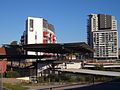
 is a heritage-listed estate and chapel at 1 Princes Highway, Wolli Creek, Bayside Council, New South Wales, Australia. It was designed by John Verge (villa) and Sheerin & Hennessy, with the original villa built from 1833 to 1836. It was added to the New South Wales State Heritage Register on 2 April 1999.

References

  1. 1 2 Australian Bureau of Statistics (28 June 2022). "Wolli Creek". 2021 Census QuickStats. Retrieved 26 April 2022. OOjs UI icon edit-ltr-progressive.svg
  2. The Book of Sydney Suburbs, Compiled by Frances Pollon, Angus & Robertson Publishers, 1990, Published in Australia ISBN   0-207-14495-8
  3. The Heritage of Australia, Macmillan Company, 1981, p.2/62
  4. Pictorial Memories ST GEORGE Rockdale, Kogarah, Hurstville, Compiled by Joan Lawrence, Kingsclear Books, Published in Australia ISBN   0-908272-45-6
  5. "Tempe House & St Magdalenes Chapel". New South Wales State Heritage Register . Department of Planning & Environment. H00725. Retrieved 18 May 2018. CC BY icon.svg Text is licensed by State of New South Wales (Department of Planning and Environment) under CC-BY 4.0 licence .
  6. 1 2 Stapleton, Dan F. (21 February 2017). "More than just a train station: Wolli Creek emerges as one of Sydney's densest areas". Domain. Retrieved 29 June 2019.
  7. "Retail Discovery Point - Frasers Property Australia". frasersproperty.com.au. Retrieved 7 March 2019.
  8. Australian Bureau of Statistics (27 June 2017). "Wolli Creek (State Suburb)". 2016 Census QuickStats. Retrieved 2 July 2017. OOjs UI icon edit-ltr-progressive.svg
  9. "Welcome to Rockdale City Council - Parks for Hire". rockdale.nsw.gov.au. Retrieved 7 March 2019.
  10. "Wolli Creek Regional Park". NSW National Parks. Retrieved 16 November 2021.

33°55′49″S151°09′15″E / 33.930173°S 151.154279°E / -33.930173; 151.154279