Related Research Articles

East Java is a province of Indonesia located in the easternmost hemisphere of Java island. It has a land border only with the province of Central Java to the west; the Java Sea and the Indian Ocean border its northern and southern coasts, respectively, while the narrow Bali Strait to the east separates Java from Bali by around 2.29 kilometres (1.42 mi). Located in eastern Java, the province also includes the island of Madura, as well as the Kangean islands and other smaller island groups located further east and Masalembu archipelagos in the north. Its capital is Surabaya, the second largest city in Indonesia, a major industrial center and also a major business center. Banyuwangi is the largest regency in East Java and the largest on the island of Java.

Pechiparai Reservoir is the largest dam in Kanyakumari district. It is located in the foothills of the Western Ghats in the Kanyakumari district of Tamil Nadu at Pachiparai. It is located 43 kilometers (27 mi) from the district capital Nagercoil. This dam is built across the Kotai river. This dam was built during the period 1897-1906 by the European engineer Mr. Minchin by the then Maharaja of Travancore during the Thirunal period. This dam fulfills the agricultural and drinking water needs of Kanyakumari district. This river is the Western GhatsBuilt at the base. The height of this dam was originally 42 feet. Then in 1964 it was decided to add 6 more feet and in 1969 the height of the dam was 48 feet. stone pool, Agatheeswaram, Thovalai and Radhapuram circles are benefited by this. About 50 thousand acres of land gets irrigation facility. The Pachiparai Dam, which was 42 feet, was raised to 48 feet. 6 feet of raised water and Radhapuram was raised for this purpose. An additional 3.75 TMC of water is added after the dam is raised. The 42 feet Pachipara dam was raised to 48 feet by Kamaraj. 6 feet of raised water was also raised for Radhapuram area. An additional 3.75 TMC of water is added after the dam is raised.

Trenggalek Regency is a regency (kabupaten) in East Java, Indonesia.

Tulungagung Regency is a regency (kabupaten) of East Java Province, Indonesia. It covers an area of 1,055.65 km2 and had a population of 990,159 at the 2010 Census and 1,089,775 at the 2020 Census. The administrative headquarters is in the town of Tulungagung.

Sumedang Regency is a landlocked regency (kabupaten) of West Java province, Indonesia. The district of North Sumedang is its capital. The regency covers an area of 1,558.72 km2, and had a population of 1,093,602 at the 2010 Census and 1,152,507 at the 2020 Census; the official estimate as at mid 2021 was 1,159,346.

The Brantas is the longest river in East Java, Indonesia. It has a length of 320 km, and drains an area over 11,000 km2 from the southern slope of Mount Kawi-Kelud-Butak, Mount Wilis, and the northern slopes of Mount Liman-Limas, Mount Welirang, and Mount Anjasmoro. Its course is semi-circular or spiral in shape: at its source the river heads southeast, but gradually curves south, then southwest, then west, then north, and finally it flows generally eastward at the point where it branches off to become the Kalimas and Porong River.
Grobogan Regency is a regency located in northeastern part of the Central Java province in Indonesia.

The Citarum River is the longest and largest river in West Java, Indonesia. It is the third longest river in Java, after Bengawan Solo and Brantas. It plays an important role in the life of the people of West Java. It has been noted for being considered one of the most polluted rivers in the world.

Jayakwadi dam is an earthen dam located on Godavari river at the site of Jayakwadi village in Paithan taluka of Aurangabad district in Maharashtra, India. It is a multipurpose project. The water is mainly used to irrigate agricultural land in the drought-prone Marathwada region of the state. It also provides water for drinking and industrial usage to nearby towns and villages and to the municipalities and industrial areas of Aurangabad and Jalna districts. The surrounding area of the dam has a garden and a bird sanctuary.

The Dahla Dam, also known as Arghandab Dam and Kasa, is located in the Shah Wali Kot District of Kandahar Province in Afghanistan, approximately 40 kilometres (25 mi) north of the provincial capital Kandahar. Constructed in 1952, it is said to be the second largest dam in Afghanistan. As of 2019, the Afghan government is spending $450 million on making the dam more useful. The project includes raising the dam's walls by 12 meters so its reservoir can hold nearly a billion cubic meters of fresh water and installing three turbines for the production of 22 megawatts (MW) of electricity.
Rengali dam is a dam located in Odisha, India. It is constructed across the Brahmani River in Rengali village, located 70 km from Angul in Angul district.

The Western Cape Water Supply System (WCWSS) is a complex water supply system in the Western Cape region of South Africa, comprising an inter-linked system of six main dams, pipelines, tunnels and distribution networks, and a number of minor dams, some owned and operated by the Department of Water and Sanitation and some by the City of Cape Town.

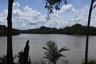
The Kayan River is a river of Borneo island, flowing in the North Kalimantan province of Indonesia, about 1600 km northeast of the capital Jakarta. Tributaries include the Bahau River.
Kosasthalaiyar River, also known as Kortalaiyar, is one of the three rivers that flow in the Chennai metropolitan area.
Lakhwar-Vyasi Dam project on Yamuna River, includes under-construction Lakhwar Dam and Power Station, Vyasi Dam, Hathiari Power Station and Katapathar Barrage, near the Lakhwar town in Kalsi block of Dehradun district of Uttarakhand in India, for the purpose of irrigation of 40,000 hectare land and total 927 MW hydroelectric power generation. "Lakhwar Dam" is a gravity dam near the Lohari village with 300MW power generation capacity. "Vyasi Dam" will be built 5 km downstream along with 120 MW "Hathiari Power Station" further 0.5 km downstream. "Katapathar Barrage", with the maximum ponding water level at 514.5m elevation, will be built further 2.75 km downstream of the Hathiari Power Station to supply the water to stakeholder states. Project will hold 580 million cubic metres water during monsoon and release into Yamuna during dry months.

Malankara dam is a gravity dam constructed across Thodupuzha river for irrigation purposes. The dam is constructed to make use of the tail water from the Moolamattom power house. The project is run under the Muvattupuzha Valley Irrigation Project and KSEB. The artificial lake covers an area of around 11 square km.

The Kanjirapuzha Dam, a masonry earth dam built for providing irrigation to a Cultural Command Area (CCA) of 9,713 hectares, is located in the Palakkad district in the Indian state of Kerala. The reservoir, which has three islands within it, also has an established commercial fisheries development programme operated by the Fisheries Department.
Ci Tanduy is a river in the island of Java, Indonesia, about 270 km to the southeast of the capital Jakarta. It flows from West Java to Central Java province, exiting through the Bay of Citanduy to the Indian Ocean, forming a delta called "Muara Citanduy."
The Kambaniru River is a river in the island of Sumba, Indonesia, about 1,500 km east of the capital Jakarta. With a length of approximately 118 km, it flows periodically through 9 districts in the East Sumba Regency, exiting to the Bay of Kambaniru near the city of Waingapu to the Sawu Sea, with high debit in the wet season, but very low in the dry season.

The Waeapo River is a river which flows on the island of Buru, Maluku, Indonesia. It is one of the main rivers of the island, draining towards the Banda Sea in the northeast of the island.
References
- 1 2 Sinaro, Radhi (2007). Menyimak Bendungan di Indonesia (1910-2006) (in Indonesian). Tangerang Selatan: Bentara Adhi Cipta. ISBN 978-979-3945-23-1.
- ↑ Development of the Brantas River Basin (part 10) (PDF). Tokyo: JICA. 1998. pp. 206–207.
- ↑ "Pola Pengelolaan Sumber Daya Air Wilayah Sungai Brantas" (PDF) (in Indonesian). Kementerian Pekerjaan Umum dan Perumahan Rakyat. 20 March 2020. p. 145. Retrieved 16 January 2023.