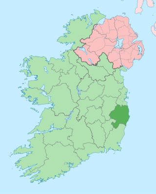
County Wicklow is a county in Ireland. The last of the traditional 32 counties, having been formed as late as 1606, it is part of the Eastern and Midland Region and the province of Leinster. It is bordered by the Irish Sea to the east and the counties of Wexford to the south, Carlow to the southwest, Kildare to the west, and South Dublin and Dún Laoghaire–Rathdown to the north.

Arklow is a town in County Wicklow on the southeast coast of Ireland. The town is overlooked by Ballymoyle Hill. It was founded by the Vikings in the ninth century. Arklow was the site of one of the bloodiest battles of the 1798 rebellion. Its proximity to Dublin led to it becoming a commuter town with a population of 13,163 as of the 2016 census. The 2022 census recorded a population of 13,399.

Wicklow is the county town of County Wicklow in Ireland. It is located on the east of Ireland, south of Dublin. According to the 2022 census, it had a population of 12,957 people. The town is to the east of the M11 route between Dublin and Wexford. It also has railway links to Dublin, Wexford, Arklow, and Rosslare Europort. There is also a commercial port for timber and textile imports. The River Vartry is the main river flowing through the town.

Kilmacanogue, officially Kilmacanoge, is a village in north County Wicklow, Ireland. It is southwest of Bray and is overlooked by Great Sugar Loaf mountain.

The Avoca is a river in County Wicklow, Ireland. It is contained completely within the county. Its length is 35 miles (56.3 km).

Avoca is a small town near Arklow, in County Wicklow, Ireland. It is situated on the River Avoca.

Kilcoole is a town in County Wicklow, Ireland. It is 3 kilometres (2 mi) south of Greystones, 14 kilometres (9 mi) north of Wicklow, and about 28 kilometres (20 mi) south of Dublin. It was used as a filming location for the Irish television series Glenroe, which ran through the 1980s and 1990s.
Shillelagh is a village in County Wicklow, Ireland. It is located in the south of the county, on the R725 regional road from Carlow to Gorey. The River Derry, a tributary of the River Slaney, flows through the village, while the Wicklow Way passes to the north and west.

Aughrim is a small town in County Wicklow, Ireland. It lies in a scenic valley in the Wicklow Mountains in the east of Ireland where the Ow and Derry rivers meet to form the Aughrim River. Aughrim is on the R747 road between Arklow and Baltinglass, and the R753 regional road.

The R752 road is a regional road in County Wicklow, Ireland. From its junction with the R772 in Rathnew on the outskirts of Wicklow Town it takes a generally south-westerly route to its junction with the R747 in the village of Woodenbridge, where it terminates. The road is 26 km (16 mi) long.

Glenealy is a village 8 km (5 mi) west of Wicklow Town, in County Wicklow, on the R752 road. The Dublin–Rosslare railway line also passes through the village.

Ashford, historically known as Ballymacahara, is a village in County Wicklow, Ireland. It lies on the River Vartry and at the meeting of the R772, R763 and R764 regional roads. The village was formerly on the main Dublin–Wexford route, the N11, but was bypassed by the new N11 in 2004. As of the 2022 census, the village had a population of 1,892 people.

Rathdrum is a village in County Wicklow, Ireland. It is situated high on the western side of the Avonmore River valley, which flows through the Vale of Clara.

The R747 road is a regional road in Ireland running north-west/south-east from the M9 near Ballitore in County Kildare to Arklow in County Wicklow, a distance of 66 km (41 mi).

Coolboy is a village in County Wicklow in Ireland. It is located between Tinahely and Carnew, in the middle of Holts Way, close to the Kilcavan Gap.

Aghavannagh is a small village and townland in south County Wicklow, Ireland. It is located in the barony of Ballinacor South on the Military Road originally constructed between 1804 and 1809, in the wake of the 1798 rebellion. It is so remote that inhabitants say that "Aghavannagh is the last place God made".

The Aughrim River flows from confluence of the Derry Water and River Ow south of the village of Aughrim in County Wicklow in Ireland. It flows in a generally easterly direction for approximately 12 km (7.5 mi) following the R747 regional road for its full length before joining the River Avoca in the Vale of Avoca, which in turn discharges into the Irish Sea at Arklow. From source to sea the river remains in East Wicklow.

Coolafancy is a townland and village in County Wicklow in Ireland. The area of Coolafancy is often referred to as Crosspatrick on maps. It is located roughly between Tinahely and Carnew, close to the neighbouring village of Coolboy. Coolafancy contains the only primary national school in the area, St. Mary's National School. The school serves the village itself and also the village of Coolboy and surrounding areas like Hillbrook, Coolroe, Cummer and Cummerduff. The name Coolafancy is sometimes written as Coolnafancy or simply Coolfancy.

The Shillelagh branch line was a branch line of some 16.5 miles (26.6 km) to Shillelagh, County Wicklow opened by the Dublin, Wicklow and Wexford Railway (DW&WR) in 1865. It joined the Dublin–Rosslare railway line at Woodenbridge halt.

The Wicklow gold rush, or the Avoca gold rush, was a gold rush that began on 15 September 1795, following the discovery of gold on the northern slopes of Croghan Kinsella mountain, County Wicklow, Ireland. The unregulated gold collection ended with a military takeover exactly one month later, on 15 October 1795. Over the four week period, as much as 80 kilograms of gold was recovered by prospectors. It was the only recorded gold rush to have occurred on the island of Ireland.


