
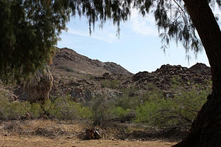
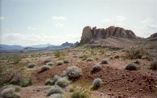
The Mojave Desert is a desert in the rain shadow of the southern Sierra Nevada mountains and Transverse Ranges in the Southwestern United States. Named for the indigenous Mohave people, it is located primarily in southeastern California and southwestern Nevada, with small portions extending into Arizona and Utah.

Mojave National Preserve is a United States National Preserve located in the Mojave Desert of San Bernardino County, California, US, between Interstate 15 and Interstate 40. The preserve was established October 31, 1994, with the enactment of the California Desert Protection Act by the United States Congress, which also established Joshua Tree National Park and Death Valley National Park as National Parks. Previously, some lands contained within the Preserve were the East Mojave National Scenic Area, under the jurisdiction of the Bureau of Land Management. At 1,542,776 acres (6,243 km2), within the contiguous United States it is the third largest unit of the National Park System and the first largest National Preserve. The preserve was created within the Pacific West Region of the National Park Service and remains within that jurisdiction today.

The desert tortoise is a species of tortoise in the family Testudinidae. The species is native to the Mojave and Sonoran Deserts of the southwestern United States and northwestern Mexico, and to the Sinaloan thornscrub of northwestern Mexico. G. agassizii is distributed in western Arizona, southeastern California, southern Nevada, and southwestern Utah. The specific name agassizii is in honor of Swiss-American zoologist Jean Louis Rodolphe Agassiz. The desert tortoise is the official state reptile in California and Nevada.
Goffs, an unincorporated community in San Bernardino County, California, is a nearly empty one-time railroad town at the route's high point in the Mojave Desert. Goffs was a stop on famous U.S. Route 66 until 1931 when a more direct road opened between Needles and Essex. Goffs was also home to workers of the nearby Santa Fe Railroad, with Homer east, Fenner south, and Blackburn and Purdy north. Goffs is also known as the "Desert Tortoise Capital of the World."

The Dead Mountains are a mountain range in the southeastern Mojave Desert, in San Bernardino County, California. The range borders the tri-state intersection of Nevada, Arizona and California, and the Mohave Valley, with the Fort Mojave Indian Reservation bordering the range foothills on the east and northeast, in the three states.
The Chuckwalla Mountains are a mountain range in the transition zone between the Colorado Desert—Sonoran Desert and the Mojave Desert, climatically and vegetationally, in Riverside County of southern California.
The Clipper Mountains are located in the eastern Mojave Desert and protected within Mojave Trails National Monument, in San Bernardino County, California.
The Piute Mountains are a mountain range located in the Eastern Mojave Desert and within Mojave Trails National Monument, in San Bernardino County, California.
The Rand Mountains are located in the Mojave Desert northeast of California City and southwest of the town of Randsburg.
The Fremont Valley is a valley located in the western Mojave Desert of California.

The Turtle Mountains, are located in northeastern San Bernardino County, in the southeastern part of California. The colorful Turtle Mountains vary from deep reds, browns, tans and grays, to black. The area has numerous springs and seeps. The Turtle Mountains are also a National Natural Landmark, with two mountain sections of entirely different composition.

The Silurian Hills are a small range of hills in the Mojave Desert, southeast of Death Valley National Park, in southern California. The surrounding lower elevation lands provide important connectivity habitat between nearby mountain ranges. The area provides critical habitat and movement corridors for bighorn sheep, desert tortoises, nesting golden eagles, kit foxes and burrowing owls. The Silurian Valley is a largely undisturbed valley that supports wildlife and is an important link for this portion of the northern Mojave Desert.
The Stepladder Mountains are located in southeastern California in the United States. The range, found in San Bernardino County, is home to the 84,199-acre (approximate) Stepladder Mountains Wilderness, which protects the Desert tortoise, California's state reptile. The mountains are located east of the Old Woman Mountains and north of the Turtle Mountains, about 29 miles (47 km) southeast of the town of Essex.

The Bigelow Cholla Garden Wilderness is in the eastern Mojave Desert and within Mojave Trails National Monument, located in San Bernardino County, California.

The Serrano are an Indigenous people of California. Their autonyms are Taaqtam meaning "people", Maarrênga’yam meaning "people from Morongo", and Yuhaaviatam meaning "people of the pines."

Parkinsonia florida, the blue palo verde, is a species of palo verde native to the Sonoran Deserts in the Southwestern United States and Northwestern Mexico. Its name means "green pole or stick" in Spanish, referring to the green trunk and branches, that perform photosynthesis.

Old Woman Mountains Wilderness is a wilderness area in the Old Woman Mountains of the eastern Mojave Desert. It is located south of Essex in San Bernardino County, California.
The Mesquite Mountains are a mountain range in eastern San Bernardino County, California, near the border with Nevada. They are north of Interstate 15 in California and southeast of Death Valley.

The Cleghorn Lakes Wilderness is a 39,167-acre (158.50 km2) wilderness area in the southern Mojave Desert. It is located 16 miles (26 km) northeast of Twentynine Palms, California, and 20 miles (32 km) north of Joshua Tree National Park. It is managed by the Bureau of Land Management.

The Clipper Mountain Wilderness is a wilderness area in the Clipper Mountains of the eastern Mojave Desert and within Mojave Trails National Monument, located in northeastern San Bernardino County, California. It is under the jurisdiction of the Bureau of Land Management.
