
The Aller is a 215-kilometre (134 mi) long river in the states of Saxony-Anhalt and Lower Saxony in Germany. It is a right-hand, and hence eastern, tributary of the Weser and is also its largest tributary. Its last 117 kilometres (73 mi) form the Lower Aller federal waterway (Bundeswasserstraße). The Aller was extensively straightened, widened and, in places, dyked, during the 1960s to provide flood control of the river. In a 20-kilometre (12 mi) long section near Gifhorn, the river meanders in its natural river bed.

Thale is a town in the Harz district in Saxony-Anhalt in central Germany. Located at the steep northeastern rim of the Harz mountain range, it is known for the scenic Bode Gorge stretching above the town centre.

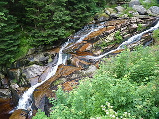
The Bode is a river in the German state of Saxony-Anhalt, a left tributary of the Saale. It rises in the Harz mountains and drains them in a northerly direction. After 169 kilometres (105 mi) it discharges into the Saale at Nienburg. The river is named after a legendary giant, the wild, rampaging, Bohemian, Prince Bodo, who, according to the Rosstrappe legend changed into a marauding dog that guarded the crown of Princess Brunhilde in the Kronensumpf in the present-day Bode Gorge. The gorge is the narrow section of the Bode valley between Treseburg and Thale.
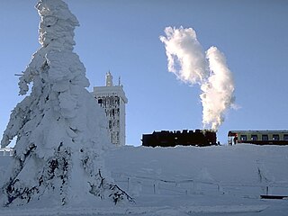
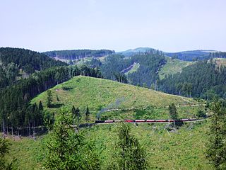
The Brocken Railway is one of three tourist metre gauge railways which together with the Harz Railway and Selke Valley Railway form the Harz Narrow Gauge Railways railway network in the Harz mountain range of Germany.
The Holtemme is a 47-kilometre (29 mi) long tributary of the river Bode in Saxony-Anhalt, Germany.

The Hohnekamm or Hohne Kamm is a mountain ridge up to 900 m above sea level high in the Harz mountains of central Germany. It is located in the state of Saxony-Anhalt, and is well known for its rock towers or tors, the Hohneklippen.
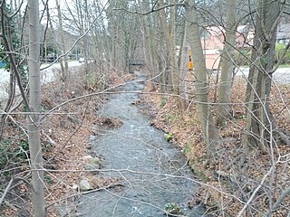
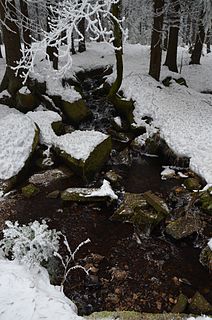
The Zillierbach is a stream in the Harz mountains of central Germany in the state of Saxony-Anhalt. It is about 13 kilometres (8 mi) long. The stream rises on the western side of the Hohneklippen crags and runs initially southwards, then swings northeast at Drei Annen Hohne. South of Drei Annen Hohne it picks up the waters of the Wormsgraben, its main tributary. The Zillierbach supplies the Zillierbach Dam near Elbingerode. In front of the settlement of Voigtstieg it is joined by another two smaller brooks. In the Middle Ages the Zillierbach powered the mills between Voigtstieg and Wernigerode. This section of the valley is still called Mühlental today. In its lower reaches before its mouth the stream is known as the Flutrenne. The stream discharges into the Holtemme at Wernigerode northwest of the West Gate (Westerntor). It drops through a vertical height of almost 400 metres (1,300 ft) from source to mouth.
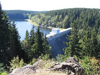
The Zillierbach Dam lies in the East Harz in the German state of Saxony-Anhalt near the town of Elbingerode (Harz) and impounds the Zillierbach stream. It supplies drinking water to several villages in the High Harz as well as the town of Wernigerode; it also provides flood protection.

The Kalte Bode is the left-hand headstream of the Bode in the High Harz Mountains in the German state of Saxony-Anhalt. It is 17 kilometres (11 mi) long.

The Warme Bode is the right-hand headstream of the Bode in the High Harz mountains of central Germany in the states of Lower Saxony and Saxony-Anhalt. It is 23 kilometres (14 mi) long and is formed by the confluence of the Große Bode and Kleine Bode rivers.

Drei Annen Hohne is the name of a small settlement within the municipal area of Wernigerode in Saxony-Anhalt, Germany.

The Rappbode is a right-hand, southwestern tributary of the River Bode in the Harz mountains in the German state of Saxony-Anhalt. In its lower reaches it is impounded by the Rappbode Dam, the largest dam in the Harz.
The Wormke is a river of Saxony-Anhalt, Germany, in the Harz Mountains. It is a left tributary of the Kalte Bode, about 6.7 kilometres (4.2 mi) long.

The Goldbach is a river of Saxony-Anhalt, Germany. It is a left tributary of the River Bode, about 30 kilometres (19 mi) long, in the Harz Mountains.

The Selke is a river of Saxony-Anhalt, Germany.
The Ahrensklint or Ahrentsklint in the Harz Mountains is a granite rock formation, 822.4 m above sea level (NN), on the Erdbeerkopf in Harz district in the German state of Saxony-Anhalt.

The Barenberg, also called the Bärenberg or Bärenkopf, is a mountain, 695.5 m above sea level (NN), in the Harz Mountains of Germany near the village of Schierke, Harz county, in the state of Saxony-Anhalt.
The Elversstein in the Harz Mountains of Germany is a granite rock formation with a maximum elevation of 499 m above sea level (NN) on the Steinberg near Hasserode in the county of Harz in Saxony-Anhalt.
The Scharfenstein is a hill spur, 462.4 m above sea level (NN), of the Eichberg-Süd (486.4 m) in the Harz Mountains of Germany, near the town of Wernigerode in the county of Harz in Saxony-Anhalt.
