
Benito Juárez is one of the eleven municipalities of the Mexican state of Quintana Roo. Most of its population reside in the municipal seat, Cancún. It is named after the 19th century president and statesman Benito Juárez.

Solidaridad is one of the eleven municipalities that make up the Mexican state of Quintana Roo. Its municipal seat is the town of Playa del Carmen.

Felipe Carrillo Puerto is the municipal seat and largest city in Felipe Carrillo Puerto Municipality in the Mexican state of Quintana Roo. According to the 2010 census, the city's population was 25,744 persons, mostly of Maya descent.

Quintana Roo is a state in Southeast Mexico divided into eleven municipalities. According to the 2020 Mexican Census, it has the twenty-forth largest population of all states with 1,857,985 inhabitants and the 19th largest by land area spanning 44,705.2 square kilometres (17,260.8 sq mi).

Akumal is a small beach-front tourist resort community in Mexico, 100 km (62 mi) south of Cancún, between the towns of Playa del Carmen and Tulum. It is located on Akumal Bay and Half Moon Bay on the site of a former coconut plantation in Tulum Municipality in the state of Quintana Roo, and is part of the Riviera Maya area. The 2010 census showed a population of 1,310 inhabitants.

Calakmul is a municipality in the Mexican state of Campeche, situated in the central part of the Yucatán Peninsula.
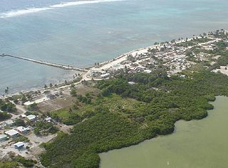
Xcalak is a village of 375 inhabitants in the municipality of Othón P. Blanco, Quintana Roo, on the Caribbean coast of Mexico. It is one of the last "unspoiled" stretches of the Mexican Caribbean located on the southern end of the Costa Maya. The world's second largest barrier reef passes just off-shore from Xcalak and it is also a departure point for dive trips to the Chinchorro Banks atoll reef system. It is designated a Mexican national reef park and is an excellent site for snorkeling, scuba diving and fly fishing. It is 60 kilometers (37 mi) south of Mahahual, the site of a new large cruise ship pier, and just north of the border with Belize. The Mahahual pier was destroyed by hurricane Dean in 2007. This section of coast is now being developed by the tourism industry and has a growing number of Americans and other expatriates investing in beach front property north of town. However, development is nowhere close to the degree of development in Cancún and Playa del Carmen to the north.
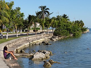
Othón P. Blanco is one of the eleven subdivisions (municipios) of the Mexican state of Quintana Roo. It had a 2010 census population of 244,553 persons. Its municipal seat is the city of Chetumal, which also serves as the state capital. The municipality is named after Othón P. Blanco Núñez de Cáceres.

Xpujil is a town in the Mexican state of Campeche. It serves as the municipal seat for the surrounding municipality of Calakmul. As of 2010, Xpujil had a population of 3,984.
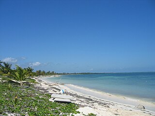
Punta Allen, is the largest village in the Sian Ka'an Biosphere Reserve at the end of the Boca Paila Peninsula in Tulum Municipality in the Mexican state of Quintana Roo. It is a small Mayan fishing village with a 2010 census population of 469 inhabitants, and the only land access is by a rough 50 kilometre track.
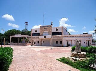
Tulum Municipality is one of the eleven municipalities that make up the Mexican state of Quintana Roo. It became one of the newest municipalities in the country when it was formed on 13 March 2008, at which time it was separated from Solidaridad Municipality.

Felipe Carrillo Puerto is a municipality in the south-central part of the Mexican state of Quintana Roo. The municipal seat is the city of the same name. It was named after the assassinated local politician Felipe Carrillo Puerto. According to the 2014 census, the municipality's population was 81,742 inhabitants, living on an area of 13,806 square kilometres (5,331 sq mi).

Isla Mujeres is one of the eleven municipalities of the Mexican state of Quintana Roo, on the Yucatán Peninsula. Most of the municipality is located on the mainland in the northeastern corner of the state. Its municipal seat, also called Isla Mujeres, is a small town situated on the island from which it takes its name, about 13 kilometres (8.1 mi) northeast of Cancún in the Caribbean Sea. It is the easternmost municipal seat in Mexico. In the 2010 census, the town had a population of 16,203 inhabitants.

Altar is a municipality in Sonora in north-western Mexico. The municipality had a 2010 census population of 9,049 inhabitants, the vast majority of whom lived in the municipal seat of Altar, which had a population of 7,927 inhabitants. There are no other localities with over 1,000 inhabitants.
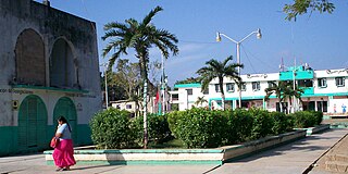
Kantunilkín is the municipal seat and largest city in Lázaro Cárdenas in the Mexican state of Quintana Roo. According to the 2010 census, the city's population was 7,150 persons.

Tres Garantías is a locality of state of Quintana Roo, which is Mexico. It has the status of ejido. It is a key location in the conservation of nature in Mexico. It has reached a sustainable forest management and has much potential in ecotourism, which has received a boost in recent years. It is also notable for having priceless cultural treasures yet to be examined and studied.

Tihosuco is a town in the Mexican state of Quintana Roo, Mexico, localized in state center, in the municipality of Felipe Carrillo Puerto. The population was 4,994 inhabitants at the 2010 census.

Tepich is a town in the Mexican state of Quintana Roo, Mexico, localized in state center, in the municipality of Felipe Carrillo Puerto. The population was 2,753 inhabitants at the 2010 census.

Chunhuhub is a town in the Mexican state of Quintana Roo, Mexico, localized in state center, in the municipality of Felipe Carrillo Puerto. The population was 4,644 inhabitants at the 2010 census.

Dziuché is a town in the Mexican state of Quintana Roo, Mexico, in the municipality of José María Morelos. The population was 2,870 inhabitants at the 2010 census.


