Related Research Articles
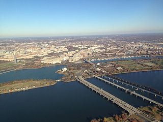
The 14th Street bridges refers to the three bridges near each other that cross the Potomac River, connecting Arlington, Virginia and Washington, D.C. Sometimes the two nearby rail bridges are included as part of the 14th Street bridge complex. A major gateway for automotive, bicycle and rail traffic, the bridge complex is named for 14th Street, which feeds automotive traffic into it on the D.C. end.

The Governor Alfred E. Driscoll Bridge, also known as the Driscoll Bridge is a toll bridge on the Garden State Parkway in the U.S. state of New Jersey, spanning the Raritan River near its mouth in Raritan Bay. The bridge connects the Middlesex County communities of Woodbridge Township on the north with Sayreville on the south. With a total of 15 travel lanes and 6 shoulder lanes, it is one of the world's widest and busiest motor vehicle bridges. Only 30 feet east of the Driscoll Bridge are the Vieser and Edison Bridges, which carry U.S. Route 9 southbound and northbound, respectively.

The Marquam Bridge is a double-deck, steel-truss cantilever bridge that carries Interstate 5 traffic across the Willamette River from south of downtown Portland, Oregon, on the west side to the industrial area of inner Southeast on the east. It is the busiest bridge in Oregon, carrying 140,500 vehicles a day as of 2016. The upper deck carries northbound traffic; the lower deck carries southbound traffic. The Marquam also has on and off ramps for Interstate 405 on the south end of the bridge, while the terminus on the east bank of the river is near the interchange with Interstate 84.

A reversible lane is a lane in which traffic may travel in either direction, depending on certain conditions. Typically, it is meant to improve traffic flow during rush hours, by having overhead traffic lights and lighted street signs notifying drivers which lanes are open or closed to driving or turning.
Interstate 295 (I-295) in Delaware, New Jersey, and Pennsylvania is an auxiliary Interstate Highway, designated as a bypass around Philadelphia, Pennsylvania, and a partial beltway of Trenton, New Jersey.

Interstate 395 (I-395) in Washington D.C. and Virginia is a 13.79-mile-long (22.19 km) spur route of I-95 that begins at an interchange with I-95 in Springfield and ends at an interchange with US Route 50 (US 50) in Northwest Washington, D.C. It passes underneath the National Mall near the US Capitol and ends at a junction with US 50 at New York Avenue, roughly one mile (1.6 km) north of the 3rd Street Tunnel. Despite its proximity to I-395 in Maryland, the route is unrelated and unconnected.
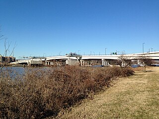
The 11th Street Bridges are a complex of three bridges across the Anacostia River in Washington, D.C., United States. The bridges convey Interstate 695 across the Anacostia to its southern terminus at Interstate 295 and DC 295. The bridges also connect the neighborhood of Anacostia with the rest of the city of Washington.

Interstate 95 (I-95) is the main north–south Interstate Highway on the East Coast of the United States, running in a general east–west compass direction for 111.57 miles (179.55 km) in Connecticut, from the New York state line to the Rhode Island state line. I-95 from Greenwich to East Lyme is part of the Connecticut Turnpike, during which it passes through the major cities of Stamford, Bridgeport, and New Haven. After leaving the turnpike in East Lyme, I-95 is known as the Jewish War Veterans Memorial Highway and passes through New London, Groton, and Mystic, before exiting the state through North Stonington at the Rhode Island border.

The South Grand Island Bridge is a pair of twin two-lane truss arch bridges spanning the Niagara River between Tonawanda and Grand Island in New York, United States. Each bridge carries one direction of Interstate 190 (I-190) and New York State Route 324 (NY 324). Both crossings are operated by the New York State Thruway Authority as part of the Niagara Thruway. The southbound span was opened in 1935 and acquired by the State of New York in 1950. The northbound span was finished in 1963. A northbound-only toll is collected via Electronic Tolling.
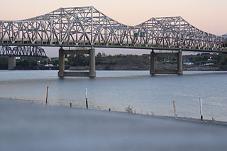
The John F. Kennedy Memorial Bridge is a six-lane, single-deck cantilever bridge that carries southbound Interstate 65 across the Ohio River, connecting Louisville, Kentucky and Jeffersonville, Indiana. The main span is 700 feet (213 m) and the bridge has a total length of 2,498 feet (761 m). The span carries six southbound lanes. It is named after U.S. President John F. Kennedy.

North Carolina Highway 150 (NC 150) is a primary state highway in the U.S. state of North Carolina. It serves the Foothills and Piedmont Triad areas of the state, connecting the cities of Shelby, Mooresville, Salisbury and Winston-Salem.
Interstate 85 (I-85) is an Interstate Highway that runs from Montgomery, Alabama, to Petersburg, Virginia. In North Carolina, I-85 travels 231.23 miles (372.13 km) from the South Carolina state line near Grover, North Carolina, to the Virginia state line near Wise. Despite being signed north–south, I-85 physically travels in a southwest–northeast direction across the state. The Interstate Highway connects the three most populous metropolitan areas of North Carolina: the Charlotte metropolitan area, Piedmont Triad, and Research Triangle, as well as nine of the 20 largest municipalities in the state. Outside of North Carolina, I-85 connects the state with Richmond, Virginia, to the north and Upstate South Carolina and Atlanta, Georgia, to the south. I-85 parallels several US Highways including US Highway 29 (US 29) between South Carolina and Greensboro, US 70 between Greensboro and Durham, US 15 between Durham and Oxford, and US 1 between Henderson and Virginia.

Interstate 55 (I-55) in Tennessee lies entirely within the city of Memphis, located in Shelby County. The highway enters the city from Southaven in Desoto County, Mississippi, and passes through the Whitehaven area of the city, bypassing Memphis International Airport to the west.

The Pearl Harbor Memorial Bridge, commonly referred to as the Q Bridge by locals, is an extradosed bridge that carries Interstate 95 over the mouth of the Quinnipiac River in New Haven, in the U.S. state of Connecticut. This bridge replaced the original 1,300 m (0.8 mi) span which opened on January 2, 1958. The old bridge had a girder and floorbeam design where steel beams supported a concrete bridge deck that carried three lanes of traffic in each direction with no inside or outside shoulders. The bridge was officially dedicated as the Pearl Harbor Memorial Bridge in 1995 to commemorate the attack on Pearl Harbor.

U.S. Route 29 is a United States highway that runs for 168 miles (270 km) from the South Carolina state line, near Blacksburg, to the commonwealth of Virginia, near Danville. It is signed with north–south cardinal directions, but is actually a north-east and south-west diagonal highway throughout the state. The route serves the North Carolina Piedmont, including the cities of Charlotte, Salisbury, High Point, and Greensboro. From Salisbury to Greensboro, US 29 spends roughly a third of its length in the state being concurrent with US 70.

U.S. Route 52 (US 52) is a north–south United States highway that runs for 150 miles (240 km) from the South Carolina state line, near McFarlan, to the Virginia state line, near Mount Airy. It serves as a strategic highway through the central North Carolina Piedmont. Because of its alignment in the state, US 52 does not follow the standard convention of an even U.S. route number going east–west.
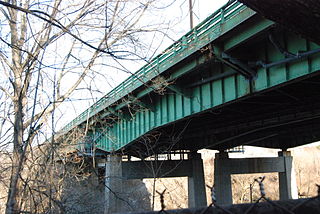
The Pawtucket River Bridge is a twin span, six-lane highway bridge that carries Interstate 95 (I-95) over the Seekonk River in Pawtucket, Rhode Island. The original bridge was built in 1958 and rehabilitated in 1996. The bridge was demolished in 2012-13 and replaced with a new deck arch bridge that was completed in summer 2013. In November 2016, the bridge was officially renamed the James E. Doyle Pawtucket River Bridge in memory of the former mayor of Pawtucket, who died two months earlier.
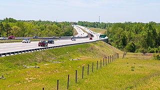
The Yadkin River Veterans Memorial Bridge is a pair of bridges, each carrying four lanes of I-85/US 52 across the Yadkin River between Rowan and Davidson Counties near Spencer, North Carolina in the United States. The northbound span opened May 5, 2012, and on August 2, 2012, southbound traffic moved to that span as well. A southbound span of the same bridge was completed in October 2012 and opened to traffic in March 2013. The pair of bridges replaces twin spans that carried I-85/US 52 from 1957 to 2012, which were separated by less than 1,000 feet (300 m). Adjacent are two Warren deck trusses carrying the North Carolina Railroad and Norfolk Southern, one bridge carrying US 29/US 70/NC 150, and the historic concrete arch Wil-Cox Bridge.

The Wil-Cox Bridge is a historic concrete arch pedestrian bridge spanning the Yadkin River between Rowan and Davidson counties in North Carolina. The bridge formerly carried two lanes of US 29/US 70/NC 150, but is now part of the Davidson County Greenway system and Yadkin River Park.

The Abraham Lincoln Bridge is a six-lane, single-deck cable-stayed bridge carrying northbound Interstate 65 across the Ohio River, connecting Louisville, Kentucky, and Jeffersonville, Indiana. The main span is 700 feet (213 m) and the bridge has a total length of 2,100 feet (640 m). It is named after U.S. President Abraham Lincoln, who was born in Kentucky and grew up in Southern Indiana.
References
- 1 2 3 Turner, Walter R. (2012-08-05). "The mysterious Yadkin River bridge". Salisbury Post . Archived from the original on 2012-08-06.
- 1 2 "Central office saga top story of 2012". Salisbury Post. 2012-12-30. Retrieved 2012-12-31.
- 1 2 Mark Wineka, "Road projects piling up for Salisbury area," Salisbury Post, 2001-09-28.
- ↑ Minn, Karissa (2010-02-18). "Rowan gets fraction of grant for bridge". Salisbury Post . Retrieved 2010-03-12.
- ↑ Smith, Shelley (2010-04-24). "Contractor selected to replace I-85 bridge". Salisbury Post . Retrieved 2010-04-24.
- ↑ "Bridge contractor selected". Salisbury Post . 2010-05-01. Retrieved 2010-05-22.
- ↑ "U.S., N.C. DOT OK Yadkin River bridge". Salisbury Post . 2010-07-07. Retrieved 2010-08-10.
- ↑ Minn, Karissa (2010-09-30). "Officials gather at site of new I-85 bridge". Salisbury Post . Retrieved 2010-09-30.
- ↑ Minn, Karissa (2010-10-09). "First 20 acres along I-85 cleared for widening, bridge project". Salisbury Post . Retrieved 2010-10-09.
- ↑ "Bridge needed to build I-85 bridge". Salisbury Post . 2010-11-16. Retrieved 2010-11-23.
- ↑ "Temporary I-85 bridge complete". Salisbury Post . 2011-07-06. Retrieved 2010-07-28.
- 1 2 "Crews removing temporary bridge over Yadkin River today". Salisbury Post . 2012-10-17. Retrieved 2012-10-18.
- ↑ "Bill to rename Yadkin River Bridge passes". Salisbury Post. 2011-05-13. Retrieved 2012-05-06.
- ↑ Minn, Karissa (2011-12-15). "I-85 bridge foundation complete; girders, spans being added". Salisbury Post . Retrieved 2011-12-15.
- ↑ "New Yadkin River bridge opens on northbound I-85". WBTV . 2012-05-05. Retrieved 2012-05-05.
- ↑ Bethea, April (2012-08-01). "Old, narrow Yadkin River bridge to close". The Charlotte Observer . Retrieved 2012-08-02.
- ↑ "Yadkin River Bridge Closed, I-85 Traffic Diverted in Rowan". Independent Tribune . 2012-08-03. p. 6A.
- ↑ "1955 bridge over Yadkin coming down". Salisbury Post. 2013-02-01. Retrieved 2013-02-27.
- ↑ "New I-85 South bridge opening Friday night". Salisbury Post. 2013-03-07. Retrieved 2013-03-07.
- ↑ "Bridge ceremony marks completion of I-85 segment". Winston-Salem Journal. 2013-11-08. Retrieved 2013-11-09.
- 1 2 3 "North Carolina US 29: The Piedmont's Highway - Wil-Cox Bridge" . Retrieved 2010-03-12.
- 1 2 Smith, Heather J. (2010-03-10). "Commissioners vote 5-2 to take ownership of Wil-Cox Bridge". The Dispatch . Retrieved 2010-03-11.
- ↑ "Thank you, Davidson". Salisbury Post . 2010-03-12. Retrieved 2010-03-12.
- 1 2 Minn, Karissa (2010-07-23). "State to pay for bridge repairs". Salisbury Post . Retrieved 2010-07-23.
- ↑ "Wilcox Bridge closed over safety concerns". Salisbury Post . 2010-04-09. Retrieved 2010-04-25.
- ↑ "Wil-Cox Bridge repairs under way". Salisbury Post . 2011-03-01. Retrieved 2011-03-01.
- ↑ "Repairs to Wil-Cox bridge progressing". Salisbury Post . 2011-04-15. Retrieved 2011-04-15.
- ↑ "Wil-Cox bridge repair advancing". Salisbury Post . 2011-05-12. Retrieved 2011-05-12.
- ↑ "Yadkin bridge project one year old". Salisbury Post . 2011-09-29. Retrieved 2011-09-29.
- ↑ "Traffic detoured at U.S. 29 bridge". Salisbury Post . 2012-04-17. Retrieved 2012-04-17.
- ↑ "Crews prep bridge for two-way traffic". Salisbury Post . 2012-08-01. Retrieved 2012-08-01.