Palakkad is one of the 14 districts in the Indian state of Kerala. It was carved out from the southeastern region of the former Malabar District on 1 January 1957. It is located at the central region of Kerala and is the second largest district in the state after Idukki. The city of Palakkad is the district headquarters. Palakkad is bordered on the northwest by the Malappuram district, on the southwest by the Thrissur district, on the northeast by Nilgiris district, and on the east by Coimbatore district of Tamil Nadu. The district is nicknamed "The granary of Kerala". Palakkad is the gateway to Kerala due to the presence of the Palakkad Gap, in the Western Ghats. The 2,383 m high Anginda peak, which is situated in the border of Palakkad district, Nilgiris district, and Malappuram district, in Silent Valley National Park, is the highest point of elevation in Palakkad district. Palakkad city is about 347 kilometres (216 mi) northeast of the state capital, Thiruvananthapuram.

Shoranur is a town and a municipality located in the Palakkad district, in the Indian state of Kerala, located on the banks of the Bharathapuzha River. The town covers an area of 32.28 km2.

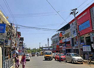
Ottapalam is a town, taluk and municipality in the Palakkad District, Kerala, India. It is the administrative headquarters of the Ottapalam taluk. Ottapalam is located about 36 km from district headquarters Palakkad. Ottapalam is located along the banks of Bharathapuzha, second longest river of the state.
Malampuzha, is a town and suburb of Palakkad city, Kerala, India. It is located about 3.5km from Malampuzha Dam and 6km from city centre.
Alathur is a town, taluk and gram panchayat in Palakkad District, Kerala, India. It is the administrative headquarters of the Alathur Taluk and is situated about 24 km from the district headquarters Palakkad through National Highway 544.Gayathripuzha River ,one of the tributary of Bharathapuzha, flows through Alathur. Alathur is one among the 29 Parliamentary Constituencies in Kerala. A Mini Civil Station is also located here which provides government related services.
Vattamkulam is a village in Malappuram district of the Indian state of Kerala. Vattamkulam means "Round Pond".

Palakkad, also known as Palghat, historically known as Palakkattussery, is a city and municipality in the Indian state of Kerala. It is the administrative headquarters of the Palakkad District. Palakkad is most densely populated municipality and fourth-most densely populated city in Kerala. It was established before Indian independence under British rule and known by the name Palghat. Palakkad is famous for the ancient Palakkad Fort, which is in the heart of the city and was captured and rebuilt by Hyder Ali in 1766. The city is about 347 kilometres (216 mi) northeast of the state capital, Thiruvananthapuram.

Kudallur is in the Palakkad district of Kerala. It is in Pattambi taluk, bordering Malappuram district, also on the banks of Bharathapuzha. The Bharathappuzha river separates Kudallur from Kuttippuram town in Malappuram district. Kudallur is a part of Thrithala and Ponnani.

Chittur-Thathamangalam is a town and municipality in Palakkad district of Kerala State, India. It is the headquarters of Chittur taluk, 13 km (8.1 mi) south-east of Palakkad, on the banks of the Kannadipuzha, a major headstream of the Bharathapuzha, the second longest river in Kerala. A Mini Civil Station is also located here which provides government related services. It consists of two areas, Chittur and Thathamangalam which together form the municipality.
N. N. Krishnadas was a member of the 12th, 13th and 14th Lok Sabha of India. He represented the Palakkad constituency of Kerala and is a state committee member of the Communist Party of India (Marxist).

Chathannoor is a town in the Indian state of Kerala situated at the Kollam District on the banks of Ithikkara River. It is about 16 km (9.9 mi) from Kollam(Quilon) City. Chathannoor is around 55 km (34 mi) north of the state capital Thiruvananthapuram(Trivandrum). Chathannoor is a Special Grade Panchayath and is one of the fastest developing towns in Kerala.. Shri Diju is the current president of Chathannoor Grama Panchayat.

Vaniyamkulam is an old town and an important trading hub of Southern Malabar in Kerala state, India, particularly of livestock arriving from the neighbouring state of Tamil Nadu. The name derived from 'Vaniyan', connected with a trading community. It is part of the Palakkad District.
Mankurussi or Mankurissi is a small town near Palakkad in the state of Kerala in southern India.

Wadakkancherry is a major town in Thrissur, Kerala. Up until 1860, this area was part of Chelakkara Taluk. Now, it is the headquarters of Talappilly Taluk. Wadakkanchery obtained municipality status from the government by merging with the Mundathikode panchayath and it is the only town in Thrissur District to be raised as municipality recently. There are two places with similarly pronounced names: Wadakanchery and Vadakkenchery.

Anthoor is a municipality in the Kannur district of the North Malabar region in the Indian state of Kerala. Anthoor is located roughly 15 km from the Kannur City, and 7 km from Taliparamba town.
K. S. Sabarinadhan is an Indian politician who belongs to the Indian National Congress. He represented Aruvikkara constituency in the Kerala Legislative Assembly from 2015 to 2021.

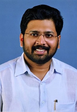
Shafi Parambil is an Indian politician and a member of the 14th Kerala Legislative Assembly. He is a member of the Indian National Congress and represents Palakkad constituency.

Palakkad State Assembly constituency, once known as Palghat constituency, is one of the 140 state legislative assembly constituencies at the state Kerala in southern India. It is also one of the 7 state legislative assembly constituencies included in the Palakkad Lok Sabha constituency. As of the 2021 assembly elections, the current MLA is Shafi Parambil of INC.

Trithala Maha Siva Temple is an ancient Hindu temple dedicated to Lord Shiva is situated on the banks of the Bharathappuzha river at Thrithala of Palakkad District in Kerala state in India. References to this temple are found in Aithihyamala of Kottarathil Sankunni and many classics of Malayalam Literature. The place where the idol is worshiped in the temple resembles the addition of sand. Legend has it that the Shiva Linga was made by Agnihotri by using the sand from Bharathapuzha river. Anointing is not performed because it is a Shivling of sand. The Shivalinga sits slightly oblique, as the mother of Agnihotri held on to the force, there was a slight tilt. The temple is a part of the 108 famous Shiva temples in Kerala. According to historians, the Trithala Siva Temple, built in the 9th or 10th century, marks the transition from Chola to Pandya style architecture.

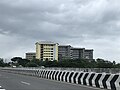
Palakkad South is a region in Palakkad city consisting of the southern suburbs of the city. Kanjikode Industrial Area, the second largest industrial area in Kerala after Kochi forms part of Palakkad South. Indian Institute of Technology, Palakkad, first and the only Indian Institute of Technology in Kerala also forms part. South police station is located at Kunnathurmedu.