
Breydon Water is a 514.4-hectare (1,271-acre) biological Site of Special Scientific Interest at Great Yarmouth, Norfolk. It is a Local Nature Reserve, a Ramsar site and a Special Protection Area. It is part of the Berney Marshes and Breydon Water nature reserve, which is managed by the Royal Society for the Protection of Birds (RSPB).

The River Axe is a 22-mile (35 km) long river in the counties of Dorset, Somerset and Devon, in the south-west of England. It rises in Dorset and flows south to Lyme Bay which it enters through the Axe Estuary in Devon. It is a shallow, non-navigable river, although its mouth at Axmouth has some boating activity. The name Axe derives from a Common Brittonic word meaning "abounding in fish", and is cognate with pysg, the Welsh word for fish.
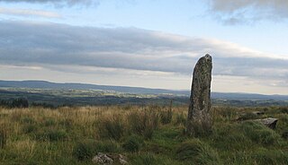
A menhir, standing stone, orthostat, or lith is a large man-made upright stone, typically dating from the European middle Bronze Age. They can be found individually as monoliths, or as part of a group of similar stones. Menhirs' size can vary considerably, but often taper toward the top.

A megalith is a large stone that has been used to construct a prehistoric structure or monument, either alone or together with other stones. There are over 35,000 in Europe alone, located widely from Sweden to the Mediterranean sea.

Mudflats or mud flats, also known as tidal flats or, in Ireland, slob or slobs, are coastal wetlands that form in intertidal areas where sediments have been deposited by tides or rivers. A global analysis published in 2019 suggested that tidal flat ecosystems are as extensive globally as mangroves, covering at least 127,921 km2 (49,391 sq mi) of the Earth's surface. They are found in sheltered areas such as bays, bayous, lagoons, and estuaries; they are also seen in freshwater lakes and salty lakes alike, wherein many rivers and creeks end. Mudflats may be viewed geologically as exposed layers of bay mud, resulting from deposition of estuarine silts, clays and aquatic animal detritus. Most of the sediment within a mudflat is within the intertidal zone, and thus the flat is submerged and exposed approximately twice daily.

Yelland is a village of 2,000 inhabitants situated in North Devon between Instow and Fremington in the English county of Devon. Yelland is included within the parish of Fremington.

A stone row or stone alignment is a linear arrangement of upright, parallel megalithic standing stones set at intervals along a common axis or series of axes, usually dating from the later Neolithic or Bronze Age. Rows may be individual or grouped, and three or more stones aligned can constitute a stone row.

The River Taw rises at Taw Head, a spring on the central northern flanks of Dartmoor, crosses north Devon and close to the sea at the town of Barnstaple, formerly a significant port, empties into Bideford Bay in the Bristol Channel having formed a large estuary of wide meanders which at its western extreme is joined by the estuary of the Torridge.
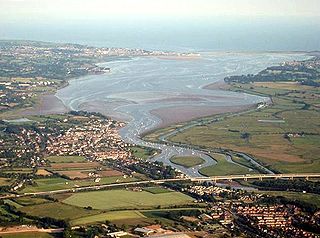
The Exe estuary is an estuary on the south coast of Devon, England.

The River Alde and River Ore form a river system in Suffolk, England passing by Snape and Aldeburgh. The River Alde and River Ore meet northwest of Blaxhall. From there downriver the combined river is known as the River Alde past Snape and Aldeburgh, and then again as the River Ore as it approaches Orford and flows by a shingle spit before emptying into the North Sea.
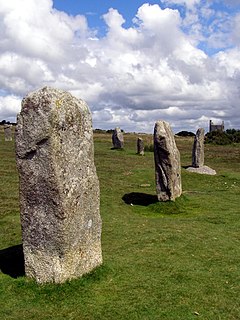
The Hurlers is a group of three stone circles in the civil parish of St Cleer, Cornwall, England, UK. The site is half-a-mile (0.8 km) west of the village of Minions on the eastern flank of Bodmin Moor, and approximately four miles (6 km) north of Liskeard at grid reference SX 258 714.

The Ythan Estuary is the tidal component of the Ythan River, emptying into the North Sea 19 kilometres (12 mi) north of Aberdeen, Scotland. The estuary’s tidal action extends a 7 kilometres (4.3 mi) inland and has characteristic widths of between 250 metres (820 ft) and 780 metres (2,560 ft). Besides the tidal channel there are interfaces to the upland dunes including mudflats, sand beaches and shingle flats. Reaches of salt marsh occur, but they are primarily near the Waterside Bridge and the mouth of the Tarty Burn, a small tributary river. Based upon the habitat of the moorland bordering the east of the Ythan River near the mouth, this estuary is the most significant coastal moorland in the northern United Kingdom.

The Callanish Stones are an arrangement of standing stones placed in a cruciform pattern with a central stone circle. They were erected in the late Neolithic era, and were a focus for ritual activity during the Bronze Age. They are near the village of Callanish on the west coast of Lewis in the Outer Hebrides, Scotland.

Burton Mere Wetlands is a nature reserve on the Dee Estuary straddling the border between Cheshire, England and Flintshire, Wales. It is run by the Royal Society for the Protection of Birds (RSPB) and incorporates the older Inner Marsh Farm reserve. It lies near the village of Burton, about 3 kilometres (1.9 mi) south of Neston. It has all been developed by the RSPB and includes a large area of mixed wetland habitats, bluebell woodlands, and arable fields all managed to attract wildlife.
The North Devon Coast was designated as an Area of Outstanding Natural Beauty in September 1959. The AONB contributes to a family of protected landscapes in the Southwest of England and a total of 38% of the region is classified by the International Union for Conservation of Nature as Category V Protected Landscapes. The twelve Areas of Outstanding Natural Beauty extend to 30% of the region, twice the proportion covered by AONBs in England as a whole and a further two National Parks, Dartmoor and Exmoor, cover an addition 7%. The North Devon Coast AONB covers 171 square kilometres (66 sq mi) of mainly coastal landscape from the border of Exmoor National Park at Combe Martin, through the mouth of the Taw & Torridge Estuary to the Cornish border at Marsland Mouth. The dune system at Braunton Burrows forms the core area of North Devon's Biosphere Reserve, the first "new style" Unesco-designated reserve in the United Kingdom. The whole of the AONB is within the Reserve boundaries.
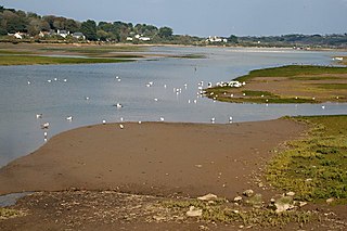
The Hayle Estuary is an estuary in west Cornwall, England, United Kingdom. It is one of the few natural harbours on the north coast of south-west England and during the prehistoric and early medieval periods was important for trade and the movement of people and ideas.
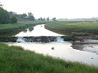
The River Clyst is a river of Devon, England. The name derives from Old English, and translates as Clean-stream. The river lends its name to several settlements on its route, Clyst Honiton, Clyst St Lawrence, Clyst St George, and Broadclyst. The William part of Clyst William derives from the Old English of aewelm, which means river source.

The Tamar–Tavy Estuary is a Site of Special Scientific Interest (SSSI) covering the tidal estuaries of the River Tamar and the River Tavy on the border between Cornwall and Devon in England, UK. Part of the Tamar estuary also forms the Tamar Estuary Nature Reserve, owned by the Cornwall Wildlife Trust. The site was designated in 1991 for its biodiversity and varying habitats that support many wader and wildfowl species, as well as the special interest of its marine biology.

Withypool Stone Circle, also known as Withypool Hill Stone Circle, is a stone circle located on the Exmoor moorland, near the village of Withypool in the southwestern English county of Somerset. The ring is part of a tradition of stone circle construction that spread throughout much of Britain, Ireland, and Brittany during the Late Neolithic and Early Bronze Age, over a period between 3300 and 900 BCE. The purpose of such monuments is unknown, although archaeologists speculate that the stones represented supernatural entities for the circle's builders.

Adur Estuary is a 62.2-hectare (154-acre) biological Site of Special Scientific Interest on the western outskirts of Shoreham-by-Sea in West Sussex. Part is a Royal Society for the Protection of Birds nature reserve.


