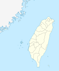
Yilan Airfield (ICAO: RCMS) (also known as Giran Airfield) is an abandoned airfield located in Yilan, Taihoku Prefecture, Taiwan. The first airfield of the three was built in 1936, with the other two built in 1943 and 1944. It mainly flew kamikaze missions until abandonment in 1945, before being acquired by the Kuomintang Government. It was closed in 1973 following failed attempts to upgrade the airfield.
This airport is not to be mistaken with Yilan Airport(IATA: ZYYL, ICAO: YLN), which operated from 1958 until 1977 by Civil Aviation Heilongjiang Provincial Administration in Yilan County, Mainland China.
History
Yilan consisted of 3 airfields, south, north and a west airfield which was considered “secret”. The southern airfield was known as Giran Airfield.
In 1925, a reconnaissance aircraft flew from Hualien to Yilan, landing at the Jinliujie Army Training Ground. The pilot briefly rested before returning to Hualien, making the event as the first time Yilan residents saw an “iron bird’ land. It also served as a psychological show of force by the colonial authorities.[1]
Giran Airfield (North airfield) was constructed in 1936, which was provided by demanding labour from students of the nearby agricultural college. The airfield was mostly built using hand-tools, and little to no equipment and machines were used. By 1938, Giran Airfield was completed with compacted earth reinforced runways installed using stone rollers, which was prone to flooding from the nearby Yilan River. Shortly after the completion, torrential rainfall submerged the runway, which subsequently underwent significant repairs and resumed operations by the end of 1938. From 1936 to 1938, Japan Air Transport operated a route to this airfield.[2] In 1939, the airfield was acquired by the Kuomintang Government (KMT), and the airfield operated as a weather observation station, with a nearby meteorological observation building.[3]
In June 1939, the control tower was built, and the airfield was expanded to an area of 0,27 square kilometers, which was relatively small. In January 1940, a weather observation facility was established, which included a three-story wind observation tower constructed using reinforced concrete.[1]
World War II
In September 1943, Giran Airfield was requisitioned for military usage, which followed the Battle of Midway's defeat in June 1942. The airfield was reserved for airfield parking, while the South Airfield was built and heavily utilized by kamikaze pilots. There were 14 camouflaged hardened aircraft shelters to conceal aircraft, as it was a frequent bombing location by the United States Army Air Forces (USAAF). As the war progressed, students and locals were recruited to construct aircraft decoys using the nearby bamboo and install them on the wrong side of the airfield. However, this backfired, and allied pilots quickly noticed as there were no black smoke.[3]
Towards the end of the Pacific War, the Kamikaze crew were stationed inside dormitories of the agricultural college, forcing the students to sleep in makeshift huts or inside the hall. Over 2,500 pilots had flown from the airfield to suicidal missions against the Allied forces.[3] In 1944, a West Airfield, known as the secret airfield was constructed.[1]
Post-war usage
After the war in 1945, Giran Airfield was abandoned by the Japanese forces, however, the KMT quickly acquired the airfield when they arrived to Taiwan. The northern and secret airfield were dismantled. Giran Airfield was used as an emergency landing ground, and also as a weather station. The airfield was renamed to Yilan, was paved by 5000 feet, and maintenance facilities installed approximately on the north-eastern side. Yilan Airfield was later handed over to the Taiwanese navy, which stationed one PC-3 Orion aircraft on the airfield as an airborne early warning aircraft. There was plans by the Navy to expand and upgrade the airfield's capabilities, however, it faced issues from the local government and nearby residents. These attempts were abandoned, and military was withdrawn along with the airfield closing down in 1973.[3]
Current usage
The site of the former three airfields were repurposed and their current usage are as follows:
North airfield — currently the site of Yilan Reserve Command and Jinliujie Recruit Training Center of the R.O.C. Armed Forces
On April 1, 1945, Consolidated B-24 Liberator bombers of the 43rd Bomb Group (H) of the US 5th Army Air Force bomber Giran Airfield.
On April 13, 1945, Avenger aircraft took off from HMS Victorious, en route back to the carrier after previously attacking Matsuyama Airfield strafed 12 aircraft on the ground at Giran Airfield.
On April 18, 1945, bombers attacked Giran Airfield.[5]
This page is based on this Wikipedia article Text is available under the CC BY-SA 4.0 license; additional terms may apply. Images, videos and audio are available under their respective licenses.