Ystradyfodwg

Last updated
Map showing the boundaries of Ystradyfodwg ancient parish (orange) and the areas added and subtracted in the formation of Rhondda Urban District. LDYstradyfodwgMap.png
Map showing the boundaries of Ystradyfodwg ancient parish (orange) and the areas added and subtracted in the formation of Rhondda Urban District.

Ystradyfodwg or Ystrad Dyfodwg (Vale of Tyfodwg) was an ancient upland parish in Glamorgan, Wales. It is believed to have been named after Dyfodwg (or Tyfodwg) a 6th-century saint or chieftain. The parish included most of the area which would later be known as Rhondda named for the parish rivers, Rhondda Fawr and Rhondda Fach.

Contents

Extent

The parish of Ystradyfodwg covered a vast area of 10,127 Hectares, but only had 542 inhabitants in 1801. It stretched from the confluence of the Rhondda rivers at Porth, over the mountain as far as the Vale of Neath. It was divided into four townships:

History

The small village of Ystradyfodwg was centred on its parish church, at the site now occupied by the church of St John the Baptist in Ton Pentre. Prior to the industrial revolution, Ton Pentre (then just called Ton) was a hamlet a short distance to the west of Ystradyfodwg, but as Ton grew it absorbed the older village. A railway station opened at Ystradyfodwg in 1861 on the Taff Vale Railway's Rhondda branch line, with the station initially called Ystrad. It was renamed Ystrad Rhondda in 1930, and renamed Ton Pentre in 1986 when a new Ystrad Rhondda railway station also opened about a mile further down the line to the east.

A local government district, governed by a local board, was established in 1877 covering most of the parish of Ystradyfodwg, but excluding the Rhigos area. [1] The district was enlarged in 1879 to cover parts of the neighbouring parishes of Llanwonno and Llantrisant. [2] [3] The Ystradyfodwg Local Board built itself a headquarters on Llewellyn Street in Pentre in 1884. [4] [5]

The local government district became the Ystradyfodwg Urban District in 1894, when the parish boundaries were also adjusted to match the urban district. [6] In 1897 the Ystradyfodwg Urban District Council formally changed the name of the parish and urban district from Ystradyfodwg to Rhondda. [7]

Development

The area would become better known in the mid 19th century a dynamic centre of the coal mining industry, with a large, new industrial population. During the 19th century, the population of the parish increased as follows:

1811182118311841185118611871188118911901
Population973985104713631998385717777450526968589907

Lower-quality coal from the Upper Coal series was worked in a small way in Trealaw as early as 1807, but the development of the Rhondda steam coal gave rise to the rapid population growth. The development began with the start-up of the Bute Merthyr colliery in Treherbert in 1855. [8] In the Rhondda Fach, the first coal was mined in 1862 at Ferndale. The Taff Vale Railway reached Treherbert in 1856. Collieries then rapidly developed along the valley, with the lower part of the valley developing last because of the deeper pits required to find the steam coal in that area. By the end of the century, mining villages formed an almost continuous urban strip along both valley floors, with coal mining and its ancillary trades virtually the sole industry.

The majority of the incomers came from West Wales, particularly Carmarthenshire and Ceredigion and spoke Welsh. Over 70% of the population of the parish was Welsh-speaking in 1891.

In 1877, the Hamlet of Rhigos was made a separate civil parish, and the remainder of Ystradyfodwg, together with the adjoining Rhondda valley portions of the parishes of Llanwonno and Llantrisant, became the urban sanitary district of Ystradyfodwg. This extended district became Ystradyfodwg Civil Parish and Urban District in 1894, and was renamed Rhondda Civil Parish and Urban District in 1897. See Rhondda (district).

See also

Related Research Articles

<span class="mw-page-title-main">Taff Vale Railway</span> Railway company and line in South Wales

The Taff Vale Railway (TVR) was a standard gauge railway in South Wales, built by the Taff Vale Railway Company to serve the iron and coal industries around Merthyr Tydfil and to connect them with docks in Cardiff. It was opened in stages in 1840 and 1841.

<span class="mw-page-title-main">Rhondda Cynon Taf</span> County borough in Wales

Rhondda Cynon Taf is a county borough in the south-east of Wales. It consists of five valleys: the Rhondda Fawr, Rhondda Fach, Cynon, Taff and Ely valleys, plus a number of towns and villages away from the valleys. Results from the 2011 census showed 19.1% of its 234,410 residents self-identified as having some ability in the use of the Welsh language. The county borough borders Merthyr Tydfil County Borough and Caerphilly County Borough to the east, Cardiff and the Vale of Glamorgan to the south, Bridgend County Borough and Neath Port Talbot to the west and Powys to the north. Its principal towns are - Aberdare, Llantrisant with Talbot Green and Pontypridd, with other key settlements/towns being - Maerdy, Ferndale, Hirwaun, Llanharan, Mountain Ash, Porth, Tonypandy, Tonyrefail and Treorchy.

<span class="mw-page-title-main">Tonypandy</span> Human settlement in Wales

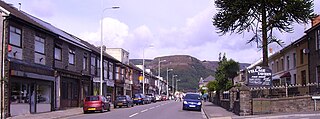
Tonypandy is a town, community and electoral ward located in the county borough of Rhondda Cynon Taf, within the historic county boundaries of Glamorgan, Wales, lying in the Rhondda Fawr Valley. A former industrial coal mining town, the town was the scene of the 1910 Tonypandy riots.

<span class="mw-page-title-main">Ynyshir</span> Human settlement in Wales

Ynyshir is a village and community located in the Rhondda Valley, within Rhondda Cynon Taf, South Wales. The name of the village means "long island" in Welsh and takes its name from a farm in the area, falling within the historic parishes of Ystradyfodwg and Llanwynno (Llanwonno). The community of Ynyshir lies between the small adjoining village of Wattstown and the larger town of neighbouring Porth.

<span class="mw-page-title-main">Rhondda</span> Urban area and district in South Wales

Rhondda, or the Rhondda Valley, is a former coalmining area in South Wales, historically in the county of Glamorgan. It takes its name from the River Rhondda, and embraces two valleys – the larger Rhondda Fawr valley and the smaller Rhondda Fach valley – so that the singular "Rhondda Valley" and the plural are both commonly used. The area forms part of the South Wales Valleys. From 1897 until 1996 there was a local government district of Rhondda. The former district at its abolition comprised sixteen communities. Since 1996 these sixteen communities of the Rhondda have been part of Rhondda Cynon Taf County Borough. The area of the former district is still used as the Rhondda Senedd constituency and Westminster constituency, having an estimated population in 2020 of 69,506. It is most noted for its historical coalmining industry, which peaked between 1840 and 1925. The valleys produced a strong Nonconformist movement manifest in the Baptist chapels that moulded Rhondda values in the 19th and early 20th centuries. It is also known for its male voice choirs and in sport and politics.

<span class="mw-page-title-main">River Rhondda</span>

The River Rhondda is a river in South Wales with two major tributaries, Rhondda Fawr and Rhondda Fach.

<span class="mw-page-title-main">District of Rhondda</span> Former district of Mid Glamorgan, Wales

Rhondda was a local government district in the geographical area of the Rhondda Valley, south Wales, from 1877 until 1996, with various statuses through its history.

<span class="mw-page-title-main">Treherbert</span> Human settlement in Wales

Treherbert is a village and community situated at the head of the Rhondda Fawr valley in the county borough of Rhondda Cynon Taf, Wales. Historically part of Glamorgan, Treherbert is a former industrial coal mining village which was at its economic peak between 1850 and 1920. Treherbert is the upper most community of the Rhondda Fawr and encompasses the districts of Blaencwm, Blaenrhondda, Tynewydd and Pen-yr-englyn.

<span class="mw-page-title-main">Ton Pentre</span> Human settlement in Wales

Ton Pentre is a village in the Rhondda Valley in the county borough of Rhondda Cynon Taf, Wales. Historically part of Glamorgan, Ton Pentre, a former industrial coal mining village, is a district of the community of Pentre. The old district of Ystradyfodwg was named after the church at Ton Pentre. Ton Pentre is, perhaps, best known for an event in 1924, when the Duke of York played a round of golf with Trade Unionist Frank Hodges.

<span class="mw-page-title-main">Dinas Rhondda</span> Human settlement in Wales

Dinas is a village near Tonypandy in the county borough of Rhondda Cynon Taf, Wales. Dinas is often referred to as Dinas Rhondda to avoid confusion with Dinas Powys in the Vale of Glamorgan. The word dinas in Modern Welsh means "city", but here it means "hill fort".

<span class="mw-page-title-main">A4061 road</span> Mountain pass road in Wales

The A4061 is the main road linking Bridgend with Hirwaun via the Ogmore and Rhondda Valleys in South Wales. It is a mix of streets connecting former mining communities, and mountain passes built as relief work for unemployed miners.

<span class="mw-page-title-main">Llanwonno</span> Human settlement in Wales

Llanwonno is a hamlet high up in the hills between the historic mining valleys of the Rhondda and the Cynon in Rhondda Cynon Taf, deep in the heart of the South Wales Valleys. Llanwonno consists of St Gwynno's Church and an inn – The Brynffynon Hotel.

<span class="mw-page-title-main">Church Village</span> Village in Rhonda Cynon Taf, Wales

Church Village is a large village in the historic parish and community of Llantwit Fardre, located within the Taff Ely district of the County Borough of Rhondda Cynon Taf in Wales. The village is centrally located being around 4 miles (6.4 km) from the local principal towns of Llantrisant to the southwest and Pontypridd to the north and is situated around 10 miles (16 km) northwest of Cardiff city centre.

Tynewydd is a village located in the County Borough of Rhondda Cynon Taf, south Wales. With Treherbert, Blaencwm, Blaenrhondda and Pen-yr-englyn it is part of a community of Treherbert. The village lies in the former industrial coal mining area at the head of Rhondda Fawr, the larger of the Rhondda Valleys.

Rhondda Tramways Company operated a tramway service in Rhondda, Wales, between 1904 and 1934.

The first election to the Glamorgan County Council was held on 17 January 1889. Results were announced over several days. They were followed by the 1892 election. The authority, by far the largest county in Wales in terms of population, was established by the 1888 Local Government Act. The county of Glamorgan was at this time becoming heavily industrialised although some areas such as the Vale of Glamorgan remained essentially rural.

<span class="mw-page-title-main">Idris Williams</span> Welsh educationalist and councillor (1836–1894)

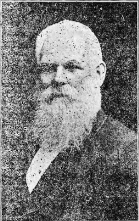
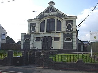
Idris Williams was an educationalist, prominent Congregationalist, and Liberal councillor for the Cymmer division of the Glamorgan County Council, South Wales.

References

  1. Parliamentary papers. London: House of Commons. 1877. p. 41. Retrieved 20 October 2022.
  2. "Ystradyfodwg Urban Sanitary District". A Vision of Britain through Time. GB Historical GIS / University of Portsmouth. Retrieved 20 October 2022.
  3. Public Works. London: House of Lords. 1879. p. 23. Retrieved 21 October 2022.
  4. "Opening of the Ystradyfodwg Public Offices". Western Mail. Cardiff. 5 May 1884. p. 4. Retrieved 20 October 2022.
  5. Cadw. "Former Rhondda Borough Council Offices (Grade II) (18105)". National Historic Assets of Wales . Retrieved 20 October 2022.
  6. Annual Report of the Local Government Board. London: Her Majesty's Stationery Office. 1895. p. 250. Retrieved 19 October 2022. The County of Glamorgan (Pontypridd, &c.) Confirmation Order, 1894
  7. "Rhondda Urban District Council: The change of name sanctioned". Glamorgan Free Press. Pontypridd. 24 July 1897. p. 3. Retrieved 20 October 2022.
  8. Davies J, A History of Wales, Penguin, 1994, ISBN   0-14-014581-8, p 402

This article incorporates text from a publication now in the public domain :  Wood, James, ed. (1907). The Nuttall Encyclopædia . London and New York: Frederick Warne.{{cite encyclopedia}}: Missing or empty |title= (help)

Coordinates: 51°38′58″N3°29′12″W / 51.64944°N 3.48667°W / 51.64944; -3.48667