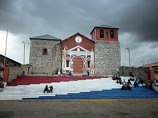
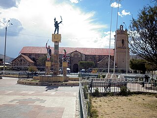
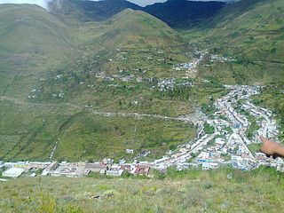
Yunga District

Last updated
Yunga
Yunka
District
Country Flag of Peru.svg  Peru
Region Moquegua
Province General Sánchez Cerro
Founded March 19, 1965
Capital Yunga
Government
   Mayor Leonardo Chivigorri Chivigorri
Area
  Total 110.74 km2 (42.76 sq mi)
Elevation 3,571 m (11,716 ft)
Population (2005 census)
  Total 1,352
  Density 12/km2 (32/sq mi)
Time zone PET (UTC-5)
UBIGEO 180211

Yunga District is one of eleven districts of the province General Sánchez Cerro in Peru. [1]

Districts of Peru third level administrative subdivision of Peru

The districts of Peru are the third-level country subdivisions of Peru. They are subdivisions of the provinces, which in turn are subdivisions of the larger regions or departments. There are 1,838 districts in total.

General Sánchez Cerro Province Province in Moquegua, Peru

The General Sánchez Cerro Province is the smallest of three provinces in the Moquegua Region of Peru. The capital of the province is Omate. The province was named after the former Peruvian army officer and president Luis Miguel Sánchez Cerro.

Peru republic in South America

Peru, officially the Republic of Peru, is a country in western South America. It is bordered in the north by Ecuador and Colombia, in the east by Brazil, in the southeast by Bolivia, in the south by Chile, and in the west by the Pacific Ocean. Peru is a megadiverse country with habitats ranging from the arid plains of the Pacific coastal region in the west to the peaks of the Andes mountains vertically extending from the north to the southeast of the country to the tropical Amazon Basin rainforest in the east with the Amazon river.

Contents

Ethnic groups

The people in the district are mainly indigenous citizens of Quechua descent. Quechua is the language which the majority of the population (73.38%) learnt to speak in childhood, 24.98% of the residents started speaking using the Spanish language (2007 Peru Census). [2]

Indigenous peoples of the Americas Pre-Columbian inhabitants of North, Central, and South America and their descendants

The indigenous peoples of the Americas are the Pre-Columbian peoples of North, Central and South America and their descendants.

Quechua people ethnic group

Quechua people or Quecha peoples may refer to any or all speakers of the Quechua languages, which originated among the indigenous peoples of South America. Most Quechua speakers are native to Peru, although there are some significant populations living in Ecuador, Bolivia, Chile, Colombia and Argentina.

Spanish language Romance language

Spanish or Castilian, is a Western Romance language that originated in the Castile region of Spain and today has hundreds of millions of native speakers in the Americas and Spain. It is a global language and the world's second-most spoken native language, after Mandarin Chinese.

See also

Related Research Articles

Lloque District is one of eleven districts of the province General Sánchez Cerro in Peru.

Achaya District is one of fifteen districts of the province Azángaro in Peru.

Arapa District is one of fifteen districts of the province Azángaro in Peru.

Asillo District is one of fifteen districts of the province Azángaro in Peru.

Azángaro District is one of fifteen districts of the province Azángaro in Peru.

José Domingo Choquehuanca District is one of fifteen districts of the province Azángaro in Peru.

San Juan de Salinas District is one of fifteen districts of the province Azángaro in Peru.

Santiago de Pupuja District is one of fifteen districts of the province Azángaro in Peru.

Tirapata District is one of fifteen districts of the province Azángaro in Peru.

Coata District District in Puno, Peru

Coata District is one of fifteen districts of the province Puno in Peru.

Huata District is one of fifteen districts of the province Puno in Peru.

Paucarcolla District District in Puno, Peru

Paucarcolla District is one of fifteen districts of the province Puno in Peru.

Cabanilla District District in Puno, Peru

Cabanilla District is one of ten districts of the province Lampa in Peru.

Calapuja District is one of ten districts of the province Lampa in Peru.

Cupi District is one of nine districts of the province Melgar in Peru.

Llalli District is one of nine districts of the province Melgar in Peru.

Orurillo District is one of nine districts of the province Melgar in Peru.

Phara District District in Puno, Peru

Phara District is one of ten districts of the province Sandia in Peru.

Cabana District is one of four districts of the province San Román in Peru.

Caracoto District is one of four districts of the province San Román in Peru.

References

  1. (in Spanish) Instituto Nacional de Estadística e Informática. Banco de Información Distrital Archived April 23, 2008, at the Wayback Machine .. Retrieved April 11, 2008.
  2. inei.gob.pe Archived January 27, 2013, at the Wayback Machine . INEI, Peru, Censos Nacionales 2007, Frequencias: Preguntas de Población: Idioma o lengua con el que aprendió hablar (in Spanish)

Coordinates: 16°11′42″S70°40′41″W / 16.1951°S 70.6780°W / -16.1951; -70.6780

Geographic coordinate system Coordinate system

A geographic coordinate system is a coordinate system that enables every location on Earth to be specified by a set of numbers, letters or symbols. The coordinates are often chosen such that one of the numbers represents a vertical position and two or three of the numbers represent a horizontal position; alternatively, a geographic position may be expressed in a combined three-dimensional Cartesian vector. A common choice of coordinates is latitude, longitude and elevation. To specify a location on a plane requires a map projection.