Kilburn railway station is located on the Gawler line. Situated in the inner northern Adelaide suburb of Kilburn, it is 7.7 kilometres (4.8 mi) from Adelaide station.
Naranbulag is a sum (district) of Uvs Province in western Mongolia.

Paulina is a village in the administrative district of Gmina Kcynia, within Nakło County, Kuyavian-Pomeranian Voivodeship, in north-central Poland. It lies approximately 12 kilometres (7 mi) north of Kcynia, 9 km (6 mi) south-west of Nakło nad Notecią, and 35 km (22 mi) west of Bydgoszcz.

Shahumyan, is a village in the Ararat Province of Armenia. It was named after Stepan Shahumyan, a Bolshevik commissar.
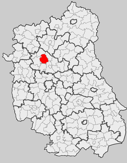
Kożanówka is a village in the administrative district of Gmina Kodeń, within Biała Podlaska County, Lublin Voivodeship, in eastern Poland, close to the border with Belarus.
Wykowo is a settlement in the administrative district of Gmina Rajgród, within Grajewo County, Podlaskie Voivodeship, in north-eastern Poland. It lies approximately 15 kilometres (9 mi) south-west of Rajgród, 10 km (6 mi) south-east of Grajewo, and 68 km (42 mi) north-west of the regional capital Białystok.
Mąkoszyn is a village in the administrative district of Gmina Tuszyn, within Łódź East County, Łódź Voivodeship, in central Poland. It lies approximately 11 kilometres (7 mi) south of Tuszyn and 31 km (19 mi) south of the regional capital Łódź.

Ağalıkənd is a village in the Bilasuvar Rayon of Azerbaijan.
Ostrów is a village in the administrative district of Gmina Brzeźnio, within Sieradz County, Łódź Voivodeship, in central Poland. It lies approximately 4 kilometres (2 mi) west of Brzeźnio, 17 km (11 mi) south-west of Sieradz, and 70 km (43 mi) south-west of the regional capital Łódź.
Wilkszyce is a village in the administrative district of Gmina Goszczanów, within Sieradz County, Łódź Voivodeship, in central Poland. It lies approximately 7 kilometres (4 mi) south of Goszczanów, 24 km (15 mi) north-west of Sieradz, and 68 km (42 mi) west of the regional capital Łódź.
Tymianka is a village in the administrative district of Gmina Stryków, within Zgierz County, Łódź Voivodeship, in central Poland. It lies approximately 4 kilometres (2 mi) north-west of Stryków, 14 km (9 mi) north-east of Zgierz, and 18 km (11 mi) north-east of the regional capital Łódź.
Luta is a village in the administrative district of Gmina Stąporków, within Końskie County, Świętokrzyskie Voivodeship, in south-central Poland. It lies approximately 10 kilometres (6 mi) south of Stąporków, 19 km (12 mi) south-east of Końskie, and 21 km (13 mi) north of the regional capital Kielce.

Dortmund University of Applied Sciences and Arts is a Fachhochschule in Dortmund, North Rhine-Westphalia, Germany with 12,300 students, and 669 staff, 232 of which are professors. It is situated in the Ruhr area, the fourth largest urban area in Europe. The Fachhochschule was created by a merger of several institutions of higher learning in 1971. Owing to its history as separate institutions, it consists of three campuses in different parts of Dortmund. The departments of mechanical and electrical engineering are located at Sonnenstraße near the city center. The department of design has its own campus at Max-Ophüls-Platz while the departments of social work, economics, computer science and architecture are housed in several buildings next to the Technical University of Dortmund campus in the suburb of Eichlinghofen. The university is known for its business faculty. Additional offices in the city centre are used for administrative purposes.
Prosna is a village in the administrative district of Gmina Nowe Miasto nad Pilicą, within Grójec County, Masovian Voivodeship, in east-central Poland.
Gródek is a village in the administrative district of Gmina Jabłonna Lacka, within Sokołów County, Masovian Voivodeship, in east-central Poland. It lies approximately 5 kilometres (3 mi) east of Jabłonna Lacka, 21 km (13 mi) north-east of Sokołów Podlaski, and 108 km (67 mi) east of Warsaw.
Müşfiqabad is a village and municipality in the Qaradağ raion of Baku, Azerbaijan. It has a population of 8,011.
Lai'an County is a county in the east of Anhui Province, China, lying between the Yangtze River and the Huai River. It is under the administration of Chuzhou city.
Laar is a hamlet in the Dutch province of North Brabant. It is located in the municipality of Nuenen, Gerwen en Nederwetten, 2 km north of the town of Nuenen, just northwest of Gerwen.

The Muxklippe is a granite rock formation in the Harz National Park in Germany.
Linnuse is a village in Saaremaa Parish, Saare County in western Estonia.