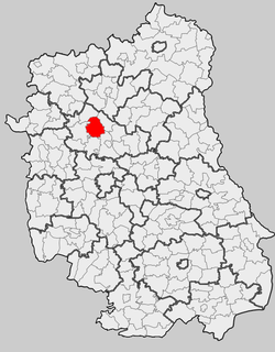
Firlej is a village in Lubartów County, Lublin Voivodeship, in eastern Poland. It is the seat of the gmina called Gmina Firlej. It lies approximately 12 kilometres (7 mi) north-west of Lubartów and 35 km (22 mi) north of the regional capital Lublin. It is situated close to Lake Firlej

Kunów is a village in the administrative district of Gmina Firlej, within Lubartów County, Lublin Voivodeship, in eastern Poland. It lies approximately 4 kilometres (2 mi) west of Firlej, 15 km (9 mi) north-west of Lubartów, and 37 km (23 mi) north of the regional capital Lublin.
Majdan Sobolewski is a village in the administrative district of Gmina Firlej, within Lubartów County, Lublin Voivodeship, in eastern Poland. It lies approximately 6 kilometres (4 mi) south-west of Firlej, 14 km (9 mi) north-west of Lubartów, and 34 km (21 mi) north of the regional capital Lublin.
Pożarów is a village in the administrative district of Gmina Firlej, within Lubartów County, Lublin Voivodeship, in eastern Poland. It lies approximately 7 kilometres (4 mi) north of Firlej, 19 km (12 mi) north-west of Lubartów, and 42 km (26 mi) north of the regional capital Lublin.
Przypisówka is a village in the administrative district of Gmina Firlej, within Lubartów County, Lublin Voivodeship, in eastern Poland. It lies approximately 5 kilometres (3 mi) east of Firlej, 10 km (6 mi) north of Lubartów, and 34 km (21 mi) north of the regional capital Lublin.
Serock is a village in the administrative district of Gmina Firlej, within Lubartów County, Lublin Voivodeship, in eastern Poland. It lies approximately 2 kilometres (1 mi) north-east of Firlej, 13 km (8 mi) north-west of Lubartów, and 36 km (22 mi) north of the regional capital Lublin.
Sułoszyn is a village in the administrative district of Gmina Firlej, within Lubartów County, Lublin Voivodeship, in eastern Poland. It lies approximately 5 kilometres (3 mi) north of Firlej, 16 km (10 mi) north of Lubartów, and 40 km (25 mi) north of the regional capital Lublin.
Wola Skromowska is a village in the administrative district of Gmina Firlej, within Lubartów County, Lublin Voivodeship, in eastern Poland. It lies approximately 8 kilometres (5 mi) north-west of Firlej, 20 km (12 mi) north-west of Lubartów, and 42 km (26 mi) north of the regional capital Lublin.
Siedliska is a village in the administrative district of Gmina Kamionka, within Lubartów County, Lublin Voivodeship, in eastern Poland. It lies approximately 2 kilometres (1 mi) east of Kamionka, 9 km (6 mi) west of Lubartów, and 25 km (16 mi) north of the regional capital Lublin.
Aleksandrówka is a village in the administrative district of Gmina Michów, within Lubartów County, Lublin Voivodeship, in eastern Poland. It lies approximately 8 kilometres (5 mi) south-east of Michów, 14 km (9 mi) west of Lubartów, and 29 km (18 mi) north-west of the regional capital Lublin.
Gołąb is a village in the administrative district of Gmina Michów, within Lubartów County, Lublin Voivodeship, in eastern Poland. It lies approximately 6 kilometres (4 mi) south-east of Michów, 16 km (10 mi) west of Lubartów, and 31 km (19 mi) north-west of the regional capital Lublin.
Rudzienko is a village in the administrative district of Gmina Michów, within Lubartów County, Lublin Voivodeship, in eastern Poland. It lies approximately 2 kilometres (1 mi) south of Michów, 21 km (13 mi) west of Lubartów, and 35 km (22 mi) north-west of the regional capital Lublin.
Pałecznica is a village in the administrative district of Gmina Niedźwiada, within Lubartów County, Lublin Voivodeship, in eastern Poland. It lies approximately 7 kilometres (4 mi) south of Niedźwiada, 5 km (3 mi) east of Lubartów, and 27 km (17 mi) north of the regional capital Lublin.
Głębokie is a village in the administrative district of Gmina Uścimów, within Lubartów County, Lublin Voivodeship, in eastern Poland. It lies approximately 2 kilometres (1 mi) north of Uścimów, 24 km (15 mi) east of Lubartów, and 37 km (23 mi) north-east of the regional capital Lublin.
Zdrapy is a village in the administrative district of Gmina Bychawa, within Lublin County, Lublin Voivodeship, in eastern Poland. It lies approximately 4 kilometres (2 mi) north of Bychawa and 23 km (14 mi) south of the regional capital Lublin.
Łukawka is a village in the administrative district of Gmina Baranów, within Puławy County, Lublin Voivodeship, in eastern Poland. It lies approximately 9 kilometres (6 mi) south-east of Baranów, 22 km (14 mi) north-east of Puławy, and 38 km (24 mi) north-west of the regional capital Lublin.
Borysów is a village in the administrative district of Gmina Żyrzyn, within Puławy County, Lublin Voivodeship, in eastern Poland. It lies approximately 4 kilometres (2 mi) north-west of Żyrzyn, 13 km (8 mi) north-east of Puławy, and 47 km (29 mi) north-west of the regional capital Lublin.
Żerdź is a village in the administrative district of Gmina Żyrzyn, within Puławy County, Lublin Voivodeship, in eastern Poland. It lies approximately 3 kilometres (2 mi) north-west of Żyrzyn, 14 km (9 mi) north-east of Puławy, and 46 km (29 mi) north-west of the regional capital Lublin.