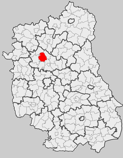
Firlej is a village in Lubartów County, Lublin Voivodeship, in eastern Poland. It is the seat of the gmina called Gmina Firlej. It lies approximately 12 kilometres (7 mi) north-west of Lubartów and 35 km (22 mi) north of the regional capital Lublin. It is situated close to Lake Firlej

Kunów is a village in the administrative district of Gmina Firlej, within Lubartów County, Lublin Voivodeship, in eastern Poland. It lies approximately 4 kilometres (2 mi) west of Firlej, 15 km (9 mi) north-west of Lubartów, and 37 km (23 mi) north of the regional capital Lublin.
Majdan Sobolewski is a village in the administrative district of Gmina Firlej, within Lubartów County, Lublin Voivodeship, in eastern Poland. It lies approximately 6 kilometres (4 mi) south-west of Firlej, 14 km (9 mi) north-west of Lubartów, and 34 km (21 mi) north of the regional capital Lublin.
Przypisówka is a village in the administrative district of Gmina Firlej, within Lubartów County, Lublin Voivodeship, in eastern Poland. It lies approximately 5 kilometres (3 mi) east of Firlej, 10 km (6 mi) north of Lubartów, and 34 km (21 mi) north of the regional capital Lublin.
Serock is a village in the administrative district of Gmina Firlej, within Lubartów County, Lublin Voivodeship, in eastern Poland. It lies approximately 2 kilometres (1 mi) north-east of Firlej, 13 km (8 mi) north-west of Lubartów, and 36 km (22 mi) north of the regional capital Lublin.
Sobolew is a village in the administrative district of Gmina Firlej, within Lubartów County, Lublin Voivodeship, in eastern Poland. It lies approximately 5 kilometres (3 mi) south of Firlej, 10 km (6 mi) north-west of Lubartów, and 31 km (19 mi) north of the regional capital Lublin.
Sułoszyn is a village in the administrative district of Gmina Firlej, within Lubartów County, Lublin Voivodeship, in eastern Poland. It lies approximately 5 kilometres (3 mi) north of Firlej, 16 km (10 mi) north of Lubartów, and 40 km (25 mi) north of the regional capital Lublin.
Wola Skromowska is a village in the administrative district of Gmina Firlej, within Lubartów County, Lublin Voivodeship, in eastern Poland. It lies approximately 8 kilometres (5 mi) north-west of Firlej, 20 km (12 mi) north-west of Lubartów, and 42 km (26 mi) north of the regional capital Lublin.
Ciemno is a village in the administrative district of Gmina Kamionka, within Lubartów County, Lublin Voivodeship, in eastern Poland. It lies approximately 4 kilometres (2 mi) north of Kamionka, 12 km (7 mi) west of Lubartów, and 30 km (19 mi) north of the regional capital Lublin.
Dąbrówka is a village in the administrative district of Gmina Kamionka, within Lubartów County, Lublin Voivodeship, in eastern Poland. It lies approximately 11 kilometres (7 mi) south of Kamionka, 12 km (7 mi) south-west of Lubartów, and 16 km (10 mi) north of the regional capital Lublin.
Górka is a village in the administrative district of Gmina Kock, within Lubartów County, Lublin Voivodeship, in eastern Poland. It lies approximately 4 kilometres (2 mi) south-east of Kock, 20 km (12 mi) north of Lubartów, and 44 km (27 mi) north of the regional capital Lublin.
Ruska Wieś is a village in the administrative district of Gmina Kock, within Lubartów County, Lublin Voivodeship, in eastern Poland. It lies approximately 5 kilometres (3 mi) south-west of Kock, 21 km (13 mi) north-west of Lubartów, and 43 km (27 mi) north of the regional capital Lublin.
Giżyce is a village in the administrative district of Gmina Michów, within Lubartów County, Lublin Voivodeship, in eastern Poland. It lies approximately 10 kilometres (6 mi) north-east of Michów, 22 km (14 mi) north-west of Lubartów, and 42 km (26 mi) north of the regional capital Lublin.
Gołąb is a village in the administrative district of Gmina Michów, within Lubartów County, Lublin Voivodeship, in eastern Poland. It lies approximately 6 kilometres (4 mi) south-east of Michów, 16 km (10 mi) west of Lubartów, and 31 km (19 mi) north-west of the regional capital Lublin.
Katarzyn is a village in the administrative district of Gmina Michów, within Lubartów County, Lublin Voivodeship, in eastern Poland. It lies approximately 6 kilometres (4 mi) north-west of Michów, 25 km (16 mi) north-west of Lubartów, and 41 km (25 mi) north-west of the regional capital Lublin.
Kolonia Giżyce is a village in the administrative district of Gmina Michów, within Lubartów County, Lublin Voivodeship, in eastern Poland. It lies approximately 8 kilometres (5 mi) north-east of Michów, 21 km (13 mi) north-west of Lubartów, and 40 km (25 mi) north of the regional capital Lublin.
Krupy is a village in the administrative district of Gmina Michów, within Lubartów County, Lublin Voivodeship, in eastern Poland. It lies approximately 7 kilometres (4 mi) north of Michów, 22 km (14 mi) north-west of Lubartów, and 41 km (25 mi) north of the regional capital Lublin.
Mejznerzyn is a village in the administrative district of Gmina Michów, within Lubartów County, Lublin Voivodeship, in eastern Poland. It lies approximately 5 kilometres (3 mi) north of Michów, 24 km (15 mi) north-west of Lubartów, and 41 km (25 mi) north-west of the regional capital Lublin.