Zaloka

Last updated
Zaloka

Zaloka.jpg

The village of Zaloka, with St. Agnes's Church
Slovenia location map.svg
Red pog.svg
Zaloka
Location in Slovenia
Coordinates: 45°59′48.3″N15°2′18.01″E / 45.996750°N 15.0383361°E / 45.996750; 15.0383361 Coordinates: 45°59′48.3″N15°2′18.01″E / 45.996750°N 15.0383361°E / 45.996750; 15.0383361
Country Flag of Slovenia.svg Slovenia
Traditional region Lower Carniola
Statistical region Southeast Slovenia
Municipality Šentrupert
Area
  Total 2.96 km2 (1.14 sq mi)
Elevation 544.6 m (1,786.7 ft)
Population (2012)
  Total 44
  Density 15/km2 (40/sq mi)
[1]

Zaloka (pronounced  [ˈzaːlɔka] ) is a village in the Municipality of Šentrupert in southeastern Slovenia. The area is part of the historical region of Lower Carniola. The municipality is now included in the Southeast Slovenia Statistical Region. [2]

Village Small clustered human settlement smaller than a town

A village is a clustered human settlement or community, larger than a hamlet but smaller than a town, with a population ranging from a few hundred to a few thousand. Though villages are often located in rural areas, the term urban village is also applied to certain urban neighborhoods. Villages are normally permanent, with fixed dwellings; however, transient villages can occur. Further, the dwellings of a village are fairly close to one another, not scattered broadly over the landscape, as a dispersed settlement.

Slovenia republic in Central Europe

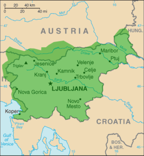
Slovenia, officially the Republic of Slovenia, is a sovereign state located in southern Central Europe at a crossroads of important European cultural and trade routes. It is bordered by Italy to the west, Austria to the north, Hungary to the northeast, Croatia to the southeast, and the Adriatic Sea to the southwest. It covers 20,273 square kilometers (7,827 sq mi) and has a population of 2.07 million. One of the successor states of the former Yugoslavia, Slovenia is a parliamentary republic and a member of the United Nations, of the European Union, and of NATO. The capital and largest city is Ljubljana.

Lower Carniola Traditional region in Slovenia

Lower Carniola is a traditional region in Slovenia, the southeastern part of the historical Carniola region.

The local church is dedicated to Saint Agnes (Slovene : sveta Neža) and belongs to the Parish of Šentrupert. It dates to the 16th century. [3]

Church (building) building constructed for Christian worship

A church building or church house, often simply called a church, is a building used for Christian religious activities, particularly for Christian worship services. The term is often used by Christians to refer to the physical buildings where they worship, but it is sometimes used to refer to buildings of other religions. In traditional Christian architecture, the church is often arranged in the shape of a Christian cross. When viewed from plan view the longest part of a cross is represented by the aisle and the junction of the cross is located at the altar area.

Agnes of Rome Christian martyr

Agnes of Rome is a virgin martyr, venerated as a saint in the Roman Catholic Church, Eastern Orthodox Church, the Anglican Communion, and Lutheranism. She is one of seven women who, along with the Blessed Virgin, are commemorated by name in the Canon of the Mass.
Slovene language language spoken in Slovenia

Slovene or Slovenian belongs to the group of South Slavic languages. It is spoken by approximately 2.5 million speakers worldwide, the majority of whom live in Slovenia. It is the first language of about 2.1 million Slovenian people and is one of the 24 official and working languages of the European Union.

Related Research Articles

Šentrupert Place in Lower Carniola, Slovenia

Šentrupert is a village in the traditional Lower Carniola region in southeastern Slovenia. In the past it was the cultural and economical centre of the Mirna Valley, but after the railway line bypassed the town the centre shifted to nearby Mirna. It is the seat of the Municipality of Šentrupert.

Bistrica, Šentrupert Place in Lower Carniola, Slovenia

Bistrica is a settlement in the Municipality of Šentrupert in southeastern Slovenia. The municipality is now included in the Southeast Slovenia Statistical Region. The settlement lies on the regional road leading southeast from Mirna to Mokronog in the historical region of Lower Carniola. The rail line from Sevnica to Trebnje runs south of the settlement.

Brinje, Šentrupert in Lower Carniola, Slovenia

Brinje is a settlement south of Šentrupert in the historical region of Lower Carniola in southeastern Slovenia. The Municipality of Šentrupert is now included in the Southeast Slovenia Statistical Region.

Draga pri Šentrupertu Place in Lower Carniola, Slovenia

Draga pri Šentrupertu is a village northwest of Šentrupert in southeastern Slovenia. The area is part of the historical region of Lower Carniola. The Municipality of Šentrupert is now included in the Southeast Slovenia Statistical Region.

Gorenje Jesenice Place in Lower Carniola, Slovenia

Gorenje Jesenice is a village in the Municipality of Šentrupert in southeastern Slovenia. The area is part of the historical region of Lower Carniola. The municipality is now included in the Southeast Slovenia Statistical Region.

Hom, Šentrupert Place in Lower Carniola, Slovenia

Hom is a dispersed settlement in the Municipality of Šentrupert in southeastern Slovenia. The area is part of the historical region of Lower Carniola. The municipality is now included in the Southeast Slovenia Statistical Region.

Hrastno in Lower Carniola, Slovenia

Hrastno is a settlement in the hills northeast of Šentrupert in the historical region of Lower Carniola in southeastern Slovenia. The Municipality of Šentrupert is now included in the Southeast Slovenia Statistical Region.

Kamnje, Šentrupert in Lower Carniola, Slovenia

Kamnje is a settlement just north of Šentrupert in southeastern Slovenia. The area is part of the historical region of Lower Carniola. The Municipality of Šentrupert is now included in the Southeast Slovenia Statistical Region.

Kostanjevica, Šentrupert in Lower Carniola, Slovenia

Kostanjevica is a village in the Municipality of Šentrupert in southeastern Slovenia. It is a dispersed settlement in the hills north of Šentrupert in the historical region of Lower Carniola. The municipality is now included in the Southeast Slovenia Statistical Region.

Okrog, Šentrupert Place in Lower Carniola, Slovenia

Okrog is a settlement in the Municipality of Šentrupert in southeastern Slovenia. The area is part of the historical region of Lower Carniola. The municipality is now included in the Southeast Slovenia Statistical Region.

Prelesje, Šentrupert Place in Lower Carniola, Slovenia

Prelesje is a settlement in the Municipality of Šentrupert in southeastern Slovenia. The area is part of the historical region of Lower Carniola. The municipality is now included in the Southeast Slovenia Statistical Region. The railway line from Sevnica to Trebnje runs just south of the settlement.

Ravne nad Šentrupertom in Lower Carniola, Slovenia

Ravne nad Šentrupertom is a small settlement in the hills north of Šentrupert in the Lower Carniola region of southeastern Slovenia. The entire Municipality of Šentrupert is included in the Southeast Slovenia Statistical Region.

Rakovnik pri Šentrupertu in Lower Carniola, Slovenia

Rakovnik pri Šentrupertu is a village in the Municipality of Šentrupert in southeastern Slovenia. It lies south of Šentrupert and east of Mirna in the historical region of Lower Carniola. The railway line from Sevnica to Trebnje runs across the settlement's territory. The Municipality of Šentrupert is now included in the Southeast Slovenia Statistical Region.

Ravnik, Šentrupert in Lower Carniola, Slovenia

Ravnik is a dispersed settlement in the hills west of Šentrupert in the historical region of Lower Carniola in Slovenia. The Municipality of Šentrupert is now included in the Southeast Slovenia Statistical Region.

Roženberk in Lower Carniola, Slovenia

Roženberk is a small settlement north of Dolenje Jesenice in the Municipality of Šentrupert in southeastern Slovenia. The area is part of the historical region of Lower Carniola. The municipality is now included in the Southeast Slovenia Statistical Region.

Straža, Šentrupert Place in Lower Carniola, Slovenia

Straža is a settlement in the Municipality of Šentrupert in southeastern Slovenia. It lies on the road from Šentrupert towards Mirna in the historical region of Lower Carniola. The municipality is now included in the Southeast Slovenia Statistical Region. The settlement includes the hamlets of Kurja Dolina, Grilov Hrib, and Praproče.

Vesela Gora Place in Lower Carniola, Slovenia

Vesela Gora is a small settlement in the Municipality of Šentrupert in southeastern Slovenia. The area is part of the historical region of Lower Carniola. The municipality is now included in the Southeast Slovenia Statistical Region.

Vrh, Šentrupert in Lower Carniola, Slovenia

Vrh is a settlement east of Šentrupert in the historical region of Lower Carniola in southeastern Slovenia. The Municipality of Šentrupert is now included in the Southeast Slovenia Statistical Region.

Zabukovje, Šentrupert Place in Lower Carniola, Slovenia

Zabukovje is a dispersed settlement in the Municipality of Šentrupert in southeastern Slovenia. It lies in the hills west of Šentrupert and north of Mirna. The area is part of the historical region of Lower Carniola. The municipality is now included in the Southeast Slovenia Statistical Region.

Municipality of Šentrupert Municipality in Slovenia

The Municipality of Šentrupert is a municipality in southeastern Slovenia. The seat of the municipality is the town of Šentrupert. The area was part of the traditional region of Lower Carniola. It is now included in the Southeast Slovenia Statistical Region.

References

  1. "Zaloka, Šentrupert". Place Names. Statistical Office of the Republic of Slovenia. Retrieved 13 March 2013.
  2. Šentrupert municipal site
  3. "EŠD 2481". Registry of Immovable Cultural Heritage (in Slovenian). Ministry of Culture of the Republic of Slovenia. Retrieved 6 July 2011.