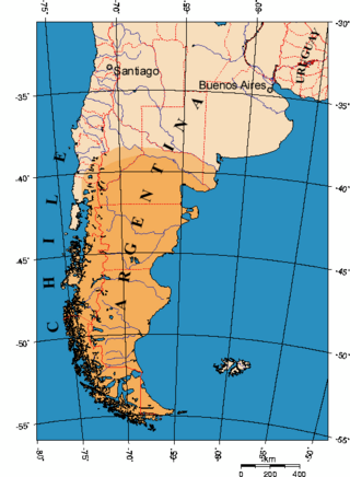
Patagonia is a geographical region that encompasses the southern end of South America, governed by Argentina and Chile. The region comprises the southern section of the Andes Mountains with lakes, fjords, temperate rainforests, and glaciers in the west and deserts, tablelands, and steppes to the east. Patagonia is bounded by the Pacific Ocean on the west, the Atlantic Ocean to the east, and many bodies of water that connect them, such as the Strait of Magellan, the Beagle Channel, and the Drake Passage to the south.

Río Negro is a province of Argentina, located in northern Patagonia. Neighboring provinces are from the south clockwise Chubut, Neuquén, Mendoza, La Pampa and Buenos Aires. To the east lies the Atlantic Ocean.

Neuquén is a province of Argentina, located in the west of the country, at the northern end of Patagonia. It borders Mendoza Province to the north, Rio Negro Province to the southeast, and Chile to the west. It also meets La Pampa Province at its northeast corner.
Neuquén is the capital city of the Argentine province of Neuquén and of the Confluencia Department, located in the east of the province. It occupies a strip of land west of the confluence of the Limay and Neuquén rivers which form the Río Negro, making it part of the ecoregion of Alto Valle del Río Negro. The city and surrounding area have a population of more than 340,000, making it the largest city in Patagonia. Along with the cities of Plottier and Cipolletti, it is part of the Neuquén – Plottier – Cipolletti conurbation.

Bahía Blanca is a city by the Atlantic Ocean, in the southwest province of Buenos Aires, Argentina. It is the seat of government of the Bahía Blanca Partido, with 301,572 inhabitants according to the 2010 census [INDEC]. Bahía Blanca is the principal city in the Greater Bahía Blanca area.

Esquel is a town in the northwest of Chubut Province in Argentine Patagonia. It is located in Futaleufú Department, of which it is the government seat. The town's name derives from one of two Tehuelche words: one meaning "marsh" and the other meaning "land of burrs", which refers to the many thorny plants including the pimpinella, and the other meaning herbaceous plants whose fruits, when ripe, turn into prickly burrs that stick to the animals' skins and wool or people's clothes as a way of propagation.
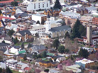
San Martín de los Andes is a city in the south-west of the province of Neuquén, Argentina, serving as the administration centre of the Lácar Department. Lying at the foot of the Andes, on the Lácar lake, it is considered one of the main tourism destinations in the province. The National Route 40 runs to the city, connecting it with important touristic points in the south of the province, such as Lanín and Nahuel Huapí national parks.
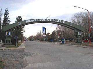
Cipolletti is a city in north of the Patagonian province of Río Negro, Argentina. With a population of 87,492 inhabitants at the 2010 census [INDEC], Cipolletti is the third-most populated settlement in the province, after San Carlos de Bariloche and General Roca.

General Roca is a city in the northeast of the Argentine province of Río Negro, northern Patagonia. It was founded on September 1, 1879, by Colonel Lorenzo Vintter, on the order of War Minister Julio A. Roca, during the Conquest of the Desert. The place of the first settlement was known by native mapuche people as Fiske Menuco, which means "deep water". It was destroyed in 1899 by a flooding of the Río Negro, and had to be rebuilt 5 kilometres (3.1 mi) northwest in higher lands.

Allen is a city in the province of Río Negro, Argentina. It has 26,083 inhabitants as per the 2001 census [INDEC]. It is located on the left-hand (northern) side of the Alto Valle of the Río Negro, near its beginning in the confluence of the Neuquén and Limay rivers, about 20 km (12 mi) west of General Roca and 35 km (22 mi) east of Neuquén.
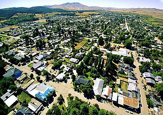
Junín de los Andes is a first category municipality and administrative center of the Huiliches Department in the province of Neuquén, Argentina. It is located in the south of the province, by the Chimehuin River, on National Route 234, about 35 km (22 mi) north of San Martín de los Andes and 17 km (11 mi) from the Chapelco Airport, which services the area.
Plottier is a city located in the Confluencia Department, in Neuquén Province, Argentina. The population is 40.000 inhabitants. It is about 15 km from Neuquén City, which turns this city into an important place for the population. Plottier is located near the Limay River and it is crossed by the 22 National Route.

Ferrosur Roca S.A. (FR) is a private company which operates freight services over part of the 5 ft 6 in broad gauge that belongs to General Roca Railway.

Loma Negra Companía Industrial Argentina S.A. is an Argentine manufacturer and the country's leading maker of cement, concrete, and lime. The company, established by businessman Alfredo Fortabat, also founded its own sports club, C.S.yD. Loma Negra three years later. After the passing of Alfredo Fortabat, his wife Amalia Lacroze took over the business.

Easy Hogar y Construcción is a chain of South American homecenters. The company was founded in Argentina in 1993, in Chile in 1994 and in Colombia in 2007, by Chilean Conglomerate Cencosud.

The Buenos Aires Great Southern Railway (BAGS) was one of the Big Four broad gauge, 5 ft 6 in, British-owned companies that built and operated railway networks in Argentina. The company was founded by Edward Lumb in 1862 and the first general manager was Edward Banfield after whom the Buenos Aires suburban station of Banfield was named, when it opened in 1873. After president Juan Perón nationalised the Argentine railway network in 1948 it became part of the state-owned company Ferrocarril General Roca.

The Salta–Antofagasta railway, also named Huaytiquina, is a non-electrified single track railway line that links Argentina and Chile passing through the Andes. It is a 1,000 mmmetre gauge railway with a total length of 941 km, connecting the city of Salta (Argentina) to the one of Antofagasta (Chile), on the Pacific Ocean, passing through the Puna de Atacama and Atacama Desert.

Tren del Valle is a 10 km (6.2 mi) commuter rail service that connects cities of Plottier, Neuquén and Cipolletti, in the Río Negro and Neuquén Provinces of Argentina, running on Roca Railway tracks. In a future stage, the line could be extended west to Senillosa and east to General Roca.

General Fernández Oro is a small train station located in the homonymous city in the General Roca Department in Río Negro Province, Argentina. It opened on August 1, 1899 as "Km. 1,181", and then renamed after General Manuel Fernández Oro (1848–1910), who took part in the Conquest of the Desert. It features the typical architectural design of stations built by Ferrocarriles del Sud at the end of the 19th century.

Neuquén is a train station in the homonymous city in Argentina, which is served by the Ferrosur Roca's Zapala-Bahía Blanca freight service and the Tren del Valle commuter service. Situated on the Central Park in the city center, adjoining other historical railway constructions such as the Emilio Saraco Art Gallery, it was declared a building of historical relevance by the National Government. Opened in 1902, the station played a significant role in the region's development and the decision to declare it the capital of the National Territory, which was to become the current Province in 1955.


