
Zeleno Brdo (Serbian Cyrillic : Зелено Брдо) is an urban neighborhood of Belgrade, the capital of Serbia. It is located in Belgrade's municipality of Zvezdara.
Zeleno Brdo (Serbian Cyrillic : Зелено Брдо) is an urban neighborhood of Belgrade, the capital of Serbia. It is located in Belgrade's municipality of Zvezdara.
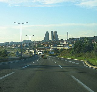
It is situated between two urban settlements those being Mali Mokri Lug and Mirijevo. It spreads along, mostly north of, the Bulevar kralja Aleksandra. It stretches from Cvetkova Pijaca on the west to Mali Mokri Lug on the southeast, bordering neighborhoods of Učiteljsko Naselje and Konjarnik on the south. It also borders Zvezdara Forest on the north, Staro Mirijevo on the northeast and Mirijevo II on the east. [1] [2]
Though today a separate neighborhood, it was previously considered, at least partly, a part of Mirijevo. It is located on the top of the hill of the same name. Name of the hill, and of the subsequent neighborhood, means "green hill" in Serbian and came from the period before the urbanization, when it was a barren hill, covered only in grass. [3]
There is a water spring in the modern neighborhood, which was the source for one of the three aqueducts which supplied the city of Singidunum, or Belgrade Fortress. During the Ottoman period, it was known as the Ekmekluk (modern Zvezdara) fork, belonging to the Mali Mokri Lug village area. It went via modern Cvetkova Pijaca and Terazije neighborhoods. The Ottomans roofed the aqueduct, turning it into the tunnel. The Dahije renegades used this tunnel to infiltrate the fortress in 1801, and to overthrow and kill Belgrade's vizier Hadji Mustafa Pasha. The Dahije then demolished the aqueduct, fearing someone might use it against them, the way they did against Mustafa Pasha. [4] [5] [3]
There was a drinking fountain at the spring, known at the time as the Colorful Fountain, Šarena česma. During the First Serbian Uprising, leader of the rebels Karađorđe made a deal with new Belgrade's vizier Suleyman Pasha, guaranteeing the safe retreat to the Ottomans and their families to Bulgaria. The rebels still ambushed the retreating Ottomans on 7 March 1807, at the fountain. The pasha and his entourage of 180 askeri nizams were killed, while women and children were dispatched to Vidin, Bulgaria, their original destination. [5] [3]
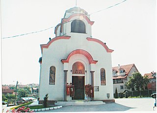
After pasha's death, the fountain became known as the Pasha's Fountain, Pašina česma, the name it still bears today. Additionally, a previously unnamed hill to the east became known as Pašino Brdo, or Pasha's Hill, and is today one of the urban neighborhoods of Belgrade. [5] [3] It is today located in the Živka Davidovića Street, on the border with the neighborhood of Učiteljsko Naselje. The fountain, and the surrounding plateau, were renovated and reopened on 15 October 2014. [6]
Zeleno Brdo is a local community, a sub-municipal administrative unit, within the municipality of Zvezdara. According to the censuses, it had a population of 10,343 in 1981, [7] 8,945 in 1991, [8] 9,819 in 2002 [9] and 11,408 in 2011. [10]
This article deals with the system of transport in Belgrade, both public and private.
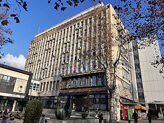
Zvezdara is a municipality of the city of Belgrade. The municipality is geographically hilly and with many forests. According to the 2011 census results, the municipality has a population of 148,014 inhabitants.
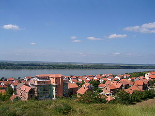
Mali Mokri Lug is an urban neighborhood of Belgrade, Serbia. It is located in the south-eastern section of Belgrade's municipality of Zvezdara. It marks the border with the municipality of Grocka. It mostly stretches between Bulevar kralja Aleksandra and the Highway Belgrade–Niš, but also north of the boulevard. It extends into the neighborhoods of Mirijevo on the north, Konjarnik on the west, Medaković III on the south-west, Veliki Mokri Lug on the south and Kaluđerica on the east.
Dušanovac, is an urban neighbourhood of Belgrade, the capital of Serbia. It is located in the municipality of Voždovac.
Čukarička padina is an urban neighborhood of Belgrade, the capital of Serbia. It is located in Belgrade's municipality of Čukarica.
Bogoslovija is an urban neighborhood of Belgrade, the capital of Serbia. It is mostly located in Belgrade's municipality of Palilula, with some parts belonging to the municipality of Zvezdara.
Višnjica is an urban neighborhood of Belgrade, Serbia. It is located in Belgrade's municipality of Palilula.

Serbia's capital city of Belgrade is divided into 17 municipalities.

Lipov Lad is an urban neighborhood of Belgrade, the capital of Serbia. It is located in Belgrade's municipality of Zvezdara.
Veliki Mokri Lug is an urban neighbourhood of Belgrade, Serbia. It is located in Belgrade's municipality of Zvezdara.
Kumodraž is an urban neighborhood of Belgrade, Serbia. It is located in Belgrade's municipality of Voždovac.
Padina is an urban neighborhood of Belgrade, the capital of Serbia. It is located in Belgrade's municipality of Zvezdara. After one of the central streets, it is also called Vojvoda Vlahović, but is also referred to as Braće Jerković II, because it makes urban connection to it. The neighborhood is sometimes also referred to as Medaković Padina.
Pašino Brdo is an urban neighborhood of Belgrade, the capital of Serbia. It is located in Belgrade's municipality of Voždovac, while the northern section belongs to the municipality of Vračar. It is also known as Lekino Brdo after the top Communist official, Aleksandar Ranković (1909–80), whose nickname was Leka.

Bulbulder is an urban neighborhood of Belgrade, the capital of Serbia. It is located in Belgrade's municipality of Zvezdara.
Cvetkova Pijaca or colloquially Cvetko is an open green market and an urban neighborhood of Belgrade, the capital of Serbia. It is located in Belgrade's municipality of Zvezdara.
Stari Đeram, colloquially Đeram, is an open greenmarket and an urban neighborhood of Belgrade, the capital of Serbia. It is located in Belgrade's municipality of Zvezdara.
Konjarnik is an urban neighborhood of Belgrade, the capital of Serbia. It is divided between Belgrade's municipalities of Voždovac and Zvezdara. As a large neighborhood, it has several sub-neighborhoods of its own, including Denkova Bašta, Učiteljsko Naselje and Rudo.

Mirijevo is an urban neighborhood of Belgrade, Serbia. It is located in Belgrade's municipality of Zvezdara. One of the largest single neighborhoods in Europe, consists of several sub-neighborhoods
Zvezdara II is an urban neighborhood of Belgrade, the capital of Serbia. It is located in the south-eastern section of Belgrade's municipality of Zvezdara.

Mehmed Paša Sokolović's Fountain is an Ottoman era fountain in Belgrade. It is located next to the Defterdar's Gate near the northwestern wall of the Upper Town of Belgrade Fortress. Evliya Çelebi states that the fountain was erected in 1576/77, during the lifetime of Grand Vizier Меhmed Paša Sokolović and it is his only surviving endowment in Belgrade. The precise position of the fountain does not appear in any cartographic sources until the 17th century. The earliest sketch dates back to a plan from the National Library in Paris from the early 17th century, in which the fountain was presented as a rectangular structure with three free sides.
Coordinates: 44°47′16″N20°31′12″E / 44.78778°N 20.52000°E
| | This Serbia location article is a stub. You can help Wikipedia by expanding it. |