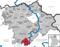
Wunsiedel is a Landkreis (district) in the northeastern part of Bavaria, Germany. Neighbouring districts are Tirschenreuth, Bayreuth, Hof, and to the east the Czech Republic.
Naila is a town in the Hof district of Bavaria, Germny. It lies in the Franconian Forest. Naila is 18 km (11 mi) from the larger city of Hof, on both banks of the Selbitz river.
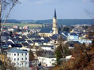
Wunsiedel is the seat of the Upper Franconian district of Wunsiedel in northeast Bavaria, Germany. The town is the birthplace of poet Jean Paul. It also became known for its annual Luisenburg Festival and the Rudolf Hess Memorial March held there by Neo-Nazis until 2005.

Lichtenberg is a town in northeastern Bavaria, lying in the district of Hof in Upper Franconia.

Marktredwitz is a town in the district of Wunsiedel, in Bavaria, Germany, close to the Czech border, 22 km west of Cheb, 50 km east of Bayreuth and 50 km south of Hof/Saale. Marktredwitz station is at the junction of the Nuremberg–Cheb railway and the Munich–Hof railway. It celebrated the Horticultural Show 2006 in cooperation with Cheb.
Rehau is a town in the district of Hof, in Bavaria, Germany. Rehau is situated in the Fichtel Mountains, 12 km southeast of Hof, and 12 km west of Aš.

Bad Berneck im Fichtelgebirge is a spa town in the district of Bayreuth, in Bavaria, Germany. It is situated on the White Main river, in the Fichtel Mountains, 13 km northeast of Bayreuth. It lies in the northern part of the Bavarian province of Upper Franconia. Since 1857 it has been a spa, initially based on its climate and whey products. In 1930 it became a Kneipp spa and, in 1950, a Kneipp health spa.

Marktleuthen is a municipality in the district of Wunsiedel, in Bavaria, Germany. It is situated on the river Eger, 10 km north of Wunsiedel and 11 km southwest of Selb.
Schauenstein is a town in the district of Hof, in Bavaria, Germany. It is situated 13 km west of Hof.

Schönwald is a town in the district of Wunsiedel, in Bavaria, Germany. It is situated near the border with the Czech Republic, five km northwest of Selb and 18 km southeast of Hof.

Schwarzenbach am Wald is a town in the district of Hof, in Bavaria, Germany. It is situated 21 km west of Hof, and 23 km northeast of Kulmbach.

Schwarzenbach an der Saale is a town in the district of Hof, in Bavaria, Germany. It is situated on the river Saale, 11 km south of Hof.

Selbitz is a town in the district of Hof, in Bavaria, Germany. It is situated 12 km west of Hof.

Weißenstadt is a town in the district of Wunsiedel, in Upper Franconia, Bavaria, Germany. It is situated on the shore of the picturesque Weißenstadter See, in the Fichtelgebirge Mountains, on the river Eger, 11 km northwest of Wunsiedel. The town got its name "White City" from the landmark church, once white now weathered dark grey.
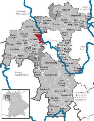
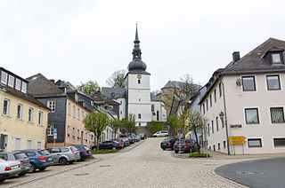
Zell am Main is a municipality in the district of Würzburg in Bavaria in Germany, situated on the river Main.

Bad Steben is a market town in the district of Hof in Bavaria in Germany. In 2007, Bad Steben celebrated its 175th anniversary as a Bavarian State Spa.

Bad Grönenbach is a market town in the district of Unterallgäu in Bavaria, Germany. It belongs to the region of Upper Swabia and the headquarters of the Gemeindeverband of the same name.

Stammbach is a market town and municipality in the district of Hof in Bavaria in Germany.

Höchstädt im Fichtelgebirge is a municipality in the district of Wunsiedel in Bavaria in Germany.

The Münchberg–Zell railway was a south German branch line in Bavaria. It linked the former county town of Münchberg in the Bavarian province of Upper Franconia with the market town of Zell im Fichtelgebirge. This standard gauge, single tracked Lokalbahn was 10 km long and was opened on 17 October 1902 by the Royal Bavarian State Railways.