Ćirikovac

Last updated
Ćirikovac
Village
Serbia adm location map.svg
Red pog.svg
Ćirikovac
Coordinates: 44°39′N21°11′E / 44.650°N 21.183°E / 44.650; 21.183
Country Serbia
District Braničevo District
City Požarevac
Population (2002)
  Total 1,407
Time zone CET (UTC+1)
  Summer (DST) CEST (UTC+2)

Ćirikovac (Serbian Cyrillic: Ћириковац) is a village in the municipality of Požarevac, Serbia. According to the 2002 census, the village has a population of 1407 people. [1]

The Serbian Cyrillic alphabet is an adaptation of the Cyrillic script for the Serbian language, developed in 1818 by Serbian linguist Vuk Karadžić. It is one of the two alphabets used to write standard modern Serbian, Bosnian and Montenegrin, the other being Latin.

Village Small clustered human settlement smaller than a town

A village is a clustered human settlement or community, larger than a hamlet but smaller than a town, with a population ranging from a few hundred to a few thousand. Though villages are often located in rural areas, the term urban village is also applied to certain urban neighborhoods. Villages are normally permanent, with fixed dwellings; however, transient villages can occur. Further, the dwellings of a village are fairly close to one another, not scattered broadly over the landscape, as a dispersed settlement.

Požarevac City in Southern and Eastern Serbia, Serbia

Požarevac is a city and the administrative center of the Braničevo District in eastern Serbia. It is located between three rivers: Danube, Great Morava and Mlava. As of 2011, the city has a population of 44,183 inhabitants, while the city administrative area has 75,334 inhabitants.

Related Research Articles

Ceremošnja Village in Serbia

Ceremosnja is a village in eastern Serbia, in the vicinity of the town of Kučevo, famous for its cave, which has been open since 1980 for tourists.

Molovin Village in Vojvodina, Serbia

Molovin is a village in Serbia. It is situated in the Šid municipality, in the Srem District, Vojvodina province. The village has a Serb ethnic majority and its population numbering 298 people.

Duboko (Užice) Village in Serbia

Duboko is a village located in the Užice municipality of Serbia. In 2002, the village had a population of 847.

Serbian Carpathians mountain range

Serbian Carpathians is a mountain range in eastern Central Serbia. It presents an extension of proper Carpathian Mountains across the Danube, connecting them with the Balkan Mountains in the southeast. They stretch in north-south direction in the eastern Serbia, east of the Great Morava valley and west of the White Timok Valley and north of the Nišava Valley. The mountains are 800–1500 m high, and dominated by karst limestone geologic features.

Bobovište

Bobovište is a village in Serbia, in the municipality of Aleksinac in Nisava district. According to the census of 2002, there were 1,074 people.

Savković Village in Serbia

Savković is a village in Serbia. It is situated in the Ljubovija municipality, in the Mačva District of Central Serbia. The village had a Serb ethnic majority and a population of 321 in 2002.

Čokešina Village in Mačva District, Serbia

Čokešina is a village in the municipality of Loznica, Serbia. According to the 2002 census, the village has a population of 881 people.

Žutice Village in Raška District, Serbia

Žutice is a village in the municipality of Raška, Serbia. According to the 2002 census, the village has a population of 224 people.

Dobrejance is a village in the municipality of Vranje, Serbia. According to the 2002 census, the village has a population of 84 people.

Prugovo Village in Braničevo District, Serbia

Prugovo is a village in the municipality of Požarevac, Serbia. According to the 2002 census, the village has a population of 774 people.

Donje Jarušice Village in Šumadija District, Serbia

Donje Jarušice is a village in the municipality of Rača, Serbia. According to the 2002 census, the village has a population of 265 people.

Mali Požarevac Village in Belgrade District, Serbia

Mali Požarevac is a village in the municipality of Beograd, Serbia. According to the 2002 census, the village has a population of 1479 people.

Masloševo Village in Šumadija District, Serbia

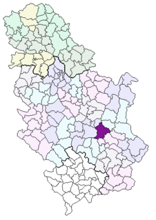
Masloševo is a village in the municipality of Stragari, Serbia. According to the 2002 census, the village has a population of 478 people.

Gornja Trnava (Topola) Village in Šumadija District, Serbia

Gornja Trnava is a village in the municipality of Topola, Serbia. According to the 2002 census, the village has a population of 1736 people.

Jarmenovci Village in Šumadija District, Serbia

Jarmenovci is a village in the municipality of Topola, Serbia. According to the 2002 census, the village has a population of 563 people.

Riđake Village in Mačva District, Serbia

Riđake is a village in the municipality of Vladimirci, Serbia. According to the 2002 census, the village has a population of 427 people.

Skupljen Village in Mačva District, Serbia

Skupljen is a village in the municipality of Vladimirci, Serbia. According to the 2002 census, the village has a population of 1030 people.

Vukošić Village in Mačva District, Serbia

Vukošić is a village in the municipality of Vladimirci, Serbia. According to the 2002 census, the village has a population of 748 people.

Zvezd Village in Mačva District, Serbia

Zvezd is a village in the municipality of Vladimirci, Serbia. According to the 2002 census, the village has a population of 813 people.

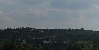
Lučica is a village near the city of Požarevac in Central Eastern Serbia.

References

  1. Popis stanovništva, domaćinstava i Stanova 2002. Knjiga 1: Nacionalna ili etnička pripadnost po naseljima. Republika Srbija, Republički zavod za statistiku Beograd 2003. ISBN   86-84433-00-9

Coordinates: 44°39′N21°11′E / 44.650°N 21.183°E / 44.650; 21.183

Geographic coordinate system Coordinate system

A geographic coordinate system is a coordinate system that enables every location on Earth to be specified by a set of numbers, letters or symbols. The coordinates are often chosen such that one of the numbers represents a vertical position and two or three of the numbers represent a horizontal position; alternatively, a geographic position may be expressed in a combined three-dimensional Cartesian vector. A common choice of coordinates is latitude, longitude and elevation. To specify a location on a plane requires a map projection.