Salento, also known as Terra d'Otranto is a cultural, historical and geographic region at the southern end of the administrative region of Apulia in Southern Italy. It is a sub-peninsula of the Italian Peninsula, sometimes described as the "heel" of the Italian "boot". It encompasses the entire administrative area of the province of Lecce, a large part of the province of Brindisi and part of that of Taranto.
The 1783 Calabrian earthquakes were a sequence of five strong earthquakes that hit the region of Calabria in southern Italy, the first two of which produced significant tsunamis. The epicenters form a clear alignment extending nearly 100 km from the Straits of Messina to about 18 km SSW of Catanzaro. The epicenter of the first earthquake occurred in the plain of Palmi. The earthquakes occurred over a period of nearly two months, all with estimated magnitudes of 5.9 or greater. Estimates of the total number of deaths lie in the range 32,000 to 50,000.
The 1992 Cape Mendocino earthquakes occurred along the Lost Coast of Northern California on April 25 and 26. The three largest events were the M7.2 thrust mainshock that struck near the unincorporated community of Petrolia midday on April 25 and two primary strike-slip aftershocks measuring 6.5 and 6.6 that followed early the next morning. The sequence encompassed both interplate and intraplate activity that was associated with the Mendocino Triple Junction, a complex system of three major faults that converge near Cape Mendocino. The total number of aftershocks that followed the events exceeded 2,000.
On October 31 at 17:53 UTC the island of New Guinea was shaken by an earthquake of magnitude 6.9 that particularly affected the city of Madang on the north coast of Papua New Guinea. Causing between five and eighteen fatalities, it triggered landslides that ran down steep hills into poorly reinforced wooden huts. The area that experienced the most powerful intensity extended 20 kilometers (12 mi) out from the epicenter. Underwater landslides caused minor tsunami over about 100 km of coast and severed underwater cables in several places.
The 1994 Taiwan Strait earthquake occurred on 16 September 1994, at 14:20 local time in the southern Taiwan Strait. The magnitude of this earthquake was given as 6.8 by the USGS and 7.3 by Fujian Seismological Bureau. The epicenter was located about 150 to 180 km from the coast of the border of Guangdong and Fujian, and about 150 km southwest of Taiwan.
The Environmental Seismic Intensity scale is a seismic scale used for measuring the intensity of an earthquake on the basis of the effects of the earthquake on the natural environment.
Seismic risk in Malta is considered to be low with little historic damage noted and no known victims. The archipelago is however in a potentially significant seismic zone and the risk to the population is probably undervalued.

The 2013 Craig, Alaska earthquake struck on January 5, at 12:58 am (UTC–7) near the city of Craig and Hydaburg, on Prince of Wales Island. The Mw 7.5 earthquake came nearly three months after an Mw 7.8 quake struck Haida Gwaii on October 28, in 2012. The quake prompted a regional tsunami warning to British Columbia and Alaska, but it was later cancelled. Due to the remote location of the quake, there were no reports of casualties or damage.
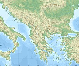
The 1856 Heraklion earthquake, also known as the Crete earthquake or Rhodes earthquake, occurred on the morning of October 12 at 02:45 am local time. This extremely catastrophic earthquake had an estimated magnitude of 7.7 to 8.3 at a depth of approximately 61 to 100 km. The earthquake was felt over a very wide area extending from Sicily, Italy to the Levant and North Africa. On the Greek island of Crete, the effects of the earthquake were cataclysmic, over 500 bodies were recovered in the city of Heraklion. Shockwaves from the earthquake were felt intensely, covering all of the Ottoman Empire; present-day Turkey, Cyprus and the Middle East where damage and human losses were reported. In Malta, the earthquake collapsed the Għajn Ħadid Tower—a coastal watchtower built around the year 1638. In Cairo, Egypt, the earthquake destroyed buildings, created seiches in canals, and killed several people. Off the Egyptian and Italian coasts, sailors reported feeling a seaquake.
The Nemuro-Oki earthquake in scientific literature, occurred on June 17 at 12:55 local time. It struck with an epicenter just off the Nemuro Peninsula in northern Hokkaidō, Japan. It measured 7.8–7.9 on the moment magnitude scale (Mw ), 8.1 on the tsunami magnitude scale (Mt ) and 7.4 on the Japan Meteorological Agency magnitude scale (MJMA ).
The 1900 Venezuelan earthquake, occurred on October 28 at between 4:30 and 4:45 am local time. This earthquake had an epicenter off Miranda State or near the Venezuelan capital Caracas, in the Cariaco Basin. It had an estimated moment magnitude of 7.6–7.7 and a surface-wave magnitude of 7.7–8.4. It had a maximum Mercalli intensity assigned VIII–X, causing landslides and liquefaction events. Many buildings were severely damaged or collapsed during the earthquake. It is thought to be the last great earthquake of the 19th century and the largest instrumentally recorded in the republic, having been felt throughout.

The 1883 Casamicciola earthquake, also known as the Ischia earthquake occurred on 28 July at 20:25 local time on the island of Ischia in the Gulf of Naples in Italy. Although the earthquake had an estimated moment magnitude of 4.2–5.5, considered moderate in size, it caused intense ground shaking that was assigned XI (Extreme) on the Modified Mercalli intensity scale. Between 2,313 and 3,100 people lost their lives. The city also suffered great property losses, with 80 percent of all homes destroyed. This earthquake was exceptionally destructive for its magnitude mainly due to its shallow focal depth.

The 1929 Cumaná earthquake occurred on January 17 at 07:45:44 local time, affecting Venezuela. Measuring 6.7 on the moment magnitude scale (Mw ) at a depth of 10 km (6.2 mi), the earthquake severely damaged the city of Cumaná in Sucre state. The earthquake had an epicenter located offshore in the Caribbean Sea, and had a maximum Modified Mercalli intensity scale rating of IX (Violent). It lasted 30 seconds, causing major damage and a tsunami. More than 200 people were killed although the finalized death toll is unknown; possibly 1,600.
The 1790 Oran earthquake occurred on October 10, striking near the coastal city of Oran in Algeria. The earthquake had an evaluated maximum seismic intensity of VIII–X on the European macroseismic scale (EMS-98). An estimated 3,000 people died during the earthquake and accompanying tsunami. The magnitude of this earthquake has been disputed among members of the paleoseismology field, with estimates ranging from 7.5 to even as small as 5.5.
The 1816 North Atlantic earthquake occurred on 2 February somewhere between the Azores Islands and Lisbon, Portugal. The estimated moment magnitude 8.3–8.9 earthquake had an epicenter offshore in the Atlantic Ocean, and was felt in Lisbon at 00:40 local time. Little is known about the quake, but it is believed to be one of the largest to have struck the Atlantic.
The 1604 Quanzhou earthquake was an extremely large seismic event that occurred in the Taiwan Strait, off the coast of Fujian Province, near Quanzhou during the Ming dynasty. According to modern-day calculations, the earthquake had a moment magnitude of 8.1 . It is unknown how many casualties resulted from the quake, but major damage was reported.
On December 5, 1456, the largest earthquake to occur on the Italian Peninsula struck the Kingdom of Naples. The earthquake had an estimated moment magnitude of Mw 7.19–7.4, and was centred near the town of Pontelandolfo in the present-day Province of Benevento, southern Italy. Earning a level of XI (Extreme) on the Modified Mercalli intensity scale, the earthquake caused widespread destruction in central and southern Italy. An estimated 30,000–70,000 people were killed. It was followed by two strong Mw 7.0 and 6.0 earthquakes to the north on December 30.
A series of four mainshocks struck Calabria on March 27–28 and June 9, 1638. The first three earthquakes had moment magnitudes estimated to be 6.6–7.1. On June 9, another mainshock estimated at Mw 6.7 struck the same region, causing further damage and casualties. The four earthquakes resulted in as many as 30,000 fatalities.
The 2012 Constitución earthquake was recorded on March 25, 2012, at 7:37 pm local time. It had a moment magnitude of 7.1 and its epicenter was located 23 km (14 mi) northeast of the city of Constitución, in the Maule Region, Chile. According to experts, it was a strong and late aftershock of the Great Chile earthquake of February 27, 2010.