Friuli-Venezia Giulia is one of the 20 regions of Italy and one of five autonomous regions with special statute. The regional capital is Trieste on the Gulf of Trieste, a bay of the Adriatic Sea.

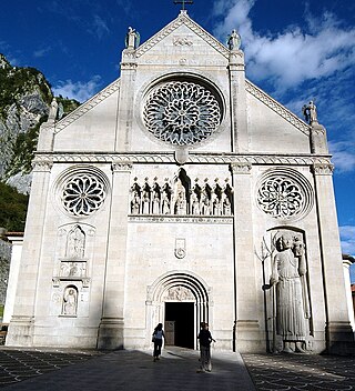
Gemona del Friuli is a comune (municipality) in the Regional decentralization entity of Udine, in the Italian region of Friuli-Venezia Giulia, located about 90 kilometres (56 mi) northwest of Trieste and about 25 kilometres (16 mi) northwest of Udine.
The 1918 San Fermín earthquake, also known as the Puerto Rico earthquake of 1918, struck the island of Puerto Rico at on October 11. The earthquake measured 7.1 on the moment magnitude scale and IX (Violent) on the Mercalli intensity scale. The mainshock epicenter occurred off the northwestern coast of the island, somewhere along the Puerto Rico Trench.

The 1857 Basilicata earthquake occurred on 16 December in the Basilicata region of Italy southeast of the city of Naples. The epicentre was in Montemurro, on the western border of the modern province of Potenza. Several towns were destroyed, and there were around 11,000 fatalities according to official sources, but unofficial estimates suggest that as many as 19,000 died. At the time it was the third-largest known earthquake and has been estimated to have been of magnitude 7.0 on the moment magnitude scale.

The 1915 Avezzano earthquake or 1915 Fucino earthquake occurred on 13 January in central Italy at . The shock had a moment magnitude of 6.7 and a maximum Mercalli intensity of XI (Extreme). The epicenter was located in the city of Avezzano in the Province of L'Aquila. Around 30,000 direct fatalities and $60 million in damage resulted from the earthquake.
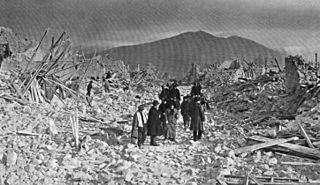
The 1348 Friuli earthquake, centered in the South Alpine region of Friuli, was felt across Europe on 25 January. The earthquake hit in the same year that the Great Plague ravaged Italy. According to contemporary sources, it caused considerable damage to structures; churches and houses collapsed, villages were destroyed and foul odors emanated from the earth.
The 2003 Dominican Republic earthquake occurred on September 22 at with a moment magnitude of 6.4 and a maximum Mercalli intensity of X (Extreme).
The 1968 Belice earthquake sequence took place in Sicily between 14 and 15 January. The largest shock measured 5.5 on the moment magnitude scale, with five others of magnitude 5+. The maximum perceived intensity was X (Extreme) on the Mercalli intensity scale. The earthquake sequence, centred between the towns of Gibellina, Salaparuta and Poggioreale, killed at least 231 people, possibly more than 400, with between 632 and about 1,000 injured and left 100,000 homeless. It is known in Italy as Terremoto del Belice.
The 1936 Cansiglio earthquake occurred on 18 October in the region between the provinces of Belluno, Treviso and Pordenone, in northern Italy. It caused 19 deaths and an unknown number of injuries.
The 1983 Popayán earthquake occurred on 31 March in Popayán, Colombia. It had a moment magnitude of 5.6 with an epicenter south west of Popayán at a depth of 15 kilometers (9.3 mi). The earthquake killed 267 people and resulted in the passing of new laws requiring earthquake resistant building materials in zones at risk of tremors.

Tarvisio Boscoverde is a railway station serving the town of Tarvisio, in the region of Friuli Venezia Giulia, in Northern Italy. The station is managed by Rete Ferroviaria Italiana (RFI). Train services are operated by Trenitalia and ÖBB.
The 1511 Idrija earthquake occurred on 26 March 1511 with a moment magnitude of 6.9 and a maximum EMS intensity of X. The epicenter was near the town of Idrija, although some place it in Friuli. The earthquake affected a large territory between Carinthia, Friuli, present-day Slovenia and Croatia. An estimated 3,000 people were killed and damage was considered severe. The earthquake was felt as far as in Switzerland and present-day Slovakia. A number of castles and churches were razed to the ground in a large area from northeast Italy to western Croatia. Among the destroyed buildings were the castles of Udine and Škofja Loka, the monastery of the Teutonic Knights in Ljubljana; the Zagreb cathedral was severely damaged. Blaž Raškaj, commander of the Jajce fortess, reported to the Hungarian Estates that the earthquake had severely damaged the fortifications.
The 2017 Ischia earthquake occurred in the island of Ischia, Campania, in southern Italy. The main shock occurred at 20:57 CEST on 21 August 2017, and was rated 3.9 Mw or 4.2 mb on the moment magnitude scale.
The 1942 Ecuador earthquake or the Guayaquil earthquake occurred on 13 May at 9:06 or 9:13 pm local time with a moment magnitude of Mw 7.9. The temblor struck the coastal (Esmeraldas) region of Manabí Province, Ecuador. It caused damage mainly to cities including Guayaquil, Portoviejo and Guaranda. More than 300 people were killed and the total cost of damage was about US$2.5 million. Ecuador's largest city Guayaquil was the most affected despite the significant distantce from the epicenter. Many reinforced concrete structures in a particular area in the city were completely destroyed, contributing to fatalities.

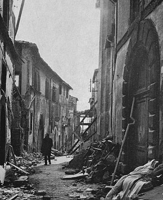
The 1971 Tuscania earthquake occurred on 6 February in Italy. It had an epicenter located halfway between Tuscania and Arlena di Castro, about 20 km west of Viterbo. It had a body wave magnitude of 4.6.
On December 5, 1456, the largest earthquake to occur on the Italian Peninsula struck the Kingdom of Naples. The earthquake had an estimated moment magnitude of Mw 7.19–7.4, and was centred near the town of Pontelandolfo in the present-day Province of Benevento, southern Italy. Earning a level of XI (Extreme) on the Modified Mercalli intensity scale, the earthquake caused widespread destruction in central and southern Italy. An estimated 30,000–70,000 people were killed. It was followed by two strong Mw 7.0 and 6.0 earthquakes to the north on December 30.
The second shock in the 1962 Irpinia earthquake sequence was the largest and most destructive in a series of earthquakes in the southern Apennines. It occurred on 21 August at 18:19 CET, measuring 6.15 and assigned a maximum intensity of IX (Violent). It was preceded by an Mw 5.68 foreshock, and followed by a 5.34 aftershock. The earthquakes resulted in nearly 20 fatalities and significant property losses.
The 1706 Abruzzo earthquake, also known as the Maiella earthquake, occurred on November 3 at 13:00 CEST. The earthquake with a possible epicenter in the Central Apennine Mountains (Maiella), Abruzzo had an estimated moment magnitude of 6.6–6.84 Mw . It was assigned a maximum Mercalli intensity of XI (Extreme), causing tremendous destruction in Valle Peligna. At least 2,400 people were killed.
The 1910 Costa Rica earthquakes were a series of destructive seismic events that affected Cartago, Costa Rica from 13 April to 4 May. The sequence began with a Ms 5.8 earthquake. The largest and most destructive in the sequence occurred on 4 May, measuring Ms 6.4. A total of 2,450 people were killed and the city of Cartago was severely affected.


