Alipura State

Last updated

Alipura State
Princely State of British India
1757–15 August 1947
Beri-Bijna-Tori Fatehpur map.jpg
Alipura State in the Imperial Gazetteer of India
Area 
 1931
189 km2 (73 sq mi)
Population 
 1931
15,316
History
History 
 Established
1757
 British seizuranity ended
15 August 1947
Succeeded by
India Flag of India.svg
Today part of Madhya Pradesh, India
The symbols of Alipura State on a stamped paper. Alipura stamped paper.jpg
The symbols of Alipura State on a stamped paper.

Alipura was a princely state in what is today the Chhatarpur District in the Indian state of Madhya Pradesh. [1]

Contents

Alipura, the capital of the state is located between Gwalior and Satna at 25°10′31″N79°20′08″E / 25.1753400°N 79.3354900°E / 25.1753400; 79.3354900 and had a population of 3,232 according to the 1881 Census of India.

History

The state was established in 1757 by Aman Singh, Raja of Panna State by granting the lands surrounding Alipura town to Achal Singh, son of Mukund Singh, who was the sardar of Panna at that time. [2] The principality became a British protectorate in 1808 and was made part of the Bundelkhand Agency of Central India. [3]

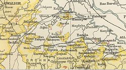
The last Pratihara ruler of Alipura signed the instrument of accession to the Indian Union on 1 January 1950. [1]

Rulers

The rulers used the title Rao . [4]

Title Rao

  • 1757–1790 Achal Singh (d. 1790)
  • 1790–1835 Pratap Singh
  • 1835–1840 Pancham Singh
  • 1840–1841 Daulat Singh
  • 1841–1871 Hindupat Singh (d. 1871)
  • 3 November 1871 – 1922 Chhatrapati Singh (b. 1853 – d. 1922)
  • 26 Mar 1922 – Nov 1934 Harpal Singh (b. 1882 – d. 1934) (regent 1919 – 1922)
  • Nov 1934 – 1934 Bhopal Singh Ju Deo
  • 1934–15 Aug 1947 Raghuraj Singh Ju Deo (b. 1901 – d. 1987)

Alipura palace

Built by the rulers of Alipura State the main part of palace is about 150 years old, with a section that is over 3 centuries old. The building has been renovated and converted to a heritage hotel that is run by a direct descendant of the former ruling family. [5]

See also

Related Research Articles

Ajaigarh or Ajaygarh is a town and a nagar panchayat in the Panna District of Madhya Pradesh state in central India.

<span class="mw-page-title-main">Vindhya Pradesh</span> Former State of India

Vindhya Pradesh was a former state of India. It occupied an area of 61,131.5 km2. It was created in 1948 as Union of Baghelkhand and Bundelkhand States, shortly after Indian independence, from the territories of the princely states in the eastern portion of the former Central India Agency. It was named as Vindhya Pradesh on 25 January 1950 after the Vindhya Range, which runs through the centre of the province. The capital of the state was the former princely state of Rewa. It lays between Uttar Pradesh to the north and Madhya Pradesh to the south, and the enclave of Datia, which lay a short distance to the west, was surrounded by the state of Madhya Bharat.

<span class="mw-page-title-main">Korea State</span>

Korea State, currently spelt as Koriya, was a princely state of the British Empire of India. After Indian independence in 1947, the ruler of Korea acceded to the Union of India on 1 January 1948, and Koriya was made part of Surguja District of Central Provinces and Berar province. In January 1950, "Central Provinces and Berar" province was renamed Madhya Pradesh state. After November 2000, Korea and the former princely state of Changbhakar became Koriya district of Chhattisgarh state.

Satna is a city in the Indian state of Madhya Pradesh. It serves as the headquarters of Satna district. It is 7th largest city and 8th most populous city of the state. The city is 500 km east of the state capital Bhopal. The city is distributed over a land area of 111.9 square kilometres.

Bijawar is a city the state of Madhya Pradesh, India. It is the administrative headquarters of Bijawar Taluk, and was formerly the capital of a princely state of British India of the same name. The people of Bijawar are demanding the district status from their state government. It is the 53rd proposed district of Madhya Pradesh

<span class="mw-page-title-main">Rewa (princely state)</span> Indian princely state

Rewa State, also known as Rewah, was a Rajput princely state of India, surrounding its eponymous capital, the town of Rewa.

Sarila is a town, a former princely state and a nagar panchayat in Hamirpur district in the northern Indian state of Uttar Pradesh.

<span class="mw-page-title-main">Maihar State</span> Princely state of the British Raj

Maihar State was a princely state in India during the British Raj, located in what is today Madhya Pradesh, central India. The state had an area of 1,050 square kilometres (407 sq mi), and a population of 63,702 in 1901. The state, which was watered by the Tons River, consists mainly of alluvial soil covering sandstone, and is fertile except in the hilly district of the south. A large area was under forest, the produce of which provided a small export trade.

<span class="mw-page-title-main">Baraundha</span>

Baraundha was a princely state of colonial India, located in modern Satna district of Madhya Pradesh. Although historically far larger, at the time of Indian independence in 1950, it was a saluted state of 9 guns.

<span class="mw-page-title-main">Narsinghgarh State</span> Princely state of India

Narsinghgarh State is a former princely state of the British Raj in India. It formed an enclave within Rajgarh State and was placed administratively under the Bhopal Agency subdivision of the Central India Agency. The state covered an area of 1,920 square kilometres (740 sq mi) and had a population of 92,093 and an average revenue of Rs.5,00,000 in 1901.

<span class="mw-page-title-main">Alirajpur State</span> Princely state of India

Alirajpur State was formerly a princely state of India, administratively under the Bhopawar Agency subdivision of the Central India Agency. The state covered an area of 2165 square kilometres, with a population of 50,185 in 1901 and its capital at Alirajpur. The average revenue of the state was Rs.100,000 in 1901.

<span class="mw-page-title-main">Khaniadhana State</span> Indian Princely State

Khaniadhana or Khaniyadhana was a princely state of British India ruled by the Judev dynasty of Bundela Rajputs. The capital of the State was Khaniadhana. It was part of the Bundelkhand Agency and later the Central India Agency.

<span class="mw-page-title-main">Charkhari State</span> Princely state of India

Charkhari State was one of the Princely states of India during the period of the British Raj. On India's independence, this Princely state acceded to India. Currently Charkhari town, the former state's capital, is a part of Uttar Pradesh state.

<span class="mw-page-title-main">Nagod State</span> State in British India

Nagod State was a princely state of colonial India, located in modern Satna district of Madhya Pradesh. The state was known as 'Unchahara' after Unchehara, its original capital until the 18th century.

<span class="mw-page-title-main">Bijawar State</span> Princely state of colonial India

Bijawar State was a princely state of colonial India, located in modern Chhatarpur district of Madhya Pradesh.

<span class="mw-page-title-main">Panna State</span> Princely state of India

Panna State was a princely state of colonial India, located in modern Panna district of Madhya Pradesh.

<span class="mw-page-title-main">Sohawal State</span> Former colonial satellite state

Sohawal State was a princely state of the Bagelkhand Agency of the British Raj. It was a relatively small Sanad state of about 552 km2 with a population of 32,216 inhabitants in 1901. Its capital was at Sohawal, a small town — 2,108 inhabitants in 1901 — located in modern Satna district of Madhya Pradesh.

<span class="mw-page-title-main">Kothi State</span>

Kothi State was a princely state of the British Raj. It belonged to the Bagelkhand Agency of Central India. Its capital was at Kothi, in modern Satna district of Madhya Pradesh.

<span class="mw-page-title-main">Jaitpur State</span>

Jaitpur State was a princely state in the Bundelkhand region. It was centered on Jaitpur, in present-day Mahoba district, Uttar Pradesh, which was the capital of the state. There were two forts in the area.

Alipura is a town in Nowgong tehsil, Chhatarpur district, Sagar division of Madhya Pradesh, India. It is located near Harpalpur at an altitude of 432 metres (1,417 ft) above sea level. The language of the local population is Hindi.

References

  1. 1 2 "Alipura Princely State". Archived from the original on 19 December 2017. Retrieved 9 August 2015.
  2. Sir William Wilson Hunter, The Imperial Gazetteer of India . Trübner & co. London, 1885
  3. "Alipura (Princely State)". Archived from the original on 24 May 2009. Retrieved 17 April 2010.
  4. Princely States of India A-J
  5. "Tourism in Madhya Pradesh India". Archived from the original on 3 March 2016. Retrieved 6 October 2015.

25°10′30″N79°24′00″E / 25.17500°N 79.40000°E / 25.17500; 79.40000 (capital)