Hyderabad State was a princely state in the south-central Deccan region of India with its capital at the city of Hyderabad. It is now divided into the present-day state of Telangana, the Kalyana-Karnataka region of Karnataka, and the Marathwada region of Maharashtra in India.
Nawab is a royal title indicating a ruler, often of a South Asian state, in many ways comparable to the western title of Prince. The relationship of a Nawab to the Emperor of India has been compared to that of the Kings of Saxony to the German Emperor. In earlier times the title was ratified and bestowed by the reigning Mughal emperor to semi-autonomous Muslim rulers of subdivisions or princely states in the Indian subcontinent loyal to the Mughal Empire, for example the Nawabs of Bengal.

A princely state was a nominally sovereign entity of the British Indian Empire that was not directly governed by the British, but rather by an Indian ruler under a form of indirect rule, subject to a subsidiary alliance and the suzerainty or paramountcy of the British crown.

The Central India Agency was created in 1854, by amalgamating the Western Malwa Agency with other smaller political offices which formerly reported to the Governor-General of India. The agency was overseen by a political agent who maintained relations of the Government of India with the princely states and influence over them on behalf of the Governor-General. The headquarters of the agent were at Indore.

The Indian Independence Act 1947 is an act of the Parliament of the United Kingdom that partitioned British India into the two new independent dominions of India and Pakistan. The Act received Royal Assent on 18 July 1947 and thus modern-day India and Pakistan, comprising west and east regions, came into being on 15 August.

Bhopal State was founded by Maharaja of Parmar Rajputs. In the beginning of 18th-century, Bhopal State was converted into an Islamic principality, in the invasion of the Afghan Mughal noble Dost Muhammad Khan. It was a tributary state within the Maratha Confederacy during 18th century (1737-1818), a princely salute state with 19-gun salute in a subsidiary alliance with British India from 1818 to 1947, and an independent state from 1947 to 1949. Islamnagar was founded and served as the State's first capital, which was later shifted to the city of Bhopal.

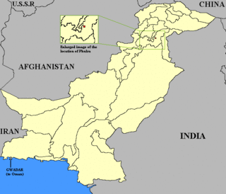
Phulra or the State of Phulra was a Muslim princely state in the days of British Raj and ruled by the Tanoli tribe, located in the region of the North West Frontier to the east of the nearby parent princely state of Amb (Tanawal).

The Bundelkhand Agency was a political agency of the British Raj, managing the relations of the British government with the protected princely states of the Bundelkhand region.

Tonk was a princely state in India under the supervision of the Rajputana Agency of the British Raj. It was located primarily in the present-day Indian state of Rajasthan with small portions in Madhya Pradesh. The town of Tonk, which was the capital of the state, had a population of 273,201 in 1901. As a salute state, its ruler, styled the Nawab of Tonk, was granted a 17-gun salute. The state came to an end after the partition of India when the Nawab of Tonk acceded to India. At that time, it was the only princely state of Rajputana with a Muslim ruling dynasty.
Kadaura is a town and a Nagar Panchayat in Jalaun District in the Indian state of Uttar Pradesh. During the British Raj, Kadaura was the capital of an 11-gun salute princely state.

Alipura was a princely state in what is today the Chhatarpur District in the Indian state of Madhya Pradesh.

The Babi dynasty was a Pashtun dynasty that formed the ruling royal houses of various kingdoms and later princely states. The Babai community, originally of Afghan descent, largely resides in India and some parts of Pakistan. The community traces its royal origins to the dynasty founded by Sherkhanji Babi in 1654, who was himself a ruler from the dynasty's founding until 1690. The last Nawab of the British Indian princely state of Junagadh, Sir Muhammad Khanji, signed an Instrument of Accession and acceded his princely state of Junagadh, as well as its vassal state of sardargadh, Bantva Manavadar, to the Dominion of Pakistan after the Partition of British India in 1947. However, the Dominion of India did not recognize the accession and annexed the princely state shortly afterwards.

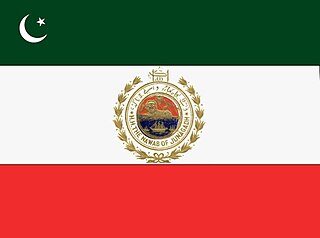
Junagarh or Junagadh was a princely state in Gujarat ruled by the Muslim Babi dynasty in India, which acceded to the Dominion of Pakistan after the Partition of British India. Subsequently, the Union of India annexed Junagadh in 1948, legitimized through a plebiscite held the same year.

The Sachin State was a princely state belonging to the Surat Agency, former Khandesh Agency, of the Bombay Presidency during the era of the British Raj. Its capital was in Sachin, the southernmost town of present-day Surat district of Gujarat State.

Loharu State was one of the princely states of India during the period of the British Raj. It was part of the Punjab States Agency and was a nine-gun salute state.

Dhurwai was a princely state in India during the British Raj. It was one of the Hasht-Bhaiya Jagirs, under the Bundelkhand Agency of British India. Its capital was the town of Dhurwai, with a population of 777 in 1901. Today it is part of Jhansi District, in the state of Uttar Pradesh. Dhurwai was administered by the native ruler, who was addressed as Indian Prince by the British authorities.

Beri State was a princely state of the Bundelkhand Agency of the British Raj. Its capital was at Beri, a small town, about 30 km from Hamirpur town.
Alipura is a town in Nowgong tehsil, Chhatarpur district, Sagar division of Madhya Pradesh, India. It is located near Harpalpur at an altitude of 432 metres (1,417 ft) above sea level. The language of the local population is Hindi.

The Mian or miyan is a royal title of the Indian subcontinent, also sometimes used as a surname. Begum or Beygum, is used to describe the wife of a Mian. It is used by several monarchs of Indian states.

The Rohilla dynasty was a muslim Jat dynasty that ruled over much of North-West Uttar Pradesh in the form of Rohilkhand and later until 1947, the Princely state of Rampur. At the height of their power the dynasty ruled over the Kingdom of Rohilkhand and held suzairnty over the Kingdom of Kumaon and Kingdom of Garhwhal.


