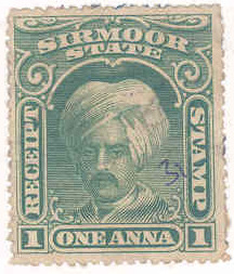
Portrait of Maharaja Kirat Prakash of Sirmur. Late 18th century.The Fort of Nahan, the capital of princely-state of SirmurStamp of Sirmour in 1800s
Sirmur (also spelled as Sirmor, Sirmaur, Sirmour, or Sirmoor) was a princely state of India, located in the region that is now the Sirmaur district of Himachal Pradesh. The state was also known as Nahan, after its main city, Nahan. The state ranked predominant amongst the Punjab Hill States. It had an area of 4,039km2 and a revenue of 300,000 rupees in 1891.[citation needed]
According to Mian Goverdhan Singh in Wooden Temples of Himachal Pradesh, the principality of Sirmaur was founded in the 7th to 8th century by Maharaja of ParmarRajputs, and Rathore noble.[1]
Nahan State
Nahan, the predecessor state of Sirmur, was founded by Soba Rawal in 1095 AD who assumed the name Raja Subans Prakash.[citation needed]
Near the end of the 12th century in the year 1195, a flood of the Giri River destroyed the old capital of Sirmaur-Tal, which killed Raja Ugar Chand.[1] A ruler of Jaisalmer, Raja Salivahana, thought this was an opportune time to attack the state as it was in a state of disarray due to the natural disaster and death of its ruler, so he sent his son Sobha to conquer the state.[1] The attack was successful and a new dynasty headed by Bhati Rajputs was established.[1] Sirmur was invaded by invader Jasrath's army, who also invaded fragments of Punjab and Jammu.[2]
Sirmur State
Eventually in 1621 Karm Parkash founded Nahan, the modern capital.[3] Budh Parkãsh, the next ruler, recovered Pinjaur for Aurangzeb’s foster-brother.[citation needed] Raja Mit Parkãsh gave an asylum to the Sikh Guru, Gobind Singh, permitting him to fortify Paonta in the Kiarda Dun; and it was at Bhangani in the Dun that the Guru defeated the Rajäs of Kahlur and Garhwäl in 1688.[3] But in 1710 Kirat Parkãsh, after defeating the Räja of Garhwal, captured Naraingarh, Morni, Pinjaur, and other territories from the Sikhs, and concluded an alliance with Amar Singh, Raja of Patiala, whom he aided in suppressing his rebellious Wazir; and he also fought in alliance with the Raja of Kahlür when Ghuläm Kãdir Khan, Rohilla, invaded that State.[4]
Painting of a panoramic view of pilgrims visiting holy sites at the Shivalik Hills near Sirmaur, Jodhpur, 1824
Note: British Punjab province era district borders are not an exact match in the present-day due to various bifurcations to district borders — which since created new districts — throughout the historic Punjab Province region during the post-independence era that have taken into account population increases.
Artwork
Fresco depicting a Devi Mahatmya scene from Indic mythology from a Shiva temple located in Nahan, painted during the reign of Sirmur State
Not many paintings depicting the historical rajas of Sirmur State have survived due to the Gurkha occupation of the state between 1803 and 1814, which led to the loss and destruction of much artwork, including any portraits of earlier rulers produced in Sirmur itself.[14][15]
1 2 3 Archer, William George (1973). Indian Paintings from the Punjab Hills. Indian Paintings from the Punjab Hills: A Survey and History of Pahari Miniature Painting. Vol.1. Sotheby Parke Bernet. p.414. ISBN9780856670022.
This page is based on this Wikipedia article Text is available under the CC BY-SA 4.0 license; additional terms may apply. Images, videos and audio are available under their respective licenses.