Dhrol State

Last updated

The State of Dhrol
ધ્રોલ રિયાસત
Princely State of British India
1595–1948
Dhrol flag.png
Flag
Dhrol coa.png
Coat of arms
SaurashtraKart.jpg
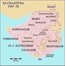
Location of Dhrol State in Saurashtra
Capital Dhrol
Area 
 1901
732 km2 (283 sq mi)
Population 
 1901
21,906
History 
 Established
1595
15 February 1948
Preceded by
Succeeded by
Flag of Nawanagar.png Nawanagar State
India Flag of India.svg
Today part of Saurashtra, India

Dhrol State was one of the 562 princely states of British India. It was a 9 gun salute state belonging to the Kathiawar Agency of the Bombay Presidency. [1] Its capital was in the town of Dhrol, located in the historical Halar region of Kathiawar.

Contents

History

Dhrol State was founded in 1595 by Jam Hardholji, a brother of Jam Rawal, the founder of Nawanagar State. The royal family belonged to the senior-most branch of the Jadeja dynasty of Rajputs who are the descendants of Samma tribe of Sindh . [2] The Khirasra state was an offshoot of Dhrol. [3] [4]

Dhrol State became a British protectorate in 1807. The population of the state was decimated by the Indian famine of 1899–1900, from 27,007 in 1891 it was reduced to 21,906 in the 1901 census. The last ruler of Dhrol State, Thakur Sahib Chandrasinhji Dipsinhji, signed the accession to the Indian Union on 15 February 1948.[ citation needed ]

Rulers

The rulers of the state bore the title 'Thakore Saheb'. They had the right to a 9 gun salute. [5] [6]

Rulers

See also

Related Research Articles

<span class="mw-page-title-main">Nawanagar State</span> Former princely state in Gujarat, India

Nawanagar was an Indian princely state in the historical Halar region, located on the southern shores of the Gulf of Kutch. It was ruled by the Jadeja Rajput dynasty and became a part of newly formed India. Its capital city was Nawanagar city, now known as Jamnagar. It had an area of 3,791 square miles (9,820 km2) and a population estimated at 336,779 in 1901. Its rulers, who use the title of "Jam Saheb" are of the same clan as the Rao of Kutch. They were entitled to a 13-gun salute. The state flag was a rectangular red flag with a white elephant, near and facing the hoist. During the British, the state was part of the Kathiawar Agency, within the Gujarat Division of Bombay Presidency.

<span class="mw-page-title-main">Halar</span> Historical region in Gujarat, India

Halar (Haalaar) is a historical region of western India, located by the Gulf of Kutch coast on the northwestern area of Nawanagar, now Jamnagar, in Gujarat State, on Saurashtra peninsula, roughly corresponding to the present Jamnagar District, Devbhumi Dwarka district, Morbi District and Rajkot District.

<span class="mw-page-title-main">Palanpur Agency</span>

Palanpur Agency, also spelled Pahlunpore Agency, was a political agency or collection of princely states in British India, within the Gujarat Division of Bombay Presidency. In 1933, the native states of the Mahi Kantha Agency, except for Danta, were included in the Western India States Agency. The agency, headquartered at Palanpur, oversaw some 17 princely states and estates in the area, encompassing an area of 6393 square miles (16,558 km2) and a population, in 1901, of 467,271.

<span class="mw-page-title-main">Rajkot State</span> Princely state of India

Rajkot State was one of the princely states of India during the period of British rule. It was a 9-gun salute state belonging to the Kathiawar Agency of the Bombay Presidency. Its capital was in Rajkot, located in the historical Halar region of Kathiawar on the banks of the Aji River. Nowadays, Rajkot is the fourth largest city of Gujarat state.

<span class="mw-page-title-main">Datia State</span> Princely state of India

Datia State was a princely state in subsidiary alliance with British India.

<span class="mw-page-title-main">Limbdi State</span> Princely state of India

Limbdi State was a princely state and was entitled to a 9-gun salute during the British Raj. It was ruled at that time by members of the Jhala dynasty. It belonged to Kathiawar Agency. After India's independence from British colonial rule in 1947, Limbdi was integrated into the Indian Union with other princely states.

<span class="mw-page-title-main">Saurashtra (state)</span> Former State of the India Union

Saurashtra State, formally known as United States of Kathiawar and later United States of Saurashtra, was a State of India that existed between 1948 and 1956, on Saurashtra alias Kathiawar peninsula, with Rajkot as its capital,

<span class="mw-page-title-main">Shahpura State</span> Former Indian princely state

The State of Shahpura or Princely State of Shahpura was a princely state in Shahpura, Bhilwara during the era of British India. Its relations with the British were managed by the Rajputana Agency. The last ruler of Shahpura signed the accession to join the Indian Union in 1949.

<span class="mw-page-title-main">Morvi State</span> Princely state of India

Morvi State, also spelled as Morvee State or Morbi State, was a princely salute state in the historical Halar prant (district) of Kathiawar during the British Raj.

<span class="mw-page-title-main">Wankaner State</span> Princely state of India

Wankaner State was one of the princely states of India in the historical Halar region of Kathiawar during the period of the British Raj. It was an eleven gun salute state belonging to the Kathiawar Agency of the Bombay Presidency. Its capital was in Wankaner, located in Rajkot district, Gujarat state. Most of the territory of the state was mountainous.

<span class="mw-page-title-main">Baroda, Western India and Gujarat States Agency</span> Agency of India from 1944 to 1947

The Baroda, Western India and Gujarat States Agency was an agency of the Indian Empire, managing the relations of the Provincial Government of the Bombay Presidency with a collection of princely states.

<span class="mw-page-title-main">Tripura (princely state)</span> State of British India

Tripura State, also known as Hill Tipperah, was a princely state in India during the period of the British Raj and for some two years after the departure of the British. Its rulers belonged to the Manikya dynasty and until August 1947 the state was in a subsidiary alliance, from which it was released by the Indian Independence Act 1947. The state acceded to the newly independent Indian Union on 13 August 1947, and subsequently merged into the Indian Union in October 1949.

<span class="mw-page-title-main">Radhanpur State</span> Princely state of India

Radhanpur State was a kingdom and later princely state in India during the British Raj. Its rulers belonged to a family of Babi House, the state was once a polity within the Mughal Empire. The last ruling Nawab of Radhanpur, Nawab Murtaza Khan, signed the instrument of accession to the Indian Union on 10 June 1948.

<span class="mw-page-title-main">Malpur State</span>

Malpur State was a small princely state belonging to the Mahi Kantha Agency of the Bombay Presidency during the era of the British Raj. It was centered on Malpur town, in present-day Aravalli district of Gujarat State.

Chuda is a town and Taluka headquarter of Chuda Taluka in Surendranagar district, Gujarat, India. It was formerly a Jhala Rajput princely state.

Jalia Devani is a former Rajput non-salute princely state on Saurashtra peninsula, in Gujarat, western India.

Katodia is a village and former non-salute Rajput princely state on Saurashtra peninsula in Gujarat, western India.

<span class="mw-page-title-main">Khirasra state</span>

Khirasra state was one of the princely states of British India. It was an offshoot of the Dhrol state.

<span class="mw-page-title-main">Harisinhji Jaisinhji</span> His Highness the Thakore Sahib of Dhrol

Harisinhji Jaisinhji was the Thakore of Dhrol from 1886 until 1914.

References

  1. "Dhrol State – Princely State (9 gun salute)". Archived from the original on 28 May 2018. Retrieved 20 September 2014.
  2. "Imperial Gazetteer2 of India, Volume 11, page 335 – Imperial Gazetteer of India – Digital South Asia Library". dsal.uchicago.edu. Retrieved 17 August 2019.
  3. Princely States of India
  4. "Khirasra: Princely State". Indian Rajputs. Indian Rajputs. 7 September 1918.
  5. "Indian Princely States before 1947 A-J". www.worldstatesmen.org. Retrieved 17 August 2019.
  6. "Indian states before 1947 A-J". rulers.org. Retrieved 17 August 2019.

22°34′N70°24′E / 22.567°N 70.400°E / 22.567; 70.400