Kingdom of Sirohi, known as Sirohi State in colonial times, was a kingdom and later princely state in present-day Rajasthan state of India. The state was founded in 1311 CE by the Deora subclan of ChauhanRajputs and lasted for six centuries till 1949 CE.
The Sirohi sword is a traditional Indian weapon originating from the town of Sirohi.
Geography
Sirohi State was in the Rajputana agency. It had an area 1,964 square miles (5,090km2) The territory was much broken up by hills and rocky ranges; the Aravalli range divided it into two portions, running from north-east to south-west. The south and south-east part of the territory is mountainous and rugged, containing the lofty Mount Abu, an isolated mass of granite rock, culminating in a cluster of hills, enclosing several valleys surrounded by rocky ridges, like great hollows. On both sides of the Aravallis the country is intersected with numerous water channels, which run with considerable force and volume during the height of the rainy season, but are dry for the greater part of the year. The only river of any importance is the Western Banas.[1]
In 1911 the Encyclopædia Britannica Eleventh Edition recorded that a large portion of the state was covered with dense jungle, in which wild animals, including the tiger, bear and leopard, abounded; and that the climate was on the whole dry (in the south and east there was usually a fair amount of rain. On Abu the average annual rainfall is about 64 inches (160cm), whereas in Erinpura, less than 50 miles (80km) to the north, the average fall is only between 12 and 13 inches (30 and 33cm).[1]
During the 19th century the Rajputana Railway was built. It traversed the state, and a station was built at Abu Road, 28 miles (45km) south of the town of Sirohi.[1]
In 1901 the population of the state was 154,544, showing a decrease of 17% in the decade, due to the results of famine. Gross revenue was £28,000, tribute to the British Raj was £450. The population of the town of Sirohi was 5,651 and its main business was the manufacturing of sword-blades and other weapons.[1] The Sirohi sword is noted for its craftsmanship.[2]
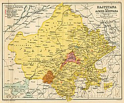
Location of Sirohi within Rajputana circa 1525, with neighbouring polities, on the eve of the establishment of the Mughal Empire.[3]
Sirohi State was founded by Maharaja of DeoraRajputs before c. 1311, and formed the area into a state.[4] In 1405, then-ruler Shivabhan established the capital of the state at Shivpuri, 3 kilometers east of the present-day town of Sirohi.[5] In 1425, Rao Sains Mal built the town of Sirohi, while later became the capital of the state.[6] The rulers of this state belong to Deora Chauhan clan of Rajputs.[7] In 1452, the state was attacked by Rana Kumbha of Mewar.[8]
During the early years of the 19th century, Sirohi suffered much from wars with Jodhpur and the hill tribes of the area. The protection of the British was sought in 1817; the pretensions of Jodhpur to suzerainty over Sirohi were disallowed, and in 1823 a treaty was concluded with the British government. Sirohi became a self-governing princely state, and part of the Rajputana Agency.[1]
For services rendered during the Revolt of 1857, the Rao received a remission of half his tribute. Rao Keshri Singh (ruled 1875-1920) and his successors were granted the title Maharao (equivalent to Maharaja) in 1889.[1]
When India became independent in 1947, there was no immediate consensus about whether Sirohi State should be merged with the new states of Bombay or Rajasthan.[9] Initially, the area under Sirohi State was merged into Bombay 1949, but was transferred to Rajasthan in 1950.[9][10]
The traditional practice of revenue collection consisted of bhog batai and halbandi. Bhog batai, the more prevalent practice, consisted of direct collection of a part of the harvested produce by the state. In some areas of the state, halbandi was used, under which a cash tax was imposed on the implements used by farmers. In 1904, a new revenue-collection system was introduced which consisted of revenue collection based on average productivity of the cultivated area as the criterion for payment. From the state's perspective, the new revenue system was largely successful, leading to a large increase in the state's revenue.[11]
This page is based on this Wikipedia article Text is available under the CC BY-SA 4.0 license; additional terms may apply. Images, videos and audio are available under their respective licenses.