Bundelkhand Agency

Last updated

Bundelkhand Agency
Agency of British India
1811–1948
Central India Agency Map.jpg
Map of the Central India Agency with the Bundelkhand Agency in the eastern part
Area 
 1901
25,510 km2 (9,850 sq mi)
Population 
 1901
1308326
History
History 
 Established
1811
1948
Succeeded by
India Flag of India.svg
Wikisource-logo.svg This article incorporates text from a publication now in the public domain: Chisholm, Hugh, ed. (1911). "Bundelkhand". Encyclopædia Britannica (11th ed.). Cambridge University Press.

The Bundelkhand Agency was a political agency of the British Raj, managing the relations of the British government with the protected princely states of the Bundelkhand region. [1]

Contents

History

Historical background

The Marathas ceded parts of Bundelkhand, which were later called later British Bundelkhand, to the British in the 1802 Treaty of Bassein. After 1802, many of the local rulers were granted sanads (leases) by the British, which entitled them to the lands they controlled at the death of Ali Bahadur, in return for the rulers signing a written bond of allegiance (ikrarnama) to the British. A political officer attached to the British forces in Bundelkhand supervised British relations with the sanad states. In 1806 British protection was promised to the Maratha ruler of Jhansi, and in 1817 the British recognized his hereditary rights to Jhansi state. In 1818 the Peshwa in Pune ceded all his rights over Bundelkhand to the British at the conclusion of the Third Anglo-Maratha War.

Creation of the agency

The sanad states were organized into the Bundelkhand Agency in 1811, when a political agent to the Governor-General of India was appointed and headquartered at Banda. In 1818 the headquarters were moved to Kalpi, in 1824 to Hamirpur, and in 1832 back to Banda. The political agent was placed under the authority of the Lieutenant-Governor of the North-Western Provinces, headquartered in Agra, in 1835. In 1849 authority over the Bundelkhand Agency was placed briefly under the Commissioner for the Saugor and Nerbudda Territories, who appointed a political assistant based at Jhansi. Shortly thereafter, authority over Bundelkhand was placed under the Resident at Gwalior, and the headquarters of the political assistant was moved to Nowgong, which remained until 1947. In 1853 the Raja of Jhansi died childless, and his territory was annexed to British Bundelkhand. The Jhansi State and the Jalaun and Chanderi districts were then formed into a superintendency. In 1854 Bundelkhand Agency was placed under the authority of the newly created Central India Agency, headquartered at Indore.

The widow of the Raja of Jhansi, Rani Lakshmi Bai, protested the annexation because she was not allowed to adopt an heir, and because the slaughter of cattle was permitted in the Jhansi territory. The Revolt of 1857 found Jhansi ripe for rebellion. In June a few men of the 12th native infantry seized the fort containing the treasure and magazine, and massacred the European officers of the garrison. The Rani put herself at the head of the rebels, and they captured several of the neighboring British districts and princely states allied to the British. She died bravely in battle in Gwalior in 1858. It was not till November 1858 that Jhansi was brought under British control. [2]

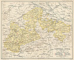
After the revolt, Jhansi was given to the Maharaja of Gwalior, but came under British rule in 1886 when it was swapped for Gwalior fort. In 1865 the political assistant was replaced with a political agent. The eastern portion of the Agency was detached to form Bagelkhand Agency in 1871. The state of Khaniadhana was transferred to the authority of the Gwalior Resident in 1888, and in 1896 Baraundha, Jaso, and the Chaube Jagirs were transferred to Bagelkhand. In 1901 there were 9 states, 13 estates, and the pargana of Alampur belonging to Indore State, with a total area of 9,851 sq mi (25,510 km2) and a total population of 1,308,326 in 1901. The most important of the states were Orchha, Panna, Samthar, Charkhari, Chhatarpur, Datia, Bijawar and Ajaigarh State. Deforestation accelerated during British rule. The population of the agency decreased 13% between 1891 and 1901 due to the effects of famine. In 1931 Bagelkhand Agency, with the exception of the state of Rewa State, was merged into the Bundelkhand Agency.

Princely States

The Bundelkhand Agency was bounded by Bagelkand to the east, the United Provinces to the north, Lalitpur District to the west, and the Central Provinces to the south. The Bagelkhand Agency was separated from Bundelkhand in 1871. In 1900 it included 9 states, 13 estates and the pargana of Alampur belonging to Indore State. In 1931, all of the Baghelkhand Agency states were transferred back to Bundelkhand, except Rewa (title Maharaja, Hereditary salute of 15-guns)), which was placed under the authority of the Indore Residency.

Salute states, by precedence :

Non-salute states :

Jagirs  :

Former princely States that were annexed or seized

See also

Related Research Articles

Princely state Type of vassal state in British India

A Princely State was a nominally sovereign entity of the British Indian Empire that was not directly governed by the British, but rather by an Indian ruler under a form of indirect rule, subject to a subsidiary alliance and the suzerainty or paramountcy of the British crown.

Central India Agency Agency of princely states in the British Raj

The Central India Agency was created in 1854, by amalgamating the Western Malwa Agency with other smaller political offices which formerly reported to the Governor-General of India. The agency was overseen by a political agent who maintained British relations with the princely states and influence over them on behalf of the Governor-General. The headquarters of the agent were at Indore.

Datia City in Madhya Pradesh, India

Datia is the district headquarter of the Datia District in north central Madhya Pradesh,a state of Central India. It is an ancient town, mentioned in the Mahabharata ruled by King Dantavakra. The city is 78 km from Gwalior, 325 km south of New Delhi and 344 km north of Bhopal. About 18 km from Datia is Sonagiri, a sacred Jain hill. Datia is also about 31 km from Jhansi and 52 km from Orchha. The nearest airport is at Gwalior. It was formerly the seat of the eponymous princely state in the British Raj. Datia is situated near Gwalior and on the border with Uttar Pradesh.

Tikamgarh City in Madhya Pradesh, India

Tikamgarh is a town and a tehsil in Tikamgarh district in the Indian state of Madhya Pradesh. The city serves as a district headquarters. The earlier name of Tikamgarh was Tehri consisting of three hamlets, forming a rough triangle. In Tikamgarh town there is locality still known as 'Purani Tehri'. Until Indian independence in 1947, Tikamgarh, formerly called Tehri, was part of the kingdom of Orchha, which was founded in the 16th century by the Bundeli chief Rudra Pratap Singh, who became the first King of Orchha. In 1783 the capital of the state was moved to Tehri, about 40 miles (64 km) south of Orchha, which was home to the fort of Tikamgarh, and the town eventually took the name of the fort. The district is famous for the old fort of Kundar known as Garh Kundar, which was built by Khangars and remained the capital of Khangar rulers from 1180 to 1347.

Datia district District of Madhya Pradesh in India

Datia District is in Gwalior Division in the Indian state of Madhya Pradesh. The town of Datia is its district headquarters.

Satna is a city in the Indian state of Madhya Pradesh. It serves as the headquarters of Satna district. It is 6th largest city and 8th most populous city of the state. The city is 500 km east of the state capital Bhopal. The city is distributed over a land area of 111.9 square kilometres.

Bhopawar Agency

Bhopawar Agency was a sub-agency of the Central India Agency in British India with the headquarters at the town of Bhopawar, so the name. Bhopawar Agency was created in 1882 from a number of princely states in the Western Nimar and Southern Malwa regions of Central India belonging to the former Bhil Agency and Bhil Sub-agency with the capitals at Bhopawar and Manpur. The agency was named after Bhopawar, a village in Sardarpur tehsil, Dhar District of present-day Madhya Pradesh state. Manpur remained a strictly British territory.

Deccan States Agency

The Deccan States Agency, also known as the Deccan States Agency and Kolhapur Residency, was a political agency of British India, managing the relations of the British government of the Bombay Presidency with a collection of princely states and jagirs in western India.

Malwa Agency was an administrative section of British India's Central India Agency. The headquarters of the political agent was at Mandsaur (Mandasor) / Neemuch (Nimach). The other chief towns of the region were : Ratlam and Jaora.

Gwalior Residency Gwalior State political office

Gwalior Residency was a political office in the British Indian Empire, which existed from 1782 until the British withdrawal from India in 1947.

Gwalior State Semi-autonomous Maratha state (1731–1948)

Gwalior state was a semi-autonomous Maratha state. It was centred in modern-day Madhya Pradesh, arising due to the rise of the Maratha Empire and fragmentation of the Mughal Empire.

Daly College School in India

The Daly College is a co-educational residential and day boarding school located in Indore, Madhya Pradesh, India. It was founded by Sir Henry Daly of the British Indian Army during India's colonial British Raj, following an English public school model. The school started in 1870 as the Residency School. It was then renamed as the East Rajkumar College in 1876, and in 1882, it came to be known as The Daly College. It was established by the Resident Governor of the erstwhile Presidency, to educate the children of the royalty, nobility and aristocracy of Central Indian Princely States of the 'Marathas', 'Rajputs', 'Mohameddans' and 'Bundelas'. It is one of the oldest co-educational boarding schools in the world.

Datia State

Datia State was a princely state in subsidiary alliance with British India.

Orchha State

Orchha State was a kingdom situated in the Bundelkhand region and later a princely state in British India. The state was ruled by Bundela clan of Rajputs. It was located within what is now the state of Madhya Pradesh.

Khaniadhana State

Khaniadhana or Khaniyadhana was a princely state of British India ruled by the Judev dynasty of Bundela Rajputs. The capital of the State was Khaniadhana. It was part of the Bundelkhand Agency and later the Central India Agency.

Jhansi State Monarchy in India (1728–1858)

Jhansi was an independent princely state ruled by the Maratha Newalkar dynasty under suzerainty of British India from 1804 till 1853, when the British authorities took over State under the terms of the Doctrine of Lapse. Before that it was under the Peshwas from 1728 to 1804. The fortified town of Jhansi served as its capital.

Hasht-Bhaiya

The Hasht-Bhaiya (e)states were a group of jagirs of Central India during the period of the British Raj.

Chaube Jagirs

The Chaube Jagirs, also known as 'Kalinjar Chaubes', jagir states were a group of five feudatory states of Central India during the period of the British Raj. They were a British protectorate from 1823 to 1947 and belonged to the Bagelkhand Agency. Their last rulers acceded to India in 1948.

Dhurwai State

Dhurwai was a princely state in India during the British Raj. It was one of the Hasht-Bhaiya Jagirs, under the Bundelkhand Agency of British India. Its capital was the town of Dhurwai, with a population of 777 in 1901. Today it is part of Jhansi District, in the state of Uttar Pradesh. Dhurwai was administered by the native ruler, who was addressed as Indian Prince by the British authorities.

References

  1. "Bundelkhand Agency". The Imperial Gazetteer of India, Vol. 9. Oxford at Clarendon Press. 1909. pp. 74–77.
  2. "British Bundelkhand". The Imperial Gazetteer of India, Vol. 9. Oxford at Clarendon Press. 1909. pp. 68–74.
  3. Orchha state The Imperial Gazetteer of India, 1909, v. 19, p. 241.
  4. Great Britain India Office. The Imperial Gazetteer of India . Oxford: Clarendon Press, 1908

Coordinates: 25°03′N79°26′E / 25.05°N 79.43°E / 25.05; 79.43