Holland is a neighborhood in the Northeast community in Minneapolis. It is one of ten neighborhoods in Ward 1 of Minneapolis, currently represented by Council President Elliott Payne.

The Victory neighborhood is located within the Camden community of Minneapolis. It is bordered by the Humboldt Industrial Area on the north, Penn Avenue on the east, Dowling Avenue on the south, and the town of Robbinsdale on the west. It is located in Ward 4, represented by council member LaTrisha Vetaw.

Webber-Camden is a neighborhood in the Camden community of Minneapolis. Its boundaries are Penn and Newton avenues to the west, the Canadian Pacific Railway tracks to the north, Interstate 94 to the east, and Dowling Avenue to the south. It is located in Ward 4, represented by council member LaTrisha Vetaw.

Hiawatha is a neighborhood within the larger Longfellow community in Minneapolis. It is bordered by 40th Street to the north, the Mississippi River to the east, 54th Street East to the south, and Hiawatha Avenue to the west. Its neighbors are Howe to the north, the Mississippi River to the east, Minnehaha Park and the Minnehaha neighborhood to the south, and Ericsson and Standish to the west.

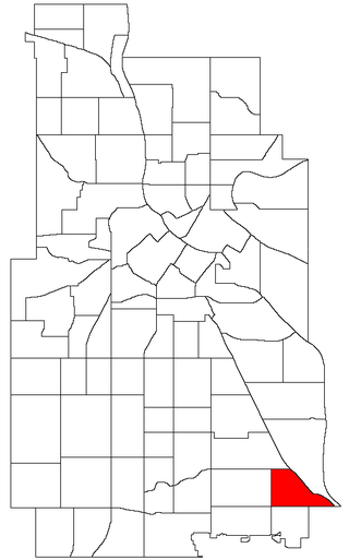
Field is a neighborhood in the Nokomis community in south Minneapolis, Minnesota. The neighborhood is bordered by East 46th Street on the north, Chicago Avenue on the east, Minnehaha Parkway on the south, and Interstate 35W on the west. Field shares a neighborhood organization with the Regina and Northrop neighborhoods, called the Field Regina Northrop Neighborhood Group (FRNNG).
Northeast is a defined community in the U.S. city of Minneapolis that is composed of 13 smaller neighborhoods whose street addresses end in "NE". Unofficially it also includes the neighborhoods of the University community which have "NE" addresses, and the entirety of the Old Saint Anthony business district, which sits on the dividing line of "NE" and "SE" addresses. In the wider community, this business district, which is the oldest settlement in the city, is often identified as the heart of Northeast, in part because it lies across the Mississippi River from Downtown Minneapolis. Northeast is sometimes referred to as "Nordeast", reflecting the history of northern and eastern European immigrants and their language influence.

Near North is one of six neighborhoods in the Near North community of Minneapolis. It is located in Ward 5, represented by city council member Jeremiah Ellison.

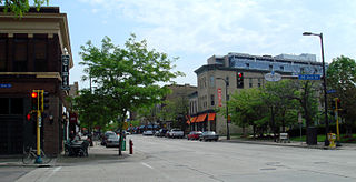
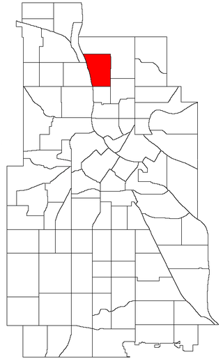
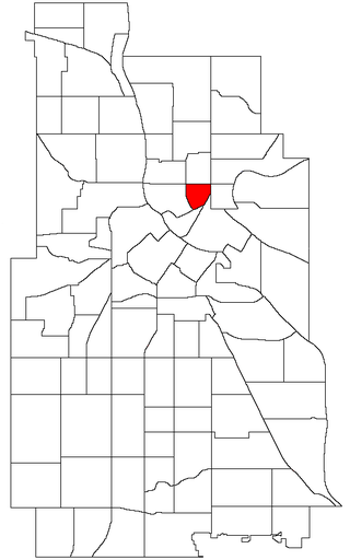
Marcy-Holmes is a neighborhood in the University community of Minneapolis. The majority of the area is residential and sits upon a bluff overlooking the river and the city skyline. A small section of the neighborhood along the river is an industrial zone.

Bottineau is a neighborhood in the Northeast community of Minneapolis. It is one of ten neighborhoods in Ward 1 of Minneapolis, currently represented by Council President Elliott Payne.

Columbia Park is a neighborhood in the Northeast community in Minneapolis. Its boundaries are 37th Avenue NE to the north, Central Avenue to the east, 27th Avenue NE to the south, and both University Avenue & Saint Anthony Parkway streets to the west. It is one of ten neighborhoods in Ward 1 of Minneapolis, currently represented by Council President Elliott Payne.

Windom Park is a neighborhood in the Northeast community in Minneapolis.

Saint Anthony West is a neighborhood in the Northeast community of Minneapolis.
Waite Park is a neighborhood in the Northeast community in Minneapolis, Minnesota. Its boundaries are 37th Avenue NE to the north, NE Stinson Boulevard to the East, Saint Anthony Parkway to the south, and NE Central Avenue to the west. It is the furthest northeast neighborhood within Minneapolis. It is one of ten neighborhoods in Ward 1 of Minneapolis, currently represented by Council President Elliott Payne, and falls under the jurisdiction of the second precinct of the Minneapolis Police Department.

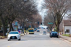
Keewaydin is a neighborhood in the Nokomis community in Minneapolis, Minnesota. Its boundaries are Minnehaha Parkway to the north, 34th Avenue to the east, 54th Street to the south, and Cedar Avenue to the west.
Minnehaha is a neighborhood in the Nokomis community in Minneapolis, Minnesota. Its boundaries are Minnehaha Parkway to the north, Hiawatha Avenue to the east, 54th Street to the south, and 34th Avenue to the west. It is located in Ward 12 of the Minneapolis City Council, currently represented by council member Aurin Chowdhury.

Logan Park is a neighborhood in the Northeast community in Minneapolis. It is one of ten neighborhoods in Ward 1 of Minneapolis, currently represented by Council President Elliott Payne.
Marshall Terrace is a neighborhood in the Northeast community in Minneapolis. It is one of ten neighborhoods in Ward 1 of Minneapolis, currently represented by Council President Elliott Payne.

Northeast Park is a neighborhood in the Northeast community in Minneapolis, Minnesota. Its boundaries are 18th Avenue NE and New Brighton Boulevard to the north, the city limits to the northeast, Interstate 35W to the southeast, Broadway Street NE to the south, and Central Avenue to the west. It is one of ten neighborhoods in Ward 1 of Minneapolis, currently represented by Council President Elliott Payne.

Sheridan is a neighborhood in the Northeast community of Minneapolis.
St. Anthony East is a neighborhood of the Northeast community in Minneapolis. It is located in Ward 3, currently represented by council member Michael Rainville.