Austinville, Alabama Decatur | |
|---|---|
Former town | |
 Austinville  Austinville | |
| Coordinates: 34°34′29.3″N87°00′31.0″W / 34.574806°N 87.008611°W | |
| Country | United States |
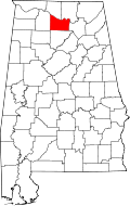
| State | Alabama |
| County | Morgan |
| Established | 1907 |
| Elevation | 617 ft (188 m) |
| Time zone | UTC-6 (Central Time) |
| • Summer (DST) | UTC-5 (CDT) |
| ZIP code | 35601 |
| Area code | 256 |
| GNIS feature ID | 0113297 |
Austinville is a former town and now a neighborhood within the city of Decatur in Morgan County, Alabama, United States. It is about 3 miles south from downtown Decatur, centered on the junction of Danville Road and Carridale Street. It was incorporated as a town in 1907 and disincorporated and annexed into the city of Decatur in 1956. [1]