Beach City, Texas

Last updated

Beach City, Texas
Chambers County BeachCity.svg
Location of Beach City, Texas
Coordinates: 29°42′9″N94°51′46″W / 29.70250°N 94.86278°W / 29.70250; -94.86278
Country United States
State Texas
County Chambers
Area
[1]
  Total4.48 sq mi (11.60 km2)
  Land4.48 sq mi (11.60 km2)
  Water0.00 sq mi (0.00 km2)
Elevation
[2]
23 ft (7 m)
Population
 (2020)
  Total3,221
  Density623.35/sq mi (240.70/km2)
Time zone UTC-6 (Central (CST))
  Summer (DST) UTC-5 (CDT)
ZIP code
77523 [3]
FIPS code 48-06200 [4]
GNIS feature ID1381006 [2]
Website www.beachcitytx.us

Beach City is a U.S. city in Chambers County, Texas, United States. The population was 3,221 at the 2020 census. [5] It can now be considered as a part of Greater Houston.

Contents

Geography

Beach City is located in western Chambers County at 29°42′9″N94°51′46″W / 29.70250°N 94.86278°W / 29.70250; -94.86278 (29.702527, –94.862789), [6] extending for 7 miles (11 km) along the northwestern shore of Trinity Bay. The city is 9 to 10 miles (14 to 16 km) southeast by east of Baytown.

According to the United States Census Bureau, Beach City has a total area of 4.5 square miles (11.6 km2), all land. [5]

Historical development

With the boom economy after World War II, people had time and money for recreation. People from Baytown especially began to take advantage of the drawbridge and built small summer/weekend houses or "fishing camps" along the shoreline of the present Beach City. By the early 1950s, they had nicknamed FM-2354 "Tri-City Beach Road", because the present Baytown resulted from a merger of three smaller towns in 1948.

However, a number who came for recreation decided to stay. By the early 1960s the community commonly called Tri-City Beach had about 500 permanent residents. At that time, the Texas legislature began to consider annexation reform. Previously, Texas municipalities had almost unfettered power to annex adjacent lands. Cities could control vast territories by annexing ten-feet-wide strips surrounding them. During that period, Baytown controlled an area larger than the California city of Los Angeles did. Larger cities could even annex smaller cities, after they had annexed to surround them. Knowing that reform was pending, many cities began a flurry of annexations. Defensively, a number of unincorporated communities began proceedings to incorporate as municipalities. The Tri-City Beach community was one of those.

On April 6, 1963, the Tri-City Beach Civic Association was formed. They met to discuss ways to better their community. The officers were Hayden Harper, a local grocer, President; Nina Harper, Secretary; Georgia Mackrell, Chairman of Publicity; and John Jennings, Chairman of the Membership Committee. The association explored a number of ideas, including the construction of a breakwater, and then began considering incorporation as a city. An Incorporation Committee was formed consisting of George Armer, Ruth Hoover, Eloice Jordan, J.D. Nicholson, and Bill White. Ms. Jordan met with County Judge Oscar F. Nelson, Jr. on March 8, 1966, and presented him with a petition for an incorporation election. On March 24, 1966, the Baytown City Council adopted Ordinance 788, consenting to the inclusion of an unspecified part of what Baytown then claimed as its extraterritorial jurisdiction within the proposed new municipality to be known as the City of Beach City. On April 5, 1966, an election was held to determine if the area would become a municipality. The results were 103 for incorporation to 4 opposed. The incorporation of Beach City was finalized by a decree issued by Judge Nelson on April 11, 1966.

To prevent annexation by the nearby city of Baytown, this community voted in April 1966 to become incorporated. [7] An election was held on May 21, 1966, to select the first municipal officers. Eloice Jordan was elected mayor. W.D. Bush, Alvin J. Crawley, William D. Daniel, J.R. Holland, and J.D. Nicholson were chosen as aldermen for the first city council. Gus Dauzat became the first city marshal. Later Ruth Hoover was appointed by the Council as city secretary and Claude Galloway as deputy marshal.

The mayors of the city have been (by date of election):

The Beach City Volunteer Fire Department was formed in 1967 and still exists. A Tri-City Beach Emergency Medical service organization had been formed before the city's incorporation and has since been merged into a county-wide emergency medical service.

With Baytown's concurrence, Beach City increased its area on August 19, 1968, by annexing approximately 1,781 acres (721 ha) near Point Barrow Road and taking in McCollum Park. The 1968 annexation moved the northern boundary of the city to Lawrence Road. This annexation brought into the city limits the historic home site of early pioneer Solomon Barrow (1801–1858), whose land included the area where McCollum Park is now located. The park, as a matter of record, contains the last resting place of Barrow, his wife Elizabeth Winfree, and Barton Clark, the first husband of their daughter Narcissa Ophelia Henrietta Jane Barrow. On October 27, 1970, again with Baytown's concurrence, Beach City annexed the area where the Beach City Community Building and the Beach City VFD fire station are located. That is the only part of the city limits that extends west of FM-2354.

Meanwhile, there were rumors that Baytown intended to annex the community of Cove. On September 22, 1970, Beach City received a petition of 84 residents of Cove to annex the community. The mayor of Beach City at the time was Jimmy McClellan. On November 24, 1970, Beach City annexed Cove, an area bounded generally on the west by FM-2354, on the east by the Old and Lost Rivers, on the south by Lawrence Road, and on the north by a line just north of FM-565. On December 2, 1970, Beach City extended its Cove annexation to include the property where the old Cove Community Building sits. This time Baytown did not concur. In 1971, Baytown sued Beach City in an attempt to stop the annexation of Cove. In 1973, Beach City released its claim to what are now the city limits of Cove. An incorporation election was held and the City of Cove was incorporated on May 23, 1973. Leroy Stevens was Cove's first mayor. The City Council of Beach City presented to Mayor Stevens Cove's first municipal seal, which is believed to be the one still in use.

Demographics

Historical population
CensusPop.Note
1970 363
1980 977169.1%
1990 852−12.8%
2000 1,64593.1%
2010 2,19833.6%
2020 3,22146.5%
U.S. Decennial Census [8]
Beach City racial composition as of 2020 [9]
(NH = Non-Hispanic) [lower-alpha 1]
RaceNumberPercentage
White (NH)2,53778.76%
Black or African American (NH)341.06%
Native American or Alaska Native (NH)110.34%
Asian (NH)310.96%
Some Other Race (NH)190.59%
Mixed/Multi-Racial (NH)1173.63%
Hispanic or Latino 47214.65%
Total3,221

As of the 2020 United States census, there were 3,221 people, 917 households, and 799 families residing in the city.

As of the census [4] of 2000, there were 1,645 people, 623 households, and 490 families residing in the city. The population density was 370.9 inhabitants per square mile (143.2/km2). There were 714 housing units at an average density of 161.0 per square mile (62.2/km2). The racial makeup of the city was 95.62% White, 1.58% African American, 0.12% Native American, 0.06% Asian, 1.76% from other races, and 0.85% from two or more races. Hispanic or Latino of any race were 4.74% of the population.

There were 623 households, out of which 35.6% had children under the age of 18 living with them, 70.5% were married couples living together, 6.1% had a female householder with no husband present, and 21.2% were non-families. 16.2% of all households were made up of individuals, and 6.1% had someone living alone who was 65 years of age or older. The average household size was 2.64 and the average family size was 2.97.

In the city, the population was spread out, with 25.8% under the age of 18, 7.0% from 18 to 24, 28.0% from 25 to 44, 29.8% from 45 to 64, and 9.4% who were 65 years of age or older. The median age was 40 years. For every 100 females, there were 103.8 males. For every 100 females age 18 and over, there were 102.5 males.

The median income for a household in the city was $70,104, and the median income for a family was $75,439. Males had a median income of $55,268 versus $33,750 for females. The per capita income for the city was $28,421. About 2.8% of families and 4.0% of the population were below the poverty line, including 3.8% of those under age 18 and 0.8% of those age 65 or over.

Transportation

RWJ Airpark, a privately owned, public use airport, is located in Beach City.

Education

The northeastern majority of the city (north of Seacrest Park Road) is zoned to Barbers Hill Independent School District. [11]

Zoned schools include (all in Mont Belvieu):

A small southwestern part of the city (south of Seacrest Park Road) is zoned to Goose Creek Independent School District. [11]

Zoned schools include: [12] (all in Baytown)

Residents of Barbers Hill ISD and Goose Creek ISD (and therefore all of Beach City) are zoned to Lee College. [13]

Related Research Articles

<span class="mw-page-title-main">Chambers County, Texas</span> County in Texas, United States

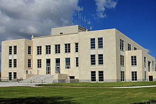
Chambers County is a county in the U.S. state of Texas. As of the 2020 census, its population was 46,571. The county seat is Anahuac.
<span class="mw-page-title-main">Homewood, Alabama</span> City in Alabama, United States

Homewood is a city in southeastern Jefferson County, Alabama, United States. It is a suburb of Birmingham, located on the other side of Red Mountain due south of the city center. As of the 2020 census, its population was 26,414.
<span class="mw-page-title-main">Salida, California</span> Census-designated place in California, United States

Salida is a census-designated place (CDP) in Stanislaus County, California, in the United States. As of the 2010 census, the CDP population was 13,722. It is part of the Modesto Metropolitan Statistical Area. Cultivation of almonds has historically been a significant activity in the vicinity, including a major Blue Diamond processing facility nearby. The plant is involved exclusively in processing whole brown almond kernels with a "dry" process involving no water, heat or chemicals. Salida is within the East Stanislaus Resource Conservation District which comprises 984 square miles (2,550 km2) of land area and attends to a variety of environmental conservation and best management agricultural practices.
<span class="mw-page-title-main">Hillcrest Heights, Florida</span> Town in the state of Florida, United States

Hillcrest Heights is a town in Polk County, Florida, United States. The population was 254 at the 2010 census. As of 2018, the population recorded by the U.S. Census Bureau is 294. It is part of the Lakeland–Winter Haven Metropolitan Statistical Area.

<span class="mw-page-title-main">Rogers, Minnesota</span> City in Minnesota, United States

Rogers is a city located in Hennepin County, Minnesota, United States. The population was 13,295 at the 2020 census. In 2012, the city annexed the surrounding Hassan Township. The City of Rogers is considered a northwest suburb of the Minneapolis–Saint Paul metropolitan area. The city's economy is mostly based on industrial activity and agriculture.
<span class="mw-page-title-main">Terrell Hills, Texas</span> City in Texas, United States

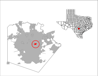
Terrell Hills is a city in Bexar County, Texas, United States; it is located 5 miles (8 km) northeast of downtown San Antonio. As of the 2020 census Terrell Hills had a population of 5,045. It is part of a group of three cities—Terrell Hills, Alamo Heights, and Olmos Park—located between Uptown San Antonio, Midtown San Antonio, Downtown San Antonio, and Fort Sam Houston. Terrell Hills is bordered on the west by Alamo Heights, on the east by Fort Sam Houston, on the north by Uptown San Antonio, and on the south by San Antonio's Near East Side. It is part of the San Antonio Metropolitan Statistical Area.

<span class="mw-page-title-main">Cove, Texas</span> City in Texas, United States

Cove is a city in Chambers County, Texas, United States. The population was 525 at the 2020 census, up from 510 at the 2010 census.

<span class="mw-page-title-main">Bunker Hill Village, Texas</span> City in Texas, United States

Bunker Hill Village is a city in Harris County, Texas, United States, part of Houston–The Woodlands–Sugar Land metropolitan area. The population was 3,822 at the 2020 census. It is part of a collection of upscale residential communities in west Houston known as the Memorial Villages. As of 2010, Bunker Hill Village was the sixth wealthiest place in Texas. Also, Bunker Hill Village is one of Forbes' top 25 places to retire rich.

<span class="mw-page-title-main">Deer Park, Texas</span> City in Texas, United States

Deer Park is a city in the U.S. state of Texas within the Houston–Sugar Land–Baytown metropolitan area. The city is located in Harris County and is situated in Southeast Harris County. At the 2020 U.S. census, the population of Deer Park was 34,495.

<span class="mw-page-title-main">Jacinto City, Texas</span> City in Texas, United States

Jacinto City is a city in Harris County, Texas, United States, east of the intersection of Interstate 10 and the East Loop of Interstate 610. Jacinto City is part of the Houston–Sugar Land–Baytown metropolitan area and is bordered by the cities of Houston and Galena Park. The population was 9,613 at the 2020 census.

<span class="mw-page-title-main">Jersey Village, Texas</span> City in Texas, United States

Jersey Village is a city in west-central Harris County, Texas, United States, located at U.S. Highway 290, Farm to Market Road 529, and the Southern Pacific Railroad. The city is located in the Houston–Sugar Land–Baytown metropolitan area. The population was 7,921 at the 2020 census.

<span class="mw-page-title-main">La Porte, Texas</span> City in Texas, United States

La Porte is a city in Harris County, Texas, United States, within the Bay Area of the Houston–Sugar Land–Baytown metropolitan area. As of the 2020 census, the city population was 35,124. La Porte is the fourth-largest incorporated city in Harris County.

<span class="mw-page-title-main">Morgan's Point, Texas</span> City in Texas, United States

Morgan's Point is located 30 miles southeast of Houston in southeastern Harris County, Texas, United States, located on the shores of Galveston Bay at the inlet to the Houston Ship Channel, near La Porte and Baytown. As of the 2010 census, it had a population of 339. As of 2020, it has approximately 356 residents and is located within the La Porte Independent School District.

<span class="mw-page-title-main">Fairwood, King County, Washington</span> Census-designated place in Washington, United States

Fairwood is an unincorporated community and census-designated place (CDP) in King County, Washington, United States. As of the 2010 census the population was 19,102.

<span class="mw-page-title-main">Shoreline, Washington</span> City in Washington, United States

Shoreline is a city in King County, Washington, United States. It is located between the city limits of Seattle and the Snohomish County border, approximately 9 miles (14 km) north of Downtown Seattle. As of the 2020 census, the population of Shoreline was 58,608, making it the 22nd largest city in the state. Based on per capita income, one of the more reliable measures of affluence, Shoreline ranks 91st of 522 areas in the state of Washington to be ranked.

<span class="mw-page-title-main">Smokey Point, Washington</span> CDP in Washington, United States

Smokey Point is a community and former census-designated place in northern Snohomish County, Washington. The area, developed as a suburban bedroom community in the late 20th century, was annexed into the nearby cities of Arlington and Marysville in the 1990s and 2000s.
<span class="mw-page-title-main">Mont Belvieu, Texas</span> City in Texas, United States

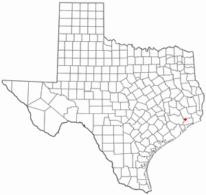
Mont Belvieu is a city in Chambers County in the U.S. state of Texas. It is just north of Interstate 10 along State Highway 146. The population was 7,654 at the 2020 census, an increase of nearly 100% from 3,835 in 2010. It is the site of the largest underground storage facility for liquefied petroleum gas in the US. The US LPG market pricing indicator is driven primarily by the Mont Belvieu market, and reported daily by the US Energy Administration.

<span class="mw-page-title-main">Chattahoochee Hills, Georgia</span> City in Georgia, United States

Chattahoochee Hills is a city in southern Fulton County, Georgia, United States. As of the 2010 census, it had a population of 2,378 living in an area of just over 32,000 acres (130 km2). The population in 2019 was estimated to 3,318 in an area of approximately 37,473 acres (151.65 km2) acres after subsequent annexations. It is the incorporated part of a region called "Chattahoochee Hill Country", an area encompassing approximately 60,000 acres (240 km2) southwest of Atlanta, bordered on the northwest side by the Chattahoochee River. Unlike the rest of metro Atlanta, it is still relatively undeveloped, and most of its rural character remains unchanged. The majority of the wider area comprises the west-southwest part of southern Fulton, and smaller adjacent parts of southern Douglas, eastern Carroll, and northern Coweta counties.
<span class="mw-page-title-main">Bull Mountain, Oregon</span> Unincorporated community in the state of Oregon, United States

Bull Mountain is an unincorporated community and census-designated place in Washington County, Oregon, United States. Bull Mountain is located mostly on a hill for which the community is named. It is bordered on the east by Tigard, on the south by King City, and Beaverton lies to the north. The north-eastern part of the Bull Mountain hill is now within the Tigard city limits, as the city has steadily annexed portions of the unincorporated region on its boundary. In 2010, the community became a census-designated place with a population of 9,133. Fire protection and EMS services are provided through Tualatin Valley Fire and Rescue.

Union Valley is a city in Hunt County, Texas, United States. The city was incorporated in 2007. The population at the 2010 census was 307.

References

  1. "2019 U.S. Gazetteer Files". United States Census Bureau. Retrieved August 7, 2020.
  2. 1 2 U.S. Geological Survey Geographic Names Information System: Beach City, Texas
  3. "Beach City ZIP Code". zipdatamaps.com. 2023. Retrieved January 12, 2023.
  4. 1 2 "U.S. Census website". United States Census Bureau . Retrieved January 31, 2008.
  5. 1 2 "Geographic Identifiers: 2010 Census Summary File 1 (G001): Beach City city, Texas". U.S. Census Bureau, American Factfinder. Archived from the original on February 13, 2020. Retrieved July 27, 2015.
  6. "US Gazetteer files: 2010, 2000, and 1990". United States Census Bureau. February 12, 2011. Retrieved April 23, 2011.
  7. BEACH CITY, TX | The Handbook of Texas Online| Texas State Historical Association (TSHA)
  8. "Census of Population and Housing". Census.gov. Retrieved June 4, 2015.
  9. "Explore Census Data". data.census.gov. Retrieved May 23, 2022.
  10. "About the Hispanic Population and its Origin". www.census.gov. Retrieved May 18, 2022.
  11. 1 2 "2020 CENSUS - SCHOOL DISTRICT REFERENCE MAP: Chambers County, TX" (PDF). U.S. Census Bureau . Retrieved April 18, 2021.
  12. "Street Name Search Archived May 16, 2008, at the Wayback Machine ." Goose Creek Independent School District .
  13. Texas Education Code, Sec. 130.186. LEE COLLEGE DISTRICT SERVICE AREA.
  1. Note: the US Census treats Hispanic/Latino as an ethnic category. This table excludes Latinos from the racial categories and assigns them to a separate category. Hispanics/Latinos can be of any race. [10]