| Bayport Container Terminal | |
|---|---|
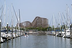
 Aerial view of the Bayport Container Terminal | |
 | |
| Location | |
| Country | United States |
| Location | Seabrook, Texas [1] |
| Coordinates | 29°36′40″N95°0′40″W / 29.61111°N 95.01111°W |
| Details | |
| Opened | 2007 |
| Operated by | Port of Houston Authority |
| Owned by | City of Houston |
| Type of harbour | Natural / artificial |
| Statistics | |
| Website http://www.portofhouston.com | |
The Bayport Container Terminal, or simply the Bayport Terminal, is a major deep water port in the Greater Houston area in Texas (United States). This relatively new terminal, part of the Port of Houston, is designed to handle standardized cargo containers and offload the nearby Barbours Cut Terminal, which has no further room for expansion. [2] The Bayport Terminal is situated along the Bayport Ship Channel off Galveston Bay, between La Porte, Texas and Seabrook, Texas adjacent to Shoreacres. This channel itself feeds into the larger Houston Ship Channel, which runs from Houston, through Galveston Bay, to the Gulf of Mexico.
Contents
The port sits adjacent to the Bayport Industrial District, a large complex of firms primarily involved in petroleum and petrochemical processing.
The facilities at Bayport formerly included a cruise ship terminal, built at a cost of US$81 million. [3] The terminal briefly saw use for cruises following Hurricane Ike when ships like Carnival Cruise Lines Ecstasy and Conquest were re-routed from the damaged Port of Galveston to Bayport for nearly two months. Bayport Cruise Terminal was a planned port of call for both Princess Cruises and Norwegian Cruise Line in 2013-2014. [4] The cruise ships have since abandoned the terminal and the Port of Houston has dismantled the gangways. [5]