
Tweed Heads is a town in New South Wales. It is located on the Tweed River in north-eastern New South Wales, Australia, in Tweed Shire, next to the border with Queensland and adjacent to its "twin town" of Coolangatta, which is a suburb of the Gold Coast. It is often referred to as a town where people can change time zones – even celebrate New Year twice within an hour – simply by crossing the street, due to its proximity to the Queensland border, and the fact that New South Wales observes daylight saving whereas Queensland does not.

Rathdowney is a rural town and locality in the Scenic Rim Region, Queensland, Australia. In the 2016 census, Rathdowney had a population of 308 people.

Beaudesert is a rural town and locality in the Scenic Rim Region, Queensland, Australia. In the 2016 census, Beaudesert had a population of 6,395 people.

The Logan River is a perennial river located in the Scenic Rim, Logan and Gold Coast local government areas of the South East region of Queensland, Australia. The 184-kilometre (114 mi)-long river is one of the dominant waterways in South East Queensland that drains the southern ranges of the Scenic Rim and empties into Moreton Bay after navigating the City of Logan, a major suburban centre located south of Brisbane. The catchment is dominated by urban and agricultural land use. Near the river mouth are mangrove forests and a number of aquaculture farms.

The South Coast railway line was a railway from Brisbane, the capital city of Queensland, Australia. The route via the South Coast to Tweed Heads on the border of Queensland and New South Wales. The line operated from 1889 to 1964. The Gold Coast railway line re-opened in 1996 along a modified alignment in the north and a new route south but does not extend as far south yet as the South Coast line.
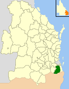
The Shire of Beaudesert was a local government area located in South East Queensland, Australia, stretching from the New South Wales border, along the Gold Coast hinterland to the urban fringes of the cities of Brisbane and Ipswich. The Shire covered an area of 2,854.3 square kilometres (1,102.1 sq mi), and existed from 1879 until its abolition on 15 March 2008, following which it was split between Logan City and the new Scenic Rim Region.
The Shire of Tingalpa was a local government area in the south-eastern suburbs of Brisbane, Queensland, Australia. The shire, administered from Mount Cotton, covered an area of 120 square miles (311 km2), and existed as a local government entity from 1879 until 1949.
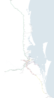
Queensland Rail operates ten suburban lines and three interurban lines. Centring in the Brisbane City, it extends as far as Gympie in the north, Varsity Lakes in the south, Rosewood in the west, and Cleveland in the east to Moreton Bay.

The Shire of Coomera was a local government area in South East Queensland, Australia. The shire, administered from Coomera, existed as a local government entity from 1879 until 1949.
The Shire of Tamborine was a local government area in South East Queensland, Australia, centred on the village of Tamborine. It existed from 1890 to 1949.
Lower Beechmont is a locality in the City of Gold Coast, Queensland, Australia. It is situated in the Gold Coast hinterland. In the 2016 census, Lower Beechmont had a population of 1,046 people.

Barney View is a rural locality in the Scenic Rim Region, Queensland, Australia. In the 2016 census, Barney View had a population of 64 people.

Christmas Creek is a rural locality in the Scenic Rim Region, Queensland, Australia. In the 2016 census Christmas Creek had a population of 53 people.
Tabooba is a rural locality in the Scenic Rim Region, Queensland, Australia. In the 2016 census, Tabooba had a population of 72 people.
Palen Creek is a rural locality in the Scenic Rim Region, Queensland, Australia. It borders New South Wales. In the 2016 census, Palen Creek had a population of 280 people.
Innisplain is a rural locality in the Scenic Rim Region, Queensland, Australia. In the 2016 census, Innisplain had a population of 85 people.

Running Creek is a rural locality in the Scenic Rim Region, Queensland, Australia. In the 2016 census Running Creek had a population of 147 people. It borders New South Wales.

Lamington is a rural locality in the Scenic Rim Region, Queensland, Australia. In the 2016 census Lamington had a population of 86 people.
Ipswich–Boonah–Rathdowney Road is a continuous 87.8 kilometres (54.6 mi) road route in the Ipswich and Scenic Rim regions of Queensland, Australia. It has two official names, Ipswich–Boonah Road and Boonah–Rathdowney Road. The entire route is signed as State Route 93, and much of it is also part of Tourist Drive 16.
Beaudesert–Beenleigh Road is a continuous 35.5 kilometres (22.1 mi) road route in the Scenic Rim and Logan City regions of Queensland, Australia. Part of the road is signed as State Route 90 and the rest as State Route 92. Beaudesert–Beenleigh Road is a state-controlled road, part district and part regional.


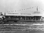 Beaudesert Tramway Station in 1927
 B13 class 185 at Beaudesert in 1944
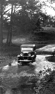
 Foden rail tractor at Tabooba in 1944
 Upper Logan Terminal Station on the Beaudesert Tramway, 1903
 Workmen on a ballast train, 1903


