Laravale, Queensland

Last updated

Map all coordinates using: OpenStreetMap  
Download coordinates as: KML
Laravale
Queensland
Round Mountain at Laravale, Queensland 2.jpg
Round Mountain, 2016
Australia Queensland location map.svg
Red pog.svg
Laravale
Coordinates 28°05′24″S152°55′59″E / 28.09°S 152.9330°E / -28.09; 152.9330 (Laravale (centre of locality)) Coordinates: 28°05′24″S152°55′59″E / 28.09°S 152.9330°E / -28.09; 152.9330 (Laravale (centre of locality))
Population189 (2016 census) [1]
 • Density3.310/km2 (8.573/sq mi)
Postcode(s) 4285
Area57.1 km2 (22.0 sq mi)
Time zone AEST (UTC+10:00)
Location
LGA(s) Scenic Rim Region
State electorate(s) Scenic Rim
Federal division(s) Wright
Localities around Laravale:
Josephville Josephville Cryna
Kooralbyn Laravale Kerry
Knapp Creek Tabooba
Tamrookum
Tabooba

Laravale is a rural locality in the Scenic Rim Region, Queensland, Australia. [2] In the 2016 census, Laravale had a population of 189 people. [1]

Contents

Geography

Mount Lindesay seen from Laravale, 2014 Mount Lindesay from Laravale.jpg
Mount Lindesay seen from Laravale, 2014

Part of the southern border is marked by the Christmas Creek, the Logan River and the Mount Lindesay Highway. [3]

Round Mountain is in the north of the locality ( 28°04′23″S152°55′21″E / 28.0730°S 152.9225°E / -28.0730; 152.9225 (Round Mountain) ) rising to 109 metres (358 ft). [4] [5]

In the east of the locality, the terrain is elevated above 350 metres (1,150 ft) above sea level. Agriculture, including dairying, has developed in the more fertile areas adjacent to the Logan River. [3]

The Sydney–Brisbane rail corridor also passes through the locality. [3]

History

Lara station on the Beaudesert Tramway StateLibQld 2 232890 Lara Station on the Beaudesert Tramway.jpg
Lara station on the Beaudesert Tramway

Errisvale Provisional School opened on 22 February 1900. In 1907 it was renamed Laravale Provisional School. On 1 January 1909 it became Laravale State School. The school was mothballed on 31 December 2007 and then closed on 31 December 2010. [6] [7] [8]

The school was located at 77 Christmas Creek Road ( 28°05′33″S152°56′15″E / 28.0926°S 152.9376°E / -28.0926; 152.9376 (Laravale State School) ). [9]

The Beaudesert Shire Tramway had a stop at Laravale.

St Stephen's Catholic Church was officially opened on Sunday 18 February 1923 by Archbishop James Duhig in the presence of 400 people. About 160 people came on a special train for the event. It was built on a 2-acre (0.81 ha) parcel of land donated by Henry Bruxner. [10] [11] On 28 July 2003, the church building was relocated to St Augustine's College at Augustine Heights, where it now serves as St Monica's Chapel for use by both the school and the wider Catholic community. [12] [13]

Prior to 2008, it was part of Beaudesert Shire.

In the 2016 census, Laravale had a population of 189 people. The locality contains 86 households, in which 50.5% of the population are males and 49.5% of the population are females with a median age of 40, 2 years above the national average. The average weekly household income is $1,321, $117 below the national average. 0.0% of Laravale's population is either of Aborigional or Torres Strait Islander descent. 61.4% of the population aged 15 or over is either registered or de facto married, while 38.6% of the population is not married. 24.2% of the population is currently attending some form of a compulsory education. The most common nominated ancestries were Australian (33.2%), English (31.0%) and Scottish (12.2%), while the most common country of birth was Australia (91.1%), and the most commonly spoken language at home was English (93.7%). The most common nominated religions were Catholic (27.6%), No religion (21.8%) and Anglican (16.7%). The most common occupation was a manager (22.4%) and the majority/plurality of residents worked 40 or more hours per week (48.3%). [1]

Education

There are no schools in Laravale. The nearest government primary school is Tamrookum State School in neighbouring Tamrookum to the south. The nearest government secondary school is Beaudesert State High School in Beaudesert to the north-east. [3]

Attractions

Cotters Lookout is in the west of the locality ( 28°04′47″S152°53′28″E / 28.0797°S 152.8910°E / -28.0797; 152.8910 (Cotters Lookout) ). [14]

See also

Related Research Articles

Rathdowney, Queensland Town in Queensland, Australia

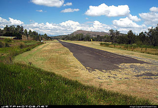
Rathdowney is a rural town and locality in the Scenic Rim Region, Queensland, Australia. In the 2016 census, Rathdowney had a population of 308 people.

Beaudesert, Queensland Town in Queensland, Australia

Beaudesert is a rural town and locality in the Scenic Rim Region, Queensland, Australia. In the 2016 census, Beaudesert had a population of 6,395 people.

Kooralbyn, Queensland Suburb of Scenic Rim Region, Queensland, Australia

Kooralbyn is a rural locality in the Scenic Rim Region, Queensland, Australia. In the 2016 census, Kooralbyn had a population of 1,725 people.

Augustine Heights, Queensland Suburb of Ipswich, Queensland, Australia

Augustine Heights is a suburb in the City of Ipswich, Queensland, Australia. In the 2016 census, Augustine Heights had a population of 4,880 people.

Tamrookum, Queensland Suburb of Scenic Rim Region, Queensland, Australia

Tamrookum is a rural locality in the Scenic Rim Region, Queensland, Australia. In the 2016 census, Tamrookum had a population of 91 people.

Barney View, Queensland Suburb of Scenic Rim Region, Queensland, Australia

Barney View is a rural locality in the Scenic Rim Region, Queensland, Australia. In the 2016 census, Barney View had a population of 64 people.

Tamborine, Queensland Suburb of Logan City, Queensland, Australia

Tamborine is a town in the Scenic Rim Region and a locality split between the Scenic Rim Region and the City of Logan in Queensland, Australia. In the 2016 census the locality of Tamborine had a population of 3,950 people.

Christmas Creek, Queensland Suburb of Scenic Rim Region, Queensland, Australia

Christmas Creek is a rural locality in the Scenic Rim Region, Queensland, Australia. In the 2016 census Christmas Creek had a population of 53 people.

Josephville, Queensland Town in Queensland, Australia

Josephville is a rural locality in the Scenic Rim Region, Queensland, Australia. In the 2016 census, Josephville had a population of 166 people.

Palen Creek, Queensland Suburb of Scenic Rim Region, Queensland, Australia

Palen Creek is a rural locality in the Scenic Rim Region, Queensland, Australia. It borders New South Wales. In the 2016 census, Palen Creek had a population of 280 people.

Mount Gipps, Queensland Suburb of Scenic Rim Region, Queensland, Australia

Mount Gipps is a rural locality in the Scenic Rim Region, Queensland, Australia. In the 2016 census, Mount Gipps had a population of 7 people.

Innisplain, Queensland Suburb of Scenic Rim Region, Queensland, Australia

Innisplain is a rural locality in the Scenic Rim Region, Queensland, Australia. In the 2016 census, Innisplain had a population of 85 people.

Oaky Creek, Queensland Suburb of Scenic Rim Region, Queensland, Australia

Oaky Creek is a rural locality in the Scenic Rim Region, Queensland, Australia. In the 2016 census Oaky Creek had a population of 83 people.

Running Creek, Queensland Suburb of Scenic Rim Region, Queensland, Australia

Running Creek is a rural locality in the Scenic Rim Region, Queensland, Australia. In the 2016 census Running Creek had a population of 147 people. It borders New South Wales.

Lamington, Queensland Suburb of Scenic Rim Region, Queensland, Australia

Lamington is a rural locality in the Scenic Rim Region, Queensland, Australia. In the 2016 census Lamington had a population of 86 people.

Gleneagle, Queensland Suburb of Scenic Rim Region, Queensland, Australia

Gleneagle is a rural locality in the Scenic Rim Region, Queensland, Australia. In the 2016 census, Gleneagle had a population of 1877 people.

Coulson, Queensland Suburb of Scenic Rim Region, Queensland, Australia

Coulson is a rural locality in the Scenic Rim Region, Queensland, Australia. In the 2016 census, Coulson had a population of 195 people.

Chinghee Creek is a rural locality in the Scenic Rim Region, Queensland, Australia. In the 2016 census Chinghee Creek had a population of 30 people.

Moogerah, Queensland Suburb of Scenic Rim Region, Queensland, Australia

Moogerah is a rural locality in the Scenic Rim Region, Queensland, Australia. In the 2016 census, Moogerah had a population of 234 people.

Croftby is a rural locality in the Scenic Rim Region, Queensland, Australia. In the 2016 census, Croftby had a population of 133 people. The town of Teviot is within the locality.

References

  1. 1 2 3 Australian Bureau of Statistics (27 June 2017). "Laravale (SSC)". 2016 Census QuickStats. Retrieved 20 October 2018. OOjs UI icon edit-ltr-progressive.svg
  2. "Laravale – locality in Scenic Rim Region (entry 49843)". Queensland Place Names. Queensland Government . Retrieved 20 July 2021.
  3. 1 2 3 4 "Queensland Globe". State of Queensland . Retrieved 22 December 2021.
  4. "Mountain peaks and capes - Queensland". Queensland Open Data. Queensland Government. 12 November 2020. Archived from the original on 25 November 2020. Retrieved 25 November 2020.
  5. "Round Mountain – mountain in Scenic Rim Region (entry 29192)". Queensland Place Names. Queensland Government . Retrieved 25 November 2020.
  6. Queensland Family History Society (2010), Queensland schools past and present (Version 1.01 ed.), Queensland Family History Society, ISBN   978-1-921171-26-0
  7. "Opening and closing dates of Queensland Schools". Queensland Government . Retrieved 30 October 2019.
  8. "Queensland state school - centre closures" (PDF). Queensland Government . 20 August 2013. Archived (PDF) from the original on 20 March 2022. Retrieved 6 April 2022.
  9. Chiclcott, Tanya; Vlasic, Kimberley (7 June 2013). "Full school asssets sale list". The Courier-Mail . Archived from the original on 30 October 2019. Retrieved 30 October 2019.
  10. "Catholic Church for Laravale". The Beaudesert Times . Vol. XIV, no. 714. Queensland, Australia. 23 June 1922. p. 2. Archived from the original on 22 December 2021. Retrieved 22 December 2021 via National Library of Australia.
  11. "New Roman Catholic Church at Laravale". The Beaudesert Times . Vol. XV, no. 749. Queensland, Australia. 23 February 1923. p. 2. Archived from the original on 22 December 2021. Retrieved 22 December 2021 via National Library of Australia.
  12. Blake, Thom. "St Stephen's Catholic Church". Queensland religious places database. Archived from the original on 22 December 2021. Retrieved 22 December 2021.
  13. "Taking delivery of God's house". The Catholic Leader. 23 August 2003. Archived from the original on 22 December 2021. Retrieved 22 December 2021.
  14. "Tourist points - Queensland". Queensland Open Data. Queensland Government. 18 November 2020. Archived from the original on 24 November 2020. Retrieved 24 November 2020.

Further reading

Commons-logo.svg Media related to Laravale, Queensland at Wikimedia Commons