Tamrookum, Queensland

Last updated

Map all coordinates using: OpenStreetMap  
Download coordinates as: KML  ·  GPX
Tamrookum
Queensland
Fields in Tamrookum.jpg
Fields, 2016
Australia Queensland location map.svg
Red pog.svg
Tamrookum
Coordinates 28°07′20″S152°54′49″E / 28.1222°S 152.9136°E / -28.1222; 152.9136 (Tamrookum (centre of locality))
Population91 (2016 census) [1]
 • Density4.76/km2 (12.34/sq mi)
Postcode(s) 4285
Area19.1 km2 (7.4 sq mi)
Time zone AEST (UTC+10:00)
Location
LGA(s) Scenic Rim Region
State electorate(s) Scenic Rim
Federal Division(s) Wright
Suburbs around Tamrookum:
Laravale Laravale Laravale
Knapp Creek Tamrookum Tabooba
Tamrookun Creek Innisplain Innisplain

Tamrookum is a rural locality in the Scenic Rim Region, Queensland, Australia. [2] In the 2016 census, Tamrookum had a population of 91 people. [1]

Contents

Geography

The Mount Lindesay Highway traverses Tamrookum from north (Laravale) to south (Innisplain) and forms part of the north-west boundary. The Logan River forms its eastern boundary. [3]

The Sydney–Brisbane rail corridor also passes through the locality from north to south to the west of the highway with Tamrookum railway station at 28°07′10″S152°55′00″E / 28.1194°S 152.9167°E / -28.1194; 152.9167 (Tamrookum railway station) . [3] [4]

A series of vegetated hills in the west rises to elevations of up to 150 metres (490 ft). [3]

In the east adjacent to the river the predominate land use is irrigated cropping and irrigated pasture for grazing. In the west the principal land use is grazing on native vegetation. [3]

History

Tamrookum Lagoon, 1903 StateLibQld 2 232906 Rowing on Tamrookum Lagoon in the Beaudesert Shire.jpg
Tamrookum Lagoon, 1903

The name Tamrookum is believed to be a corruption of the Aboriginal words (from the Bundjalung language, Yugumbir dialect) dhan/buragun meaning place of boomerangs. [2]

The first Tamrookum squatter was John Campbell and the lessee from 1848 was William Barker. In 1872 he paid £ 325 for portion 343 and was issued with a Deed of Grant for 1,000 acres (400 ha) which included the homestead (demolished in 1931) and church site. [5]

Pastoralist John Collins of Mundoolun acquired the land in 1878 and in 1879 his eldest son Robert Martin Collins took up residence after his marriage to Arabella Smyth. RM Collins became the owner in 1886. [5]

Tamrookum Memorial Hall, 2016 Tamrookum Memorial Hall at Tamrookum, Queensland.jpg
Tamrookum Memorial Hall, 2016

RM Collins and his brothers established vast pastoral interests in Queensland and the Northern Territory. He was a founding partner in the North Australian Pastoral Company and a pioneer of the frozen meat industry. He was a parliamentarian from 1896 to 1913 and was responsible for the establishment of Lamington National Park, proclaimed in 1915 after his death. [5]

Following the death of RM Collins in 1913, his family constructed an Anglican church in his memory (Collins had chosen the site prior to his death). All Saint's Memorial Church was dedicated on 31 August 1915 by Archbishop St Clair Donaldson. [6] [7]

Tamrookum State School opened on 31 January 1939. [8]

In October 1944, a meeting of local residents decided to construct memorial hall. [9] However, the project took some years and the Tamrookum Memorial Hall finally opened on 5 April 1952. [10] [11]

In the 2011 census, Tamrookum and surrounds had a population of 266 people. [12]

In the 2016 census, Tamrookum had a population of 91 people. [1]

Heritage listings

All Saints Anglican Church, 2005 Tamrookum-All-Saints-Anglican-Church.JPG
All Saints Anglican Church, 2005

Tamrookum has a number of heritage-listed sites, including:

Education

Tamrookum State School is a government primary (Prep-6) school for boys and girls at 9019 Mount Lindesay Highway ( 28°06′23″S152°54′56″E / 28.1064°S 152.9155°E / -28.1064; 152.9155 (Tamrookum State School) ). [14] [15] In 2017, the school had an enrolment of 141 students with 15 teachers (8 full-time equivalent) and 12 non-teaching staff (7 full-time equivalent). [16] There is no secondary school in Tamrookum; the nearest is Beaudesert State High School in Beaudesert. [3]

Amentities

Tamrookum has a roadhouse and general store, located on the eastern side of the Mount Lindsay Highway. [17]

Anglican services are held once a month at All Saints Memorial Church at Tamrookum Church Road ( 28°07′25″S152°55′22″E / 28.1236°S 152.9227°E / -28.1236; 152.9227 (All Saints' Memorial Church) ). [18]

Tamrookum Memorial Hall is on the corner of the Mount Lindesday Highway and Tamrookrum Church Road ( 28°07′24″S152°55′02″E / 28.1233°S 152.9173°E / -28.1233; 152.9173 (Tamrookum Memorial Hall) ). [10]

Related Research Articles

Mount Lindesay Highway

The Mount Lindesay Highway is an Australian national highway located in Queensland, also known as National Route 13. The highway runs southwest from Brisbane, where it leaves Ipswich Road in the suburb of Moorooka, to the Queensland – New South Wales border and is approximately 116 kilometres (72 mi) in length. For most of its length it is roughly aligned with the Sydney–Brisbane rail corridor. At its southern end these transport routes take different passes over the Scenic Rim into the Northern Rivers region.

Rathdowney, Queensland Town in Queensland, Australia

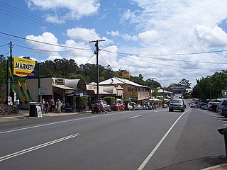
Rathdowney is a rural town and locality in the Scenic Rim Region, Queensland, Australia. In the 2016 census, Rathdowney had a population of 308 people.

Beaudesert, Queensland Town in Queensland, Australia

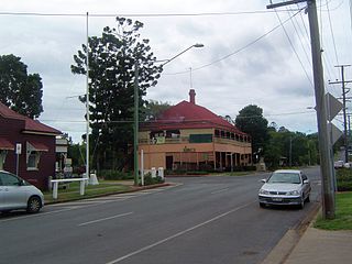
Beaudesert is a rural town and locality in the Scenic Rim Region, Queensland, Australia. In the 2016 census, Beaudesert had a population of 6,395 people.

Boonah, Queensland Town in Queensland, Australia

Boonah is a rural town and locality in the Scenic Rim Region, Queensland, Australia. In the 2016 census, Boonah had a population of 2,484 people.

Mount Lindesay (Queensland) Suburb of Scenic Rim Region, Queensland, Australia

Mount Lindesay is a rural locality in the Scenic Rim Region, Queensland, Australia. It borders New South Wales. In the 2016 census, Mount Lindesay had a population of 3 people.

Toogoolawah Town in Queensland, Australia

Toogoolawah is a rural town and locality in the Somerset Region, Queensland, Australia. In the 2016 census, Toogoolawah had a population of 1,279 people.

Marburg, Queensland Town in Queensland, Australia

Marburg is a rural town in the City of Ipswich and a locality split between the City of Ipswich and the Somerset Region, both in Queensland, Australia. In the 2016 census, Marburg had a population of 873 people.

Goomeri Town in Queensland, Australia

Goomeri is a town and locality in the Gympie Region, Queensland, Australia. In the 2016 census, Goomeri had a population of 664 people.

Eumundi, Queensland Town in Queensland, Australia

Eumundi is a small town and locality in the Sunshine Coast hinterland in the Sunshine Coast Region, Queensland, Australia. Eumundi is very popular on the coast for its bi-weekly farmers' markets. The marketplace is full of locally-made produce, which has made Eumundi and the surrounding area a haven for small businesses.

Howard, Queensland Town in Queensland, Australia

Howard is a rural town and locality in the Fraser Coast Region, Queensland, Australia. In the 2016 census, Howard had a population of 1,359 people. It is located 284 kilometres (176 mi) north of Brisbane and 37 kilometres (23 mi) west of Hervey Bay.

Crows Nest, Queensland Town in Queensland, Australia

Crows Nest is a rural town and locality in the Toowoomba Region, Queensland, Australia. The town is located in the Darling Downs on the New England Highway, 158 kilometres (98 mi) from the state capital, Brisbane and 43 kilometres (27 mi) from the nearby city of Toowoomba. In the 2016 census, Crows Nest had a population of 2160 people.

North Maclean, Queensland Suburb of City of Logan, Queensland, Australia

North Maclean is a locality in the City of Logan, Queensland, Australia. At the 2016 census, North Maclean had a population of 1,536.

Mount Alford, Queensland Town in Queensland, Australia

Mount Alford is a locality and town in the Scenic Rim Region of South East Queensland, Australia. At the 2016 census, Mount Alford recorded a population of 268. A store, school and church in the area were first built in the late 1880s. A cemetery, war memorial and other churches were established later.

Laravale, Queensland Town in Queensland, Australia

Laravale is a locality in the Scenic Rim Region of South East Queensland, Australia. At the 2016 census, Laravale recorded a population total of 189.

Josephville, Queensland Town in Queensland, Australia

Josephville is a rural locality in the Scenic Rim Region, Queensland, Australia. At the 2016 census Josephville recorded a population of 166 people. The main land use in the area is agriculture.

All Saints Memorial Church, Tamrookum

All Saints Memorial Church is a heritage-listed Anglican church at Tamrookum Church Road, Tamrookum, Scenic Rim Region, Queensland, Australia. It was designed by Robin Dods and built in 1915. It was added to the Queensland Heritage Register on 21 October 1992.

Palen Creek, Queensland Suburb of Scenic Rim Region, Queensland, Australia

Palen Creek is a rural locality in the Scenic Rim Region, Queensland, Australia. It borders New South Wales. In the 2016 census, Palen Creek had a population of 280 people.

Gleneagle, Queensland Suburb of Scenic Rim Region, Queensland, Australia

Gleneagle is a rural locality in the Scenic Rim Region, Queensland, Australia. In the 2016 census, Gleneagle had a population of 1877 people.

Cannon Creek, Queensland (Scenic Rim Region) Suburb of Scenic Rim Region, Queensland, Australia

Cannon Creek is a rural locality in the Scenic Rim Region, Queensland, Australia. In the 2016 census, Cannon Creek had a population of 78 people.

Boonara, Queensland Suburb of Gympie Region, Queensland, Australia

Boonara is a rural locality in the Gympie Region, Queensland, Australia. In the 2016 census, Boonara had a population of 74 people.

References

  1. 1 2 3 Australian Bureau of Statistics (27 June 2017). "Tamrookum (SSC)". 2016 Census QuickStats. Retrieved 20 October 2018. OOjs UI icon edit-ltr-progressive.svg
  2. 1 2 "Tamrookum - locality in Scenic Rim Region (entry 45193)". Queensland Place Names. Queensland Government . Retrieved 19 September 2020.
  3. 1 2 3 4 5 "Queensland Globe". State of Queensland . Retrieved 19 August 2019.
  4. "Tamrookum - railway station in the Scenic Rim Region (entry 33243)". Queensland Place Names. Queensland Government . Retrieved 22 September 2020.
  5. 1 2 3 "All Saints Memorial Church (entry 600030)". Queensland Heritage Register . Queensland Heritage Council. Retrieved 1 August 2014.
  6. "Year Book" (PDF). Anglican Archdiocese of Brisbane. 2019. p. 132. Archived (PDF) from the original on 15 September 2020. Retrieved 15 September 2020.
  7. "Memorial Church". The Beaudesert Times . 6 (359). Queensland, Australia. 3 September 1915. p. 7. Retrieved 22 September 2020 via National Library of Australia.
  8. Queensland Family History Society (2010), Queensland schools past and present (Version 1.01 ed.), Queensland Family History Society, ISBN   978-1-921171-26-0
  9. "MEMORIAL HALL FOR TAMROOKUM". The Beaudesert Times . XXXVII (1890). Queensland, Australia. 20 October 1944. p. 5. Retrieved 20 August 2019 via National Library of Australia.
  10. 1 2 "Tamrookum Memorial Hall". Monument Australia. Archived from the original on 19 August 2019. Retrieved 20 August 2019.
  11. "NOW COMPLETED". The Beaudesert Times . XLIV (2278). Queensland, Australia. 24 April 1952. p. 1. Retrieved 20 August 2019 via National Library of Australia.
  12. Australian Bureau of Statistics (25 October 2007). "Tamrookum (Gazetted locality)". 2006 Census QuickStats. Retrieved 26 March 2016.
  13. "All Saints Memorial Church (entry 600030)". Queensland Heritage Register . Queensland Heritage Council. Retrieved 12 July 2013.
  14. "State and non-state school details". Queensland Government. 9 July 2018. Archived from the original on 21 November 2018. Retrieved 21 November 2018.
  15. "Tamrookum State School" . Retrieved 21 November 2018.
  16. "ACARA School Profile 2017". Archived from the original on 22 November 2018. Retrieved 22 November 2018.
  17. ABC news report: https://www.abc.net.au/news/rural/2013-06-17/making-milk-money-dairy,marketing/4760538, accessed 24 May 2020.
  18. "Beaudesert Anglican Church". www.facebook.com. Retrieved 22 September 2020.

Commons-logo.svg Media related to Tamrookum, Queensland at Wikimedia Commons