
The Mount Lindesay Highway is an Australian national highway located in Queensland, also known as National Route 13. The highway runs southwest from Brisbane, where it leaves Ipswich Road in the suburb of Moorooka, to the Queensland – New South Wales border and is approximately 116 kilometres (72 mi) in length. For most of its length it is roughly aligned with the Sydney–Brisbane rail corridor. At its southern end these transport routes take different passes over the Scenic Rim into the Northern Rivers region.

Rathdowney is a rural town and locality in the Scenic Rim Region, Queensland, Australia. In the 2016 census, Rathdowney had a population of 308 people.
Kooralbyn is a rural locality in the Scenic Rim Region, Queensland, Australia. In the 2016 census, Kooralbyn had a population of 1,725 people.

Canungra is a small rural town and locality in the Scenic Rim Region, Queensland, Australia. At the 2016 census, Canungra had a population of 1,229.

Numinbah Valley is a rural locality in the City of Gold Coast, Queensland, Australia. In the 2016 census, Numinbah Valley had a population of 218 people.

Dugandan is a rural town and locality in the Scenic Rim Region, Queensland, Australia. In the 2016 census, Dugandan had a population of 593 people.

Maroon is a rural locality in the Scenic Rim Region, Queensland, Australia. In the 2016 census, Maroon had a population of 149 people.

Barney View is a rural locality in the Scenic Rim Region, Queensland, Australia. In the 2016 census, Barney View had a population of 64 people.

Tamborine is a town in the Scenic Rim Region and a locality split between the Scenic Rim Region and the City of Logan in Queensland, Australia. The neighbourhood of Plunkett is within the locality.

Undullah is a locality split between the City of Logan and the Scenic Rim Region, Queensland, Australia.
Tabooba is a rural locality in the Scenic Rim Region, Queensland, Australia. In the 2016 census, Tabooba had a population of 72 people.
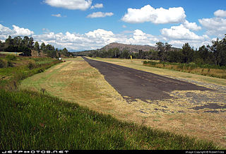
Palen Creek is a rural locality in the Scenic Rim Region, Queensland, Australia. It borders New South Wales. In the 2016 census, Palen Creek had a population of 280 people.

Oaky Creek is a rural locality in the Scenic Rim Region, Queensland, Australia.

Running Creek is a large rural locality in the Scenic Rim Region, Queensland, Australia. It borders New South Wales.

Knapp Creek is a locality in the Scenic Rim Region of South East Queensland, Australia. At the 2016 census, Knapp Creek had a population of 59.
Cannon Creek is a rural locality in the Scenic Rim Region, Queensland, Australia. In the 2016 census, Cannon Creek had a population of 78 people.
Chinghee Creek is a locality in the Scenic Rim Region, Queensland, Australia.
Burnett Creek is a locality in the Scenic Rim Region, Queensland, Australia. It borders New South Wales.
Frenches Creek is a locality in the Scenic Rim Region, Queensland, Australia.
Wallaces Creek is a locality in the Scenic Rim Region, Queensland, Australia.
