Boyland, Queensland

Last updated

Map all coordinates using: OpenStreetMap  
Download coordinates as: KML  ·  GPX
Boyland
Queensland
Paddocks at Boyland.jpg
View northwards from Boyland Road, 2014
Australia Queensland location map.svg
Red pog.svg
Boyland
Coordinates 27°56′20″S153°7′48″E / 27.93889°S 153.13000°E / -27.93889; 153.13000 Coordinates: 27°56′20″S153°7′48″E / 27.93889°S 153.13000°E / -27.93889; 153.13000
Population823 (2016 census) [1]
Postcode(s) 4275
LGA(s) Scenic Rim Region
State electorate(s) Scenic Rim
Federal Division(s) Wright
Localities around Boyland:
Mundoolun Tamborine Tamborine Mountain
Birnan Boyland Tamborine Mountain
Tabragalba Wonglepong Tamborine Mountain

Boyland is a locality in the Scenic Rim Region, Queensland, Australia. [2] At the 2016 Australian Census, the locality recorded a population of 823. [1]

Contents

Geography

Boyland's western extent is defined by the Albert River. In the east the slopes of Tamborine Mountain rise sharply to elevations greater than 500 m.

History

The area is named after the railway station which is in turn named after George Boyland, the chairman of Tamborine Shire Council from 1907 to 1908 and supporter of the Canungra branch railway. [2]

Boyland Post Office opened on 1 July 1927 (a receiving office had been open from 1915) and closed in 1945. [3]

Boyland railway station ( 27°56′38″S153°07′55″E / 27.9439°S 153.132°E / -27.9439; 153.132 (Boyland railway station) ) was on the Canungra railway line, which operated from 1915 to 1955. [4]

In 1948 a hall in the Canungra Church grounds was relocated to Bibbaddaba Street in Boyland (approx 27°56′34″S153°07′58″E / 27.9429°S 153.1329°E / -27.9429; 153.1329 (St Hilda's Anglican Church (former)) ) to hold Anglican services. The land was donated by Ronald Graham. [5] St Hilda's Anglican Church was dedicated on 3 May 1953 by Coadjutor Bishop Horace Henry Dixon. The lack of funds for necessary repairs resulted in the closure of the church with its last service being held on 5 March 1965. The building was relocated to Wonglepong where George Smith used it as a shed. The interior fittings and furnishings were donated to other churches with the chairs going to St George's Anglican Church on Tamborine Mountain, while the altar, cross and organ went to the proposed chapel at the Australian Army's Jungle Training Centre at Canugra. [5] [6]

Demographics

In the 2011 census, Boyland recorded a population of 715 people, 52.4% female and 47.6% male. [7] The median age of the Boyland population was 38 years, compared to the national median age of 37. 78.9% of people living in Boyland were born in Australia. The other top responses for country of birth were New Zealand 6.4%, England 5.6%, Guam 1%, Germany 0.8%, Netherlands 0.6%. 95.1% of people spoke only English at home; the next most common languages were 1.3% Italian, 0.6% German, 0.6% Czech. [7]

Related Research Articles

Beaudesert, Queensland Town in Queensland, Australia

Beaudesert is a rural town and locality in the Scenic Rim Region, Queensland, Australia. In the 2016 census, Beaudesert had a population of 6,395 people.

Bethania, Queensland Suburb of Logan City, Queensland, Australia

Bethania is a suburb of Logan City, Queensland, Australia.

Acacia Ridge, Queensland Suburb of Brisbane, Queensland, Australia

Acacia Ridge is a southern suburb in the City of Brisbane, Queensland, Australia. In the 2016 census, Acacia Ridge had a population of 7,429 people.

Pinkenba, Queensland Suburb of Brisbane, Queensland, Australia

Pinkenba is a coastal eastern suburb of the City of Brisbane, Queensland, Australia. In the 2016 census, Pinkenba had a population of 368 people.

Gaythorne, Queensland Suburb of Brisbane, Queensland, Australia

Gaythorne is a suburb in the City of Brisbane, Queensland, Australia. In the 2016 census, Gaythorne had a population of 3,023 people.

Hendra, Queensland Suburb of Brisbane, Queensland, Australia

Hendra is a suburb of the City of Brisbane, Queensland, Australia. In the 2016 census, Hendra had a population of 4,625 people.

Canungra, Queensland Town in Queensland, Australia

Canungra is a small rural town and locality in the Scenic Rim Region, Queensland, Australia. At the 2016 census, Canungra had a population of 1229.

Auchenflower, Queensland Suburb of Brisbane, Queensland, Australia

Auchenflower is an inner suburb of the City of Brisbane, Queensland, Australia.

Northgate, Queensland Suburb of Brisbane, Queensland, Australia

Northgate is a suburb in the City of Brisbane, Queensland, Australia. In the 2016 census, Northgate had a population of 4,568 people.

Lota, Queensland Suburb of Brisbane, Queensland, Australia

Lota is an eastern outer coastal suburb in the City of Brisbane, Queensland, Australia.

Hemmant, Queensland Suburb of Brisbane, Queensland, Australia

Hemmant is a suburb of the City of Brisbane, Queensland, Australia. In the 2016 census, Hemmant had a population of 2,385 people.

Beechmont, Queensland Suburb of Scenic Rim Region, Queensland, Australia

Beechmont is a rural town and locality in the Scenic Rim Region, Queensland, Australia. In the 2016 census, Beechmont had a population of 842 people.

Logan Village, Queensland Suburb of Logan City, Queensland, Australia

Logan Village is a town and locality within Logan City, Queensland, Australia.

Waterford, Queensland Suburb of Logan City, Queensland, Australia

Waterford is a suburb in Logan City, Queensland, Australia.

Canungra railway line

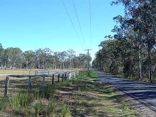
The Canungra railway line was a branch railway in South East Queensland, Australia. It connected Logan Village on the Beaudesert line and Canungra.

Wonglepong, Queensland Suburb of Scenic Rim Region, Queensland, Australia

Wonglepong is a rural locality in the Scenic Rim Region of Queensland, Australia.

Tamborine, Queensland Suburb of Logan City, Queensland, Australia

Tamborine is a town in the Scenic Rim Region and a locality split between the Scenic Rim Region and the City of Logan in Queensland, Australia. The neighbourhood of Plunkett is within the locality.

OReilly, Queensland Suburb of Scenic Rim Region, Queensland, Australia

O'Reilly is a rural locality in the Scenic Rim Region, Queensland, Australia. It borders New South Wales. In the 2016 census, O'Reilly had no population.

Hoya, Queensland Suburb of Scenic Rim Region, Queensland, Australia

Hoya is a locality in the Scenic Rim Region, Queensland, Australia. In the 2016 census, Hoya had a population of 220 people.

Benobble, Queensland Suburb of Scenic Rim Region, Queensland, Australia

Benobble is a locality in the Scenic Rim Region, Queensland, Australia.

References

  1. 1 2 Australian Bureau of Statistics (27 June 2017). "Boyland (State Suburb)". 2016 Census QuickStats. Retrieved 25 March 2018. OOjs UI icon edit-ltr-progressive.svg
  2. 1 2 "Boyland (entry 45117)". Queensland Place Names. Queensland Government . Retrieved 11 April 2014.
  3. Premier Postal History. "Post Office List". Premier Postal Auctions. Retrieved 10 May 2014.
  4. "Tamborine" (Map). Queensland Government. 1954. Archived from the original on 2 April 2020. Retrieved 4 July 2020.
  5. 1 2 Libke, Joyce (30 October 2019). "Our History - Buildings". Canungra Times . p. 30. Retrieved 4 July 2020.
  6. "Closed Anglican Churches". Anglican Church South Queensland. Archived from the original on 3 April 2019. Retrieved 29 June 2020.
  7. 1 2 Australian Bureau of Statistics (31 October 2012). "Boyland (State Suburb)". 2011 Census QuickStats. Retrieved 17 August 2014. OOjs UI icon edit-ltr-progressive.svg