Kooralbyn, Queensland

Last updated

Kooralbyn
Queensland
Frola 91369 1176816716 (5718691750).jpg
Kooralbyn Airstrip runway, 2011
Australia Queensland location map.svg
Red pog.svg
Kooralbyn
Coordinates 28°04′21″S152°49′15″E / 28.0725°S 152.8208°E / -28.0725; 152.8208 (Kooralbyn (centre of locality))
Population1,697 (2021 census) [1]
 • Density19.416/km2 (50.29/sq mi)
Established1830s
Postcode(s) 4285
Area87.4 km2 (33.7 sq mi)
Time zone AEST (UTC+10:00)
Location
LGA(s) Scenic Rim Region
State electorate(s) Scenic Rim
Federal division(s) Wright
Suburbs around Kooralbyn:
Allandale Bromelton Josephville
Cannon Creek Kooralbyn Laravale
Cannon Creek Knapp Creek Knapp Creek

Kooralbyn is a rural locality in the Scenic Rim Region, Queensland, Australia. [2] In the 2021 census, Kooralbyn had a population of 1,697 people. [1]

Contents

Geography

Kooralbyn is approximately 22 kilometres (14 mi) south-west of Beaudesert, itself some 64 kilometres (40 mi) south of Brisbane in South East Queensland, and 56 kilometres (35 mi) west of Queensland's Gold Coast.[ citation needed ]

Kooralbyn is commonly referred to as the Valley by its residents due to the former name Kooralbyn Valley.[ citation needed ]

History

Kooralbyn is a Yugambeh word meaning the place of the copperhead snake . [2]

First European settlement in the area can be traced back to the 1830s when southern timber millers sought the quality hardwoods of the lower valleys. It was not until Australia's first major land booms in the 1840s that free settler pastoralists migrated to the region. Kooralbyn subsequently became one of the region's most significant pastoral estates, the land used largely for cattle grazing.[ citation needed ]

Kooralbyn International School opened on 30 January 1985. [3]

Demographics

Kooralbyn has a population of 1725 at the 2016 census. [4] The locality contained 820 households, in which 49.9% of the population were male and 50.1% of the population were female with a median age of 46, 8 years above the national average. The average weekly household income was $844, $594 below the national average. 5.2% of Kooralbyn's population were either of Aborigional or Torres Strait Islander descent. 60.1% of the population aged 15 or over were either registered or de facto married, while 39.9% of the population were not married. 27.7% of the population were attending some form of a compulsory education. The most common nominated ancestries were English (32.5%), Australian (28.2%) and Irish (9.0%), while the most common country of birth was Australia (71.7%), and the most commonly spoken language at home was English (89.4%). The most common nominated religions were No religion (32.2%), Anglican (22.8%) and Catholic (16.2%). The most common occupation was a technician/trades worker (18.1%) and the majority/plurality of residents worked 40 or more hours per week (43.0%). [4]

In the 2021 census, Kooralbyn had a population of 1,697 people. [1]

Education

The Kooralbyn International School is a private primary and secondary (Prep-12) school for boys and girls at Ogilvie Place ( 28°05′38″S152°50′41″E / 28.0939°S 152.8447°E / -28.0939; 152.8447 (The Kooralbyn International School) ). [5] [6] In 2017, the school had an enrolment of 285 students with 24 teachers (21 full-time equivalent) and 24 non-teaching staff (16 full-time equivalent). [7]

There are no government schools in Kooralbyn. The nearest government primary schools are in Tamrookum and Boonah. The nearest government secondary schools are in Boonah and Beaudesert. [8]

Amenities

The locality has a shopping complex (with real estate, fuel, groceries and other conveniences), a hotel, an 18-hole golf course, polo fields, an airstrip, a light commercial area, mini golf, tennis, self-contained accommodation, the Kooralbyn International School, and other facilities.[ citation needed ]

The Scenic Rim Regional Council operates a mobile library service which visits Salisbury Avenue. [9]

Resort

In 1979, work began on a resort that featured a diverse range of recreational facilities. 55 hillside holiday houses were completed in 1982 and designed by Harry Seidler. [10] In 1991 a new hotel was added to the resort. In July 2008 the resort and golf course closed and went into liquidation. [11] In June 2014 Peter Huang, founder of the Yong Real Estate group, settled on the purchase of the Kooralbyn Resort. [12]

After a lengthy restoration costing over $7m, the newly-renamed Ramada Resort Kooralbyn Valley re-opened to visitors in June 2016. [13]

Related Research Articles

<span class="mw-page-title-main">Rathdowney, Queensland</span> Town in Queensland, Australia

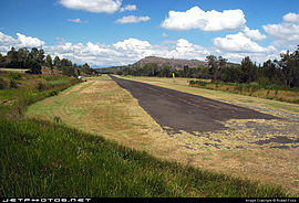
Rathdowney is a rural town and locality in the Scenic Rim Region, Queensland, Australia. In the 2016 census, Rathdowney had a population of 308 people.

<span class="mw-page-title-main">Scenic Rim Region</span> Local government area in Queensland, Australia

The Scenic Rim Region is a local government area in West Moreton region of South East Queensland, Australia. Established in 2008, it was preceded by several previous local government areas with histories extending back to the early 1900s and beyond. The main town of the region is Beaudesert.

<span class="mw-page-title-main">Rosevale, Queensland</span> Town in Queensland, Australia

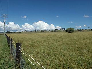
Rosevale is a rural locality in the Scenic Rim Region, Queensland, Australia. In the 2016 census, Rosevale had a population of 208 people.

<span class="mw-page-title-main">Warrill View, Queensland</span> Town in Queensland, Australia

Warrill View is a rural town and locality in the Scenic Rim Region, Queensland, Australia. In the 2021 census, the locality of Warrill View had a population of 203 people.

<span class="mw-page-title-main">Munbilla, Queensland</span> Town in Queensland, Australia

Munbilla is a rural town and locality in the Scenic Rim Region, Queensland, Australia. In the 2016 census, the locality of Munbilla had a population of 100 people.

<span class="mw-page-title-main">Barney View, Queensland</span> Suburb of Scenic Rim Region, Queensland, Australia

Barney View is a rural locality in the Scenic Rim Region, Queensland, Australia. In the 2021 census, Barney View had a population of 38 people.

<span class="mw-page-title-main">Hillview, Queensland</span> Town in Queensland, Australia

Hillview is a rural town and locality in the Scenic Rim Region, Queensland, Australia. In the 2016 census, the locality of Hillview had a population of 74 people.

<span class="mw-page-title-main">Josephville, Queensland</span> Town in Queensland, Australia

Josephville is a rural locality in the Scenic Rim Region, Queensland, Australia. In the 2016 census, Josephville had a population of 166 people.

<span class="mw-page-title-main">Palen Creek, Queensland</span> Suburb of Scenic Rim Region, Queensland, Australia

Palen Creek is a rural locality in the Scenic Rim Region, Queensland, Australia. It borders New South Wales. In the 2016 census, Palen Creek had a population of 280 people.

<span class="mw-page-title-main">Wyaralong, Queensland</span> Suburb of Scenic Rim Region, Queensland, Australia

Wyaralong is a rural locality in the Scenic Rim Region, Queensland, Australia. In the 2016 census, Wyaralong had a population of 20 people.

<span class="mw-page-title-main">Innisplain, Queensland</span> Suburb of Scenic Rim Region, Queensland, Australia

Innisplain is a rural locality in the Scenic Rim Region, Queensland, Australia. In the 2021 census, Innisplain had a population of 79 people.

<span class="mw-page-title-main">Lamington, Queensland</span> Suburb of Scenic Rim Region, Queensland, Australia

Lamington is a rural locality in the Scenic Rim Region, Queensland, Australia. In the 2021 census, Lamington had a population of 89 people.

<span class="mw-page-title-main">Coochin, Queensland</span> Suburb of Scenic Rim Region, Queensland, Australia

Coochin is a rural locality in the Scenic Rim Region, Queensland, Australia. In the 2021 census, Coochin had a population of 115 people.

<span class="mw-page-title-main">Coulson, Queensland</span> Suburb of Scenic Rim Region, Queensland, Australia

Coulson is a rural locality in the Scenic Rim Region, Queensland, Australia. In the 2021 census, Coulson had a population of 168 people.

Cannon Creek is a rural locality in the Scenic Rim Region, Queensland, Australia. In the 2021 census, Cannon Creek had a population of 75 people.

<span class="mw-page-title-main">Carneys Creek, Queensland</span> Rural locality in Queensland, Australia

Carneys Creek is a rural locality in the Scenic Rim Region, Queensland, Australia. It borders New South Wales. In the 2021 census, Carneys Creek had a population of 71 people.

<span class="mw-page-title-main">Fassifern Valley, Queensland</span> Suburb of Scenic Rim Region, Queensland, Australia

Fassifern Valley is a rural locality in the Scenic Rim Region, Queensland, Australia. In the 2021 census, Fassifern Valley had a population of 112 people.

Anthony is a rural locality in the Scenic Rim Region, Queensland, Australia. In the 2021 census, Anthony had a population of 133 people.

<span class="mw-page-title-main">Moorang, Queensland</span> Suburb of Scenic Rim Region, Queensland, Australia

Moorang is a rural locality in the Scenic Rim Region, Queensland, Australia. In the 2016 census, Moorang had a population of 46 people.

Burnett Creek is a rural locality in the Scenic Rim Region, Queensland, Australia. It borders New South Wales to the south. In the 2021 census, Burnett Creek had a population of 16 people.

References

  1. 1 2 3 Australian Bureau of Statistics (28 June 2022). "Kooralbyn (SAL)". 2021 Census QuickStats. Retrieved 28 February 2023. OOjs UI icon edit-ltr-progressive.svg
  2. 1 2 "Kooralbyn – locality in Scenic Rim Region (entry 45156)". Queensland Place Names. Queensland Government . Retrieved 17 November 2019.
  3. Queensland Family History Society (2010), Queensland schools past and present (Version 1.01 ed.), Queensland Family History Society, ISBN   978-1-921171-26-0
  4. 1 2 Australian Bureau of Statistics (27 June 2017). "Kooralbyn (SSC)". 2016 Census QuickStats. Retrieved 20 October 2018. OOjs UI icon edit-ltr-progressive.svg
  5. "State and non-state school details". Queensland Government. 9 July 2018. Archived from the original on 21 November 2018. Retrieved 21 November 2018.
  6. "The Kooralbyn International School". Archived from the original on 3 January 2019. Retrieved 21 November 2018.
  7. "ACARA School Profile 2017". Archived from the original on 22 November 2018. Retrieved 22 November 2018.
  8. "Queensland Globe". State of Queensland . Retrieved 19 November 2019.
  9. "Mobile Library" (PDF). Scenic Rim Regional Council . Archived from the original (PDF) on 30 January 2018. Retrieved 31 January 2018.
  10. "Hillside Housing". Kooralbyn, Queensland: Harry Seidler and Associates. Archived from the original on 13 October 2009. Retrieved 15 July 2009.
  11. "Kooralbyn resort and golf course go into liquidation". Courier Mail . Queensland Newspapers. 20 July 2008. Archived from the original on 21 May 2022. Retrieved 15 July 2009.
  12. "Kooralbyn Resort sale settles". Beaudesert Times . 5 June 2014. Archived from the original on 10 June 2014. Retrieved 12 June 2014.
  13. "Coast's Kooralbyn Resort reopens". Gold Coast Bulletin . 23 June 2016. Archived from the original on 22 December 2016. Retrieved 19 November 2019.