Kagaru, Queensland

Last updated

Kagaru
Queensland
Closed road bridge over Teviot Brook at Kagaru, Queensland.jpg
Teviot Brook crossing, 2016
Australia Queensland location map.svg
Red pog.svg
Kagaru
Coordinates 27°51′40″S152°54′39″E / 27.8612°S 152.9109°E / -27.8612; 152.9109 (Kagaru (centre of locality))
Population19 (2021 census) [1]
 • Density0.655/km2 (1.70/sq mi)
Established1997
Postcode(s) 4285
Area29.0 km2 (11.2 sq mi)
Time zone AEST (UTC+10:00)
Location
LGA(s)
State electorate(s)
Federal division(s) Wright
Suburbs around Kagaru:
Flinders Lakes Monarch Glen Flagstone
Riverbend
Undullah Kagaru Cedar Grove
Wyaralong Allenview Woodhill

Kagaru is a rural locality split between Scenic Rim Region and City of Logan, Queensland, Australia. [2] [3] In the 2021 census, Kagaru had a population of 19 people. [1]

Contents

Geography

Kagaru's eastern border is marked by the Sydney–Brisbane rail corridor, the Logan River and Teviot Brook. There is very little development in the area.

History

In the 1930s, a railway station in the area was named Kagaru, a Ugarapul word for the blue-winged kookaburra. On the 24 April 1997, the locality was formally bounded and took the name of the railway station. [4] Formerly in the Shire of Beaudesert, Kagaru became split between Logan City and Scenic Rim Region following the local government amalgamations in March 2008. [4] The railway station no longer exists. [4]

Demographics

In the 2016 census, Kagaru had a population of 13 people. The locality contains 6 households, in which 45.0% of the population are males and 55.0% of the population are females with a median age of 57, 19 years above the national average. The average weekly household income is $1,375, $63 below the national average. [5]

In the 2021 census, Kagaru had a population of 19 people. [1]

Related Research Articles

<span class="mw-page-title-main">Mount Barney, Queensland</span> Suburb of Scenic Rim Region, Queensland, Australia

Mount Barney is a rural locality in the Scenic Rim Region, Queensland, Australia. In the 2016 census, Mount Barney had a population of 22 people.

<span class="mw-page-title-main">Tamborine, Queensland</span> Suburb of Logan City, Queensland, Australia

Tamborine is a rural town in the Scenic Rim Region and a locality split between the Scenic Rim Region and the City of Logan in Queensland, Australia. In the 2016 census, the locality of Tamborine had a population of 3,950 people.

<span class="mw-page-title-main">Veresdale, Queensland</span> Suburb of Logan City, Queensland, Australia

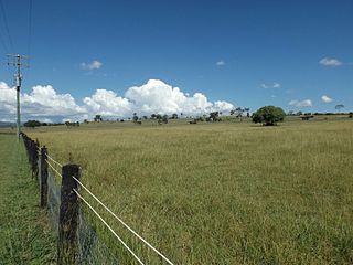
Veresdale is a locality split between the City of Logan and the Scenic Rim Region, Queensland, Australia. In the 2016 census, Veresdale had a population of 392 people.

<span class="mw-page-title-main">Allenview, Queensland</span> Suburb of Scenic Rim Region, Queensland, Australia

Allenview is a rural locality in the Scenic Rim Region, Queensland, Australia. In the 2021 census, Allenview had a population of 209 people.

<span class="mw-page-title-main">Birnam, Queensland (Scenic Rim Region)</span> Suburb of Logan City, Queensland, Australia

Birnam is a rural locality in the Scenic Rim Region, Queensland, Australia. In the 2021 census, Birnam had a population of 109 people.

<span class="mw-page-title-main">Kents Lagoon, Queensland</span> Suburb of Scenic Rim Region, Queensland, Australia

Kents Lagoon is a rural locality in the Scenic Rim Region, Queensland, Australia. In the 2021 census, Kents Lagoon had a population of 60 people.

<span class="mw-page-title-main">Innisplain, Queensland</span> Suburb of Scenic Rim Region, Queensland, Australia

Innisplain is a rural locality in the Scenic Rim Region, Queensland, Australia. In the 2021 census, Innisplain had a population of 79 people.

<span class="mw-page-title-main">Knapp Creek, Queensland</span> Suburb of Scenic Rim Region, Queensland, Australia

Knapp Creek is a rural locality in the Scenic Rim Region, Queensland, Australia. In the 2021 census, Knapp Creek had a population of 59 people.

<span class="mw-page-title-main">Lamington, Queensland</span> Suburb of Scenic Rim Region, Queensland, Australia

Lamington is a rural locality in the Scenic Rim Region, Queensland, Australia. In the 2021 census, Lamington had a population of 89 people.

<span class="mw-page-title-main">Gleneagle, Queensland</span> Suburb of Scenic Rim Region, Queensland, Australia

Gleneagle is a rural locality in the Scenic Rim Region, Queensland, Australia. In the 2021 census, Gleneagle had a population of 2,106 people.

<span class="mw-page-title-main">Coulson, Queensland</span> Suburb of Scenic Rim Region, Queensland, Australia

Coulson is a rural locality in the Scenic Rim Region, Queensland, Australia. In the 2021 census, Coulson had a population of 168 people.

<span class="mw-page-title-main">Allandale, Queensland</span> Suburb in Queensland, Australia

Allandale is a rural locality in the Scenic Rim Region, Queensland, Australia. In the 2016 census, Allandale had a population of 56 people.

<span class="mw-page-title-main">Hoya, Queensland</span> Suburb of Scenic Rim Region, Queensland, Australia

Hoya is a rural locality in the Scenic Rim Region, Queensland, Australia. In the 2021 census, Hoya had a population of 251 people.

<span class="mw-page-title-main">Clumber, Queensland</span> Suburb of Scenic Rim Region, Queensland, Australia

Clumber is a rural locality in the Scenic Rim Region, Queensland, Australia. In the 2021 census, Clumber had a population of 91 people.

<span class="mw-page-title-main">Mount Edwards, Queensland</span> Suburb of Scenic Rim Region, Queensland, Australia

Mount Edwards is a rural locality in the Scenic Rim Region, Queensland, Australia. In the 2016 census, Mount Edwards had a population of 63 people.

Anthony is a rural locality in the Scenic Rim Region, Queensland, Australia. In the 2021 census, Anthony had a population of 133 people.

Kulgun is a locality in the Scenic Rim Region, Queensland, Australia. In the 2021 census, Kulgun had a population of 104 people.

Benobble is a rural locality in the Scenic Rim Region, Queensland, Australia. In the 2021 census, Benobble had a population of 29 people.

Bunburra is a rural locality in the Scenic Rim Region, Queensland, Australia. In the 2021 census, Bunburra had a population of 93 people.

Kents Pocket is a rural locality in the Scenic Rim Region, Queensland, Australia. In the 2021 census, Kents Pocket had a population of 21 people.

References

  1. 1 2 3 Australian Bureau of Statistics (28 June 2022). "Kagaru (SAL)". 2021 Census QuickStats. Retrieved 28 February 2023. OOjs UI icon edit-ltr-progressive.svg
  2. "Kagaru – locality in the Scenic Rim Region (entry 45150)". Queensland Place Names. Queensland Government . Retrieved 28 September 2017.
  3. "Kagaru – locality in Logan City (entry 45302)". Queensland Place Names. Queensland Government . Retrieved 28 September 2017.
  4. 1 2 3 "Kagaru". Suburbs. Logan City Council . Retrieved 6 May 2014.
  5. Australian Bureau of Statistics (27 June 2017). "Kagaru (SSC)". 2016 Census QuickStats. Retrieved 20 October 2018. OOjs UI icon edit-ltr-progressive.svg