Cornubia, Queensland

Last updated

Cornubia
Logan City,  Queensland
Gavin Way Cornubia Queensland.jpg
Gavin Way, 2014
Australia Queensland location map.svg
Red pog.svg
Cornubia
Coordinates 27°39′36″S153°12′50″E / 27.6599°S 153.2138°E / -27.6599; 153.2138 (Cornubia (centre of suburb))
Population7,810 (2021 census) [1]
 • Density524.2/km2 (1,358/sq mi)
Postcode(s) 4130
Area14.9 km2 (5.8 sq mi)
Time zone AEST (UTC+10:00)
Location
LGA(s) Logan City
State electorate(s) Macalister
Federal division(s) Forde
Suburbs around Cornubia:
Mount Cotton Mount Cotton Mount Cotton
Shailer Park Cornubia Carbrook
Loganholme Eagleby Carbrook

Cornubia is a suburb in the City of Logan, Queensland, Australia. [2] In the 2021 census, Cornubia had a population of 7,810 people. [1]

Contents

Geography

Cornubia is situated 28 kilometres (17 mi) south-east of the Brisbane central business district. [3] Many street names reflect its lush bush setting (e.g. Sugarwood, Parkview).[ citation needed ] The Beenleigh–Redland Bay Road runs through the south of the locality from west to east. [4]

History

Cornubia was originally named Cornubia Park, getting its name from the property's owners in the 1920s, [5] during this time, it was a large farm, [3] with timber getting, dairying, crops of corn, oats and barley being the main activities carried out. [5] In September 1934, the land was purchased by the Jessens, and they changed the name of the property to Cornubia. [5] The land was sold again in 1956 and was subdivided into smaller lots. [5] By the early 1980's residential development was apparent. [3]

Cornubia was named as a bounded locality by Queensland Place Names Board on 1 May 1975. [2] Cornubia is the Latin name for Cornwall.[ citation needed ]

St Matthew's Catholic Primary School opened on 23 January 1984 [3] with 57 students in Years 1 through 3 with the support of the Sisters of St Joseph of the Sacred Heart in the tradition of Mary McKillop. [6] [7]

Chisholm Catholic College opened in 1992. [8] [3]

Demographics

In the 2011 census, Cornubia had a population of 6,833 people, 49.9% female and 50.1% male. The median age of the Cornubia population was 37 years, the same as the national median. 70.2% of people living in Cornubia were born in Australia. The other top responses for country of birth were England 7%, New Zealand 6.4%, Scotland 1.7%, South Africa 1.5%, Germany 0.7%. 88.9% of people spoke only English at home; the next most common languages were 0.7% Mandarin, 0.6% Afrikaans, 0.5% German, 0.4% Dutch, 0.4% Greek. [9]

In the 2016 census, Cornubia had a population of 7,317 people, 51% female and 49% male. The median age of the Cornubia population was 38 years, on par with the national median of 38. 71.5% of people living in Cornubia were born in Australia. The other top responses for country of birth were England 6.4%, New Zealand 5.7%, South Africa 1.5%, Scotland 1.0%, and Philippines 0.6%. 87.3% of people spoke only English at home, the next most common languages were 0.7% Mandarin, 0.5% Greek, 0.5% Afrikaans, 0.4% German, and 0.4% Spanish. [10]

In the 2021 census, Cornubia recorded a population of 7,810 people, 50.3% female and 49.7% male. The median age of the Cornubia population was 40 years, 2 years above the national median of 38. 73.2% of people living in Cornubia were born in Australia. The other top responses for country of birth were England 6.3%, New Zealand 5.1%, South Africa 1.5%, Scotland 1.0% and India 0.8%. 88.6% of people spoke only English at home, the next most common languages were 0.9% Mandarin, 0.4% Punjabi, 0.4% Afrikaans, 0.4% Spanish, and 0.3% German. [11] In the 2021 census, Cornubia had a population of 7,810 people. [1]

Education

St Matthew's School is a Catholic primary (Prep-6) school for boys and girls at 172-180 Bryants Road ( 27°40′02″S153°11′21″E / 27.6671°S 153.1891°E / -27.6671; 153.1891 (St Matthew's School) ). [12] [13] In 2017, the school had an enrolment of 552 students with 37 teachers (32 full-time equivalent) and 28 non-teaching staff (17 full-time equivalent). [14]

Chisholm Catholic College is a Catholic secondary (7-12) school for boys and girls at 204 California Creek Road ( 27°39′59″S153°12′16″E / 27.6663°S 153.2045°E / -27.6663; 153.2045 (Chisholm Catholic College) ). [12] [15] In 2017, the school had an enrolment of 937 students with 72 teachers (69 full-time equivalent) and 45 non-teaching staff (34 full-time equivalent). [14]

Fauna

Cornubia is part of the Koala Coast and is home to hundreds of Australian native animals including koalas, wallabies, goannas and various species of birds (e.g. rainbow lorikeet).[ citation needed ]

Cornubia Forest Nature Refuge

Walking and biking track in the Cornubia Forest Nature Refuge Cornubia Forest Nature Refuge, Logan City, Queensland, track.JPG
Walking and biking track in the Cornubia Forest Nature Refuge

A protected nature conservation area was created by the local government council from land purchased between 1999 and 2010. Located in the north-west of the suburb, the 196-hectare (480-acre) nature refuge consists of the former Cornubia Forest Park to the south and land known as the Cornubia Escarpment in the north. It is managed as part of Australia’s National Reserve System with objectives that include both conservation of flora and fauna, and recreation such as bushwalking and mountain bike riding. The refuge is also managed under a Koala Nature Refuge Agreement with the state government. The tall open forest ecosystem of blackbutt ( Eucalyptus pilularis ) and the brown thornbill ( Acanthiza pusilla ) in the area are described as endangered. [16]

Transport

Over 70% of employed people travel by car as most residents work in Brisbane City or at the Gold Coast. Efficient and cost-effective public transport is available in the area and is provided by the Logan City Bus Service, a privately owned company.[ citation needed ]

Related Research Articles

<span class="mw-page-title-main">Bethania, Queensland</span> Suburb of Logan City, Queensland, Australia

Bethania is a suburb in the City of Logan, Queensland, Australia. In the 2021 census, Bethania had a population of 6,333 people.

<span class="mw-page-title-main">Mount Cotton, Queensland</span> Locale in Queensland, Australia

Mount Cotton is a rural locality in the City of Redland, Queensland, Australia. In the 2021 census, Mount Cotton had a population of 7,302 people.

<span class="mw-page-title-main">Woodridge, Queensland</span> Town in Queensland, Australia

Woodridge is a town and suburb in the City of Logan, Queensland, Australia. In the 2021 census, the suburb of Woodridge had a population of 12,982 people.

<span class="mw-page-title-main">Browns Plains, Queensland</span> Suburb of Logan City, Queensland, Australia

Browns Plains is a suburb in the City of Logan, Queensland, Australia. In the 2021 census, Browns Plains had a population of 6,632 people.

<span class="mw-page-title-main">Berrinba, Queensland</span> Suburb of Logan City, Queensland, Australia

Berrinba is a suburb in Logan City, Queensland, Australia. In the 2021 census, Berrinba had a population of 2,615 people.

<span class="mw-page-title-main">Boronia Heights, Queensland</span> Suburb of Logan City, Queensland, Australia

Boronia Heights is a suburb in the City of Logan, Queensland, Australia. In the 2021 census, Boronia Heights had a population of 8,175 people.

<span class="mw-page-title-main">Daisy Hill, Queensland</span> Suburb of Logan City, Queensland, Australia

Daisy Hill is a suburb in the City of Logan, Queensland, Australia. In the 2021 census, Daisy Hill had a population of 6,925 people.
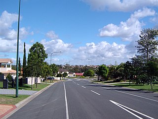
<span class="mw-page-title-main">Heritage Park, Queensland</span> Suburb of Logan City, Queensland, Australia

Heritage Park is a suburb in the City of Logan, Queensland, Australia. In the 2021 census, Heritage Park had a population of 4,930 people.

<span class="mw-page-title-main">Logan Reserve, Queensland</span> Suburb of Logan City, Queensland, Australia

Logan Reserve is a rural residential suburb in the City of Logan, Queensland, Australia. In the 2021 census, Logan Reserve had a population of 7,016 people.

<span class="mw-page-title-main">Loganholme, Queensland</span> Suburb of Logan City, Queensland, Australia

Loganholme is a suburb in the City of Logan, Queensland, Australia. In the 2016 census, Loganholme had a population of 6,303 people.

<span class="mw-page-title-main">Regents Park, Queensland</span> Suburb of Logan City, Queensland, Australia

Regents Park is a suburb in the City of Logan, Queensland, Australia. In the 2021 census, Regents Park had a population of 11,103 people.

<span class="mw-page-title-main">Shailer Park, Queensland</span> Suburb of City of Logan, Queensland, Australia

Shailer Park is a suburb in the City of Logan, Queensland, Australia. In the 2021 census, Shailer Park had a population of 12,182 people.

<span class="mw-page-title-main">Tanah Merah, Queensland</span> Suburb of Logan City, Queensland, Australia

Tanah Merah is a residential suburb in the City of Logan, Queensland, Australia. It was officially named by the Queensland Place Names Board in 1971. In the 2021 census, Tanah Merah had a population of 4,754 people.

<span class="mw-page-title-main">Waterford West, Queensland</span> Suburb of Logan City, Queensland, Australia

Waterford West is a suburb in the City of Logan, Queensland, Australia. In the 2021 census, Waterford West had a population of 6,942 people.
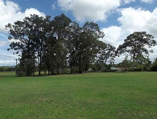
<span class="mw-page-title-main">Eagleby, Queensland</span> Suburb of Logan City, Queensland, Australia

Eagleby is a suburb in the City of Logan, Queensland, Australia. In the 2021 census, Eagleby had a population of 13,594 people.

<span class="mw-page-title-main">Sheldon, Queensland</span> Suburb of Redland City, Queensland, Australia

Sheldon is a rural residential locality in the City of Redland, Queensland, Australia. In the 2021 census, Sheldon had a population of 1,762 people.
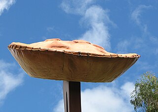
<span class="mw-page-title-main">Yatala, Queensland</span> Suburb of Gold Coast City, Queensland, Australia

Yatala is a suburb in the City of Gold Coast, Queensland, Australia. In the 2021 census, Yatala had a population of 1,405 people.

<span class="mw-page-title-main">Bahrs Scrub, Queensland</span> Suburb of Logan City, Queensland, Australia

Bahrs Scrub is an urban locality in the City of Logan, Queensland, Australia. In the 2021 census, Bahrs Scrub had a population of 4,508 people.

<span class="mw-page-title-main">Windaroo, Queensland</span> Suburb of Logan City, Queensland, Australia

Windaroo is a residential suburb in the outer southern areas of the City of Logan, Queensland, Australia. In the 2021 census, Windaroo had a population of 2,771 people.

<span class="mw-page-title-main">Waterford, Queensland</span> Town in Queensland, Australia

Waterford is a town and suburb in the City of Logan, Queensland, Australia. In the 2021 census, the suburb of Waterford had a population of 5,796 people.

References

  1. 1 2 3 Australian Bureau of Statistics (28 June 2022). "Cornubia (SAL)". 2021 Census QuickStats. Retrieved 28 February 2023. OOjs UI icon edit-ltr-progressive.svg
  2. 1 2 "Cornubia – suburb in City of Logan (entry 45260)". Queensland Place Names. Queensland Government . Retrieved 26 January 2020.
  3. 1 2 3 4 5 "Cornubia | Queensland Places". queenslandplaces.com.au. Archived from the original on 30 November 2023. Retrieved 5 May 2024.
  4. Google (13 August 2022). "Cornubia, Queensland" (Map). Google Maps . Google. Retrieved 13 August 2022.
  5. 1 2 3 4 Council, Logan City. "Cornubia". Logan City Council. Retrieved 5 May 2024.
  6. "Opening and closing dates of Queensland Schools". Queensland Government . Retrieved 5 March 2020.
  7. "School History". St Matthew's Catholic Primary School. Archived from the original on 1 March 2020. Retrieved 5 March 2020.
  8. Queensland Family History Society (2010), Queensland schools past and present (Version 1.01 ed.), Queensland Family History Society, ISBN   978-1-921171-26-0
  9. Australian Bureau of Statistics (31 October 2012). "Cornubia (State Suburb)". 2011 Census QuickStats. Retrieved 16 February 2014. OOjs UI icon edit-ltr-progressive.svg
  10. Australian Bureau of Statistics (27 June 2017). "Cornubia (SSC)". 2016 Census QuickStats. Retrieved 20 October 2018. OOjs UI icon edit-ltr-progressive.svg
  11. "2021 Cornubia, Census All persons QuickStats | Australian Bureau of Statistics". www.abs.gov.au. Retrieved 5 May 2024.
  12. 1 2 "State and non-state school details". Queensland Government. 9 July 2018. Archived from the original on 21 November 2018. Retrieved 21 November 2018.
  13. "St Matthew's School". Archived from the original on 27 February 2015. Retrieved 21 November 2018.
  14. 1 2 "ACARA School Profile 2017". Archived from the original on 22 November 2018. Retrieved 22 November 2018.
  15. "Chisholm Catholic College". Archived from the original on 27 February 2015. Retrieved 21 November 2018.
  16. Cornubia Forest Management Plan 2011-2021 (PDF), Logan City Council - Community Planning, 2011, archived from the original (PDF) on 25 March 2012, retrieved 4 June 2014