Slacks Creek, Queensland

Last updated

Slacks Creek
Logan City,  Queensland
Old St Mark's Anglican Church, Daisy Hill, Queensland, 2010.jpg
St Mark's Anglican Church, 2010
Australia Queensland location map.svg
Red pog.svg
Slacks Creek
Coordinates 27°38′40″S153°08′05″E / 27.6444°S 153.1347°E / -27.6444; 153.1347 (Slacks Creek (centre of suburb))
Population10,408 (2021 census) [1]
 • Density1,210/km2 (3,134/sq mi)
Established1971 [2]
Postcode(s) 4127
Elevation20 m (66 ft)
Area8.6 km2 (3.3 sq mi)
Time zone AEST (UTC+10:00)
Location
LGA(s) Logan City
State electorate(s) Waterford
Federal division(s) Rankin
Suburbs around Slacks Creek:
Underwood Springwood Springwood
Woodridge
Logan Central
Slacks Creek Daisy Hill
Kingston Meadowbrook Shailer Park
Tanah Merah

Slacks Creek is a suburb in the City of Logan, Queensland, Australia. [2] In the 2021 census, Slacks Creek had a population of 10,408 people. [1]

Contents

Geography

The Pacific Motorway forms most of the eastern boundary of the suburb.

The creek that gave its name to the district is part of the Logan River catchment and was named after the Slack family who had a cattle run there before the days of closer settlement. The Aboriginal name for it was Mungaree, place of fishes, which is the name they gave to their property. In September 2006 Queensland's first IKEA store moved from its original home in the nearby suburb Rochedale South to its new location in Slacks Creek. [3]

History

Like a number of other Logan City suburbs Slacks Creek was once part of the Shire of Tingalpa. [4] It was first officially named by Queensland Place Names Board on 1 April 1971. It was bounded as a locality by on 31 March 1979 and redesignated as a suburb on 31 August 1991. [2]

Slacks Creek Provisional School opened on 19 May 1873 in the original Wesleyan Church located in Centenary Road. In July 1879 it relocated to a new site on Loganlea Road. Due to flooding at that site, it was moved in 1893 to Logan Road near the intersection with Daisy Hill Road. On 1 January 1909 it became Slacks Creek State School. [5] In 1964, due to the increasingly heavy traffic on Logan Road, the school was relocated to its current site. On 14 October 2016 it was renamed Daisy Hill State School as changes to the suburban boundaries had resulted in the school falling within the neighbouring suburb of Daisy Hill. [6] [7] [8]

Mabel Park State School opened on 29 January 1974. [5] On 23 January 1978, a separate Mabel Park State Infants School was split off from the main school. The infants school closed on 12 December 1997 and was reintegrated with the main school. [9] [10]

Demographics

In the 2011 census, Slacks Creek recorded a population of 10,435 people, 50.7% female and 49.3% male. The median age of the Slacks Creek population was 32 years, 5 years below the national median of 37. 62.9% of people living in Slacks Creek were born in Australia. The other top responses for country of birth were New Zealand 9.9%, England 3.3%, Samoa 1.5%, Philippines 0.9%, Fiji 0.8%. 75.9% of people spoke only English at home; the next most common languages were 3% Samoan, 1% Hindi, 0.6% Khmer, 0.6% Arabic, 0.6% Romanian. [11]

In the 2016 census, Slacks Creek had a population of 10,432 people. [12]

In the 2021 census, Slacks Creek had a population of 10,408 people. [1]

Education

Mabel Park State School is a government primary (Prep-6) school for boys and girls at Borman Street ( 27°38′35″S153°07′35″E / 27.6431°S 153.1264°E / -27.6431; 153.1264 (Mabel Park State School) ). [13] [14] In 2018, the school had an enrolment of 730 students with 54 teachers (53 full-time equivalent) and 41 non-teaching staff (29 full-time equivalent). [15] It includes a special education program. [13] [16]

Mabel Park State High School is a government secondary (7-12) school for boys and girls at 72-116 Paradise Road ( 27°38′23″S153°07′44″E / 27.6396°S 153.1288°E / -27.6396; 153.1288 (Mabel Park State High School) ). [13] [17] In 2018, the school had an enrolment of 906 students with 88 teachers (82 full-time equivalent) and 47 non-teaching staff (35 full-time equivalent). [15] It includes a special education program. [13]

Notable residents

Related Research Articles

<span class="mw-page-title-main">Tingalpa, Queensland</span> Suburb of Brisbane, Queensland, Australia

Tingalpa is a suburb in the City of Brisbane, Queensland, Australia. In the 2021 census, Tingalpa had a population of 8,461 people.

<span class="mw-page-title-main">Kuraby, Queensland</span> Suburb of Brisbane, Queensland, Australia

Kuraby is an outer southern suburb in the City of Brisbane, Queensland, Australia. In the 2016 census, Kuraby had a population of 8,108 people.

<span class="mw-page-title-main">Greenslopes, Queensland</span> Suburb of Brisbane, Queensland, Australia

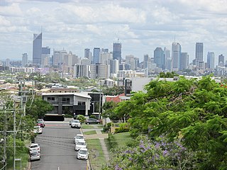
Greenslopes is a southern suburb in the City of Brisbane, Queensland, Australia. It is 6.0 kilometres (3.7 mi) by road south of the Brisbane GPO. In the 2021 census, Greenslopes had a population of 7,941 people.

<span class="mw-page-title-main">Woodridge, Queensland</span> Town in Queensland, Australia

Woodridge is a town and suburb in the City of Logan, Queensland, Australia. In the 2021 census, the suburb of Woodridge had a population of 12,982 people.

<span class="mw-page-title-main">Browns Plains, Queensland</span> Suburb of Logan City, Queensland, Australia

Browns Plains is a suburb in the City of Logan, Queensland, Australia. In the 2021 census, Browns Plains had a population of 6,632 people.

<span class="mw-page-title-main">Berrinba, Queensland</span> Suburb of Logan City, Queensland, Australia

Berrinba is a suburb in Logan City, Queensland, Australia. In the 2021 census, Berrinba had a population of 2,615 people.

<span class="mw-page-title-main">Daisy Hill, Queensland</span> Suburb of Logan City, Queensland, Australia

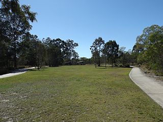
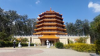
Daisy Hill is a suburb in the City of Logan, Queensland, Australia. In the 2021 census, Daisy Hill had a population of 6,925 people.

<span class="mw-page-title-main">Kingston, Queensland</span> Town in Queensland, Australia

Kingston is a town and suburb in the City of Logan, Queensland, Australia. In the 2021 census, the suburb of Kingston had a population of 10,506 people.

<span class="mw-page-title-main">Loganlea, Queensland</span> Suburb of Logan City, Queensland, Australia

Loganlea is a suburb in the City of Logan, Queensland, Australia. In the 2021 census, Loganlea had a population of 8,716 people.

<span class="mw-page-title-main">Marsden, Queensland</span> Suburb of Logan City, Queensland, Australia

Marsden is a suburb in the City of Logan, Queensland, Australia. In the 2021 census, Marsden had a population of 14,795 people.

<span class="mw-page-title-main">Meadowbrook, Queensland</span> Suburb of Logan City, Queensland, Australia

Meadowbrook is a mixed-use suburb in the City of Logan, Queensland, Australia. The Logan Hospital and a TAFE college are located in the suburb. In the 2021 census, Meadowbrook had a population of 3,069 people.

<span class="mw-page-title-main">Priestdale, Queensland</span> Suburb of Logan City, Queensland, Australia

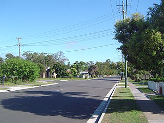
Priestdale is a suburb in the north-west of the City of Logan, Queensland, Australia. In the 2021 census, Priestdale had a population of 160 people.

<span class="mw-page-title-main">Shailer Park, Queensland</span> Suburb of City of Logan, Queensland, Australia

Shailer Park is a suburb in the City of Logan, Queensland, Australia. In the 2021 census, Shailer Park had a population of 12,182 people.

<span class="mw-page-title-main">Springwood, Queensland</span> Suburb of Logan City, Queensland, Australia

Springwood is a suburb in the City of Logan, Queensland, Australia. In the 2021 census, Springwood had a population of 9,710 people.

<span class="mw-page-title-main">Tanah Merah, Queensland</span> Suburb of Logan City, Queensland, Australia

Tanah Merah is a residential suburb in the City of Logan, Queensland, Australia. It was officially named by the Queensland Place Names Board in 1971. In the 2021 census, Tanah Merah had a population of 4,754 people.

<span class="mw-page-title-main">Holland Park West, Queensland</span> Suburb of Brisbane, Queensland, Australia

Holland Park West is a suburb in the City of Brisbane, Queensland, Australia. In the 2021 census, Holland Park West had a population of 6,468 people.

Mountain Creek is a suburb in the Sunshine Coast Region, Queensland, Australia. In the 2021 census, Mountain Creek had a population of 11,950 people.

Kuluin is a suburb of Maroochydore in the Sunshine Coast Region, Queensland, Australia. In the 2021 census, Kuluin had a population of 2,700 people.

<span class="mw-page-title-main">Mount Warren Park, Queensland</span> Suburb of Logan City, Queensland, Australia

Mount Warren Park is a residential suburb in the outer eastern area of the City of Logan, Queensland, Australia. The mountain of Mount Warren is within the suburb.

<span class="mw-page-title-main">Waterford, Queensland</span> Town in Queensland, Australia

Waterford is a town and suburb in the City of Logan, Queensland, Australia. In the 2021 census, the suburb of Waterford had a population of 5,796 people.

References

  1. 1 2 3 Australian Bureau of Statistics (28 June 2022). "Slacks Creek (SAL)". 2021 Census QuickStats. Retrieved 28 February 2023. OOjs UI icon edit-ltr-progressive.svg
  2. 1 2 3 "Slacks Creek – suburb in City of Logan (entry 45288)". Queensland Place Names. Queensland Government . Retrieved 8 July 2020.
  3. "IKEA moves to Slacks Creek". Archived from the original on 12 December 2008. Retrieved 8 December 2008.
  4. Mary Howells. "Mount Cotton - a brief history" (PDF). Redland City Council. Archived from the original (PDF) on 29 March 2011. Retrieved 26 June 2014.
  5. 1 2 Queensland Family History Society (2010), Queensland schools past and present (Version 1.01 ed.), Queensland Family History Society, ISBN   978-1-921171-26-0
  6. "Register of Recent School Openings, Closures and Name Changes". Queensland Government. Archived from the original on 20 July 2020. Retrieved 21 July 2020.
  7. Orr, Sarah (23 November 2016). "Name change to boost enrolments". The Courier-Mail . Archived from the original on 1 May 2022. Retrieved 20 July 2020.
  8. "History". Daisy Hill State School. 28 April 2020. Archived from the original on 20 July 2020. Retrieved 20 July 2020.
  9. Queensland Family History Society (2010), Queensland schools past and present (Version 1.01 ed.), Queensland Family History Society, ISBN   978-1-921171-26-0
  10. "Queensland state school - centre closures" (PDF). Queensland Government . 20 August 2013. Archived (PDF) from the original on 20 March 2022. Retrieved 7 April 2022.
  11. Australian Bureau of Statistics (31 October 2012). "Slacks Creek, Queensland (State Suburb)". 2011 Census QuickStats. Retrieved 12 December 2013. OOjs UI icon edit-ltr-progressive.svg
  12. Australian Bureau of Statistics (27 June 2017). "Slacks Creek (SSC)". 2016 Census QuickStats. Retrieved 20 October 2018. OOjs UI icon edit-ltr-progressive.svg
  13. 1 2 3 4 "State and non-state school details". Queensland Government. 9 July 2018. Archived from the original on 21 November 2018. Retrieved 21 November 2018.
  14. "Mabel Park State School". Archived from the original on 27 July 2012. Retrieved 21 November 2018.
  15. 1 2 "ACARA School Profile 2018". Australian Curriculum, Assessment and Reporting Authority. Archived from the original on 27 August 2020. Retrieved 28 January 2020.
  16. "Mabel Park SS - Special Education Program". Archived from the original on 27 July 2012. Retrieved 21 November 2018.
  17. "Mabel Park State High School". Archived from the original on 19 March 2020. Retrieved 21 November 2018.