Flinders Lakes, Queensland

Last updated

Flinders Lakes
Logan City,  Queensland
Wyatt Road Flinders Lakes 2023.jpg
Wyatt Road, 2023
Australia Queensland location map.svg
Red pog.svg
Flinders Lakes
Coordinates 27°49′45″S152°53′20″E / 27.8291°S 152.8888°E / -27.8291; 152.8888 (Flinders Lakes (centre of locality))
Postcode(s) 4285 [1]
Area11.9 km2 (4.6 sq mi)
Time zone AEST (UTC+10:00)
Location
LGA(s) Logan City
State electorate(s) Jordan
Federal division(s) Wright
Suburbs around Flinders Lakes:
Undullah Undullah Undullah
Undullah Flinders Lakes Monarch Glen
Undullah Kagaru Kagaru

Flinders Lakes is a rural locality in the City of Logan, Queensland, Australia. [2] It is situated along the development corridor south of Brisbane in the Greater Flagstone development area and is one of four new suburbs that have been created in Logan to house a predicted population boom between Brisbane and the Gold Coast. [3]

Contents

Geography

Flinders Lakes is located at the most southerly point of the City of Logan. [4]

History

Flinders Lakes is situated in the Bundjalung traditional Indigenous Australian country. [5] [6] The origin of the locality name is based upon the views of nearby Flinders Peak. [4] It was designated as a locality within Logan City by the Department of Natural Resources and Mines on 20 May 2016. [2] [4] The redistribution of the state’s electoral boundaries in 2017 led to the suburb being part of the Jordan electoral district. [7]

Future plans

Planned development in Flinders Lakes includes a mixed-use zoned central area, residential, parks and recreation, and knowledge-based industries and services focusing on health, education, tourism and agriculture. [8]

Planned transportation projects that would service Flinders Lakes and the Greater Flagstone development areas include passenger railway links between Salisbury and Beaudesert. [9]

Education

There are no schools in Flinders Lake. The nearest government primary schools are Flagstone State School in Flagstone to the east and Ripley Valley State School in South Ripley to the north-west. The nearest government secondary schools are Flagstone State Community College in Flagstone and Ripley Valley State Secondary College in South Ripley. [10]

Related Research Articles

<span class="mw-page-title-main">Jimboomba</span> Town in Queensland, Australia

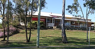
Jimboomba is a town and locality in the City of Logan, Queensland, Australia. In the 2016 census, the locality of Jimboomba had a population of 13,201 people.

<span class="mw-page-title-main">Logan City</span> City in Queensland, Australia

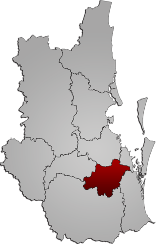
The Logan City is a local government area situated within the south of the Brisbane in South East Queensland, Australia. Situated between the City of Brisbane to the north and the City of Gold Coast to the south, the City also borders the Scenic Rim Region, the City of Ipswich, and Redland City LGAs. Logan City is divided into 70 suburbs and 12 divisions; a councillor is elected to each of the latter. The council had a population of 326,615 in June 2018.

<span class="mw-page-title-main">Underwood, Queensland</span> Suburb of Logan City, Queensland, Australia

Underwood is a suburb in the City of Logan, Queensland, Australia. In the 2021 census, Underwood had a population of 6,801 people.

<span class="mw-page-title-main">Munruben, Queensland</span> Suburb of Logan City, Queensland, Australia

Munruben is a rural locality in the City of Logan, Queensland, Australia. Once a rural community, it has been developed into a low density residential community. In the 2021 census, Munruben had a population of 2,753 people.

<span class="mw-page-title-main">Yarrabilba</span> Suburb of Logan City, Queensland, Australia

Yarrabilba is a locality in the City of Logan, Queensland, Australia. In the 2021 census, Yarrabilba had a population of 10,240 people.

<span class="mw-page-title-main">Greater Flagstone</span>

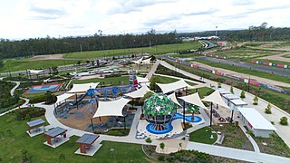
Greater Flagstone is a district and development area located within the Logan City local government area in south-east Queensland, Australia. Greater Flagstone is situated along the Sydney–Brisbane rail corridor between two future employment precincts at North Maclean and Bromelton. Greater Flagstone is expected to provide approximately 50,000 dwellings to house a population of up to 120,000 people with a development plan expected to take 30-40 years. The suburb of Flagstone was gazetted in 1997 and district suburbs were gazetted from 2016.

<span class="mw-page-title-main">New Beith, Queensland</span> Suburb of Logan City, Queensland, Australia

New Beith is a rural residential locality in the City of Logan, Queensland, Australia. In the 2021 census, New Beith had a population of 5,642 people.

<span class="mw-page-title-main">North Maclean, Queensland</span> Suburb of City of Logan, Queensland, Australia

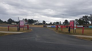
North Maclean is a locality in the City of Logan, Queensland, Australia. In the 2021 census, North Maclean had a population of 1,581 people.

<span class="mw-page-title-main">Cedar Grove, Queensland</span> Suburb of Logan City, Queensland, Australia

Cedar Grove is a mixed-use locality in the City of Logan, Queensland, Australia. In the 2021 census, Cedar Grove had a population of 1,992 people.

<span class="mw-page-title-main">Cedar Vale, Queensland</span> Suburb of Logan City, Queensland, Australia

Cedar Vale is a rural locality in the City of Logan, Queensland, Australia. In the 2021 census, Cedar Vale had a population of 2,856 people.

<span class="mw-page-title-main">Kagaru, Queensland</span> Suburb of Scenic Rim Region, Queensland, Australia

Kagaru is a rural locality split between Scenic Rim Region and City of Logan, Queensland, Australia. In the 2021 census, Kagaru had a population of 19 people.

<span class="mw-page-title-main">Undullah, Queensland</span> Suburb of City of Logan, Queensland, Australia

Undullah is a rural locality split between the City of Logan and the Scenic Rim Region, Queensland, Australia. In the 2021 census, Undullah had a population of 24 people.

<span class="mw-page-title-main">Allenview, Queensland</span> Suburb of Scenic Rim Region, Queensland, Australia

Allenview is a rural locality in the Scenic Rim Region, Queensland, Australia. In the 2021 census, Allenview had a population of 209 people.

<span class="mw-page-title-main">Flagstone, Queensland</span> Suburb of Logan City, Queensland, Australia

Flagstone is a suburban locality in the Greater Flagstone district of the City of Logan, Queensland, Australia. In the 2021 census, Flagstone had a population of 7,087 people.

<span class="mw-page-title-main">Monarch Glen, Queensland</span> Suburb of Logan City, Queensland, Australia

Monarch Glen is a rural locality in the City of Logan, Queensland, Australia. It is situated along the development corridor south of Brisbane in the Greater Flagstone development area and is one of four new suburbs that have been created in Logan to house a predicted population boom between Brisbane and the Gold Coast. In the 2021 census, Monarch Glen had "no people or a very low population".

<span class="mw-page-title-main">Riverbend, Queensland</span> Suburb of Logan City, Queensland, Australia

Riverbend is a rural locality in the City of Logan, Queensland, Australia. Designated as a separate locality in 2017, it will be progressively developed for residential use as the population of the city grows. In the 2021 census, Riverbend had a population of 661 people.

<span class="mw-page-title-main">Glenlogan, Queensland</span> Suburb of Logan City, Queensland, Australia

Glenlogan is a rural locality in the City of Logan, Queensland, Australia. It is part of the suburban development corridor south of Brisbane in the Greater Flagstone development area. In the 2021 census, Glenlogan had a population of 1,122 people.

Silverbark Ridge is a rural locality in the City of Logan, Queensland, Australia. It is situated along the development corridor south of Brisbane in the Greater Flagstone development area and is one of four new suburbs in Logan to house a predicted population boom between Brisbane and the Gold Coast. In the 2021 census, Silverbark Ridge had "no people or a very low population".

Beaudesert–Beenleigh Road is a continuous 35.5 kilometres (22.1 mi) road route in the Scenic Rim and Logan City regions of Queensland, Australia. Part of the road is signed as State Route 90 and the rest as State Route 92. Beaudesert–Beenleigh Road is a state-controlled road, part district and part regional.

References

  1. "Flinders Lakes Postcode". Archived from the original on 28 July 2019. Retrieved 15 November 2019.
  2. 1 2 "Flinders Lakes – locality in City of Logan (entry 49725)". Queensland Place Names. Queensland Government . Retrieved 5 November 2019.
  3. "Four new Logan suburbs as population booms". ABC News. 24 May 2016. Retrieved 12 May 2024.
  4. 1 2 3 "Flinders Lakes". Logan City Council. Retrieved 12 August 2022.
  5. "Bundjalung – Muurrbay Aboriginal Language and Culture Co-operative". muurrbay.org.au. Retrieved 19 December 2020.
  6. "AIATSIS code E66: Yugarabul". Federal government. Australian Institute of Aboriginal and Torres Strait Islander Studies. Retrieved 31 July 2020.
  7. Botting, H. (2017). "Final Determination Report" (PDF). Queensland Electoral Commission. Archived (PDF) from the original on 22 March 2024. Retrieved 12 May 2024.
  8. "Flinders | Masterplan". Archived from the original on 2 March 2019. Retrieved 15 November 2019.
  9. "Salisbury to Beaudesert Rail Corridor Study". 5 March 2019. Archived from the original on 28 July 2019. Retrieved 15 November 2019.
  10. "Queensland Globe". State of Queensland . Retrieved 12 August 2022.