Bunjurgen, Queensland

Last updated

Bunjurgen
Queensland
Australia Queensland location map.svg
Red pog.svg
Bunjurgen
Coordinates 28°02′23″S152°37′02″E / 28.0397°S 152.6172°E / -28.0397; 152.6172 Coordinates: 28°02′23″S152°37′02″E / 28.0397°S 152.6172°E / -28.0397; 152.6172
Population116 (2016 census) [1]
 • Density6.20/km2 (16.07/sq mi)
Postcode(s) 4310
Area18.7 km2 (7.2 sq mi)
LGA(s) Scenic Rim Region
State electorate(s) Scenic Rim
Federal Division(s) Wright
Suburbs around Bunjurgen:
Charlwood Mount French Frenches Creek
Mount Alford Bunjurgen Dugandan
Mount Alford Mount Alford Wallaces Creek

Bunjurgen is a locality in the Scenic Rim Region, Queensland, Australia. [2]

Contents

History

Mount French Provisional School opened on 26 September 1887. In 1901 it was renamed Coochin Lower Provisional School. On 1 January 1909 it became Coochin Lower State School. On 29 April 1926 it was renamed Bunjurgen State School. It closed on 11 April 1968. (It should not be confused with another Mount French State School which opened in 1900). [3]

Census Data

Bunjurgen has a population of 116 at the 2016 census. The locality contains 56 households, in which 51.3% of the population are males and 48.7% of the population are females with a median age of 49, 11 years above the national average. The average weekly household income is $1,463, $25 above the national average.

0.0% of Bunjurgen's population is either of Aborigional or Torres Strait Islander descent. 77.1% of the population aged 15 or over is either registered or de facto married, while 22.9% of the population is not married. 24.3% of the population is currently attending some form of a compulsory education. The most common nominated ancestries were English (39.3%), Australian (26.0%) and Irish (14.0%), while the most common countries of birth are Australia (87.9%), New Zealand (7.1%) and England (2.7%), and the most commonly spoken language at home was English (96.4%). The most common nominated religions were Anglican (24.1%), No religion (20.7%) and Catholic (19.0%). The most common occupation was a tie between a cleric/administration worker and a machinery operator/driver (16.9%) the majority/plurality of residents worked 40 or more hours per week (49.1%). [1]

Related Research Articles

Kooralbyn, Queensland Suburb of Scenic Rim Region, Queensland, Australia

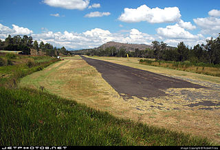
Kooralbyn is a rural locality in the Scenic Rim Region, Queensland, Australia. In the 2016 census, Kooralbyn had a population of 1,725 people.

Dugandan, Queensland Suburb of Boonah, Queensland, Australia

Dugandan is a rural town and locality in the Scenic Rim Region, Queensland, Australia. In the 2016 census, Dugandan had a population of 593 people.

Maroon, Queensland Town in Queensland, Australia

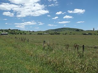
Maroon is a rural locality in the Scenic Rim Region, Queensland, Australia. In the 2016 census, Maroon had a population of 149 people.

Mount Walker, Queensland Suburb of Scenic Rim Region, Queensland, Australia

Mount Walker is a mountain and locality in the Scenic Rim Region of Queensland, Australia. The western boundary of Mount Walker is marked by the Bremer River. The central eastern parts of the locality rise to elevations above 400 m around Mount Walker. At the 2016 census Mount Walker and surrounds recorded a population of 134.

Mount Forbes, Queensland Suburb of City of Ipswich, Queensland, Australia

Mount Forbes is a locality in south-east Queensland, Australia. It is split between the local government areas of City of Ipswich and Scenic Rim Region.

Mount Alford, Queensland Town in Queensland, Australia

Mount Alford is a locality and town in the Scenic Rim Region of South East Queensland, Australia. At the 2016 census, Mount Alford recorded a population of 268. A store, school and church in the area were first built in the late 1880s. A cemetery, war memorial and other churches were established later.

Laravale, Queensland Town in Queensland, Australia

Laravale is a locality in the Scenic Rim Region of South East Queensland, Australia. At the 2016 census, Laravale recorded a population total of 189.

Josephville, Queensland Town in Queensland, Australia

Josephville is a rural locality in the Scenic Rim Region, Queensland, Australia. At the 2016 census Josephville recorded a population of 166 people. The main land use in the area is agriculture.

Coleyville, Queensland Suburb of Scenic Rim Region, Queensland, Australia

Coleyville is a rural locality in the Scenic Rim Region, Queensland, Australia. In the 2016 census, Coleyville had a population of 185 people.

Lower Mount Walker, Queensland Suburb of City of Ipswich, Queensland, Australia

Lower Mount Walker is a locality split between the Scenic Rim Region and City of Ipswich local government areas of South East Queensland, Australia. In the 2016 census, Lower Mount Walker had a population of 185 people.

Cryna, Queensland Suburb of Scenic Rim Region, Queensland, Australia

Cryna is a rural locality in the Scenic Rim Region, Queensland, Australia. In the 2016 census, Cryna had a population of 113 people.

Coochin, Queensland Suburb of Scenic Rim Region, Queensland, Australia

Coochin is a locality in the Scenic Rim Region, Queensland, Australia. In the 2016 census, Coochin had a population of 96 people.

Gleneagle, Queensland Suburb of Scenic Rim Region, Queensland, Australia

Gleneagle is a rural locality in the Scenic Rim Region, Queensland, Australia. In the 2016 census, Gleneagle had a population of 1877 people.

Coulson, Queensland Suburb of Scenic Rim Region, Queensland, Australia

Coulson is a rural locality in the Scenic Rim Region, Queensland, Australia. In the 2016 census, Coulson had a population of 195 people.

Milford, Queensland Suburb of Scenic Rim Region, Queensland, Australia

Milford is a rural locality in the Scenic Rim Region, Queensland, Australia. In the 2016 census, Milford had a population of 207 people.

Charlwood, Queensland Suburb of Scenic Rim Region, Queensland, Australia

Charlwood is a locality in the Scenic Rim Region, Queensland, Australia. In the 2016 census, Charlwood had a population of 139 people.

Milbong, Queensland Suburb of Scenic Rim Region, Queensland, Australia

Milbong is a locality in the Scenic Rim Region, Queensland, Australia.

Moogerah, Queensland Suburb of Scenic Rim Region, Queensland, Australia

Moogerah is a locality in the Scenic Rim Region, Queensland, Australia.

Tarome, Queensland Suburb of Scenic Rim Region, Queensland, Australia

Tarome is a rural locality in the Scenic Rim Region, Queensland, Australia.

Croftby, Queensland Suburb of Scenic Rim Region, Queensland, Australia

Croftby is the locality in the Scenic Rim Region, Queensland, Australia. In the 2016 census, Croftby had a population of 133. The town of Teviot is within the locality.

References

  1. 1 2 Australian Bureau of Statistics (27 June 2017). "Tarome". 2016 Census QuickStats. Retrieved 14 September 2019. OOjs UI icon edit-ltr-progressive.svg
  2. "Bunjurgen – locality in Scenic Rim Region (entry 45120)". Queensland Place Names. Queensland Government . Retrieved 8 November 2017.
  3. Queensland Family History Society (2010), Queensland schools past and present (Version 1.01 ed.), Queensland Family History Society, ISBN   978-1-921171-26-0