
Rathdowney is a rural town and locality in the Scenic Rim Region, Queensland, Australia. In the 2016 census, Rathdowney had a population of 308 people.

Beaudesert is a rural town and locality in the Scenic Rim Region, Queensland, Australia. It is south of Brisbane and west of Gold Coast. In the 2016 census, Beaudesert had a population of 6,395 people.

The Logan River is a perennial river located in the Scenic Rim, Logan and Gold Coast local government areas of the South East region of Queensland, Australia. The 184-kilometre (114 mi)-long river is one of the dominant waterways in South East Queensland that drains the southern ranges of the Scenic Rim and empties into Moreton Bay after navigating the City of Logan, a major suburban centre located south of Brisbane. The catchment is dominated by urban and agricultural land use. Near the river mouth are mangrove forests and a number of aquaculture farms.

The Albert River is a perennial river located in the South East region of Queensland, Australia. Its catchment lies within the Gold Coast and Scenic Rim Region local government areas and covers an area of 782 square kilometres (302 sq mi). The river provides potable water for the town of Beaudesert.
The Shire of Beaudesert was a local government area located in South East Queensland, Australia, stretching from the New South Wales border, along the Gold Coast hinterland to the urban fringes of the cities of Brisbane and Ipswich. The Shire covered an area of 2,854.3 square kilometres (1,102.1 sq mi), and existed from 1879 until its abolition on 15 March 2008, following which it was split between Logan City and the new Scenic Rim Region.

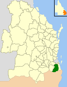
The Scenic Rim Region is a local government area in West Moreton region of South East Queensland, Australia. Established in 2008, it was preceded by several previous local government areas with histories extending back to the early 1900s and beyond. The main town of the region is Beaudesert.

The Beaudesert Shire Tramway was a narrow gauge tramway which operated from Beaudesert to Lamington and Rathdowney in Queensland. It was one of 15 light railways built and operated by Divisional Boards and Shire Councils in Queensland. The line carried passengers and cargo. It operated from 1903 to 1944. It was initially profitable and seen as a great success for the local shire council. The tramway is credited with opening up the agricultural lands of the upper Logan River.

Kagaru is a rural locality split between Scenic Rim Region and City of Logan, Queensland, Australia. In the 2016 census, Kagaru had a population of 13.

Tamborine is a town in the Scenic Rim Region and a locality split between the Scenic Rim Region and the City of Logan in Queensland, Australia. The neighbourhood of Plunkett is within the locality.

Undullah is a locality split between the City of Logan and the Scenic Rim Region, Queensland, Australia.

Veresdale is a locality split between the City of Logan and the Scenic Rim Region, Queensland, Australia.
Veresdale Scrub is a locality split between the City of Logan and the Scenic Rim Region, Queensland, Australia.

Tabragalba is a locality in the Scenic Rim Region of South East Queensland, Australia.

Hillview is a small town and locality in the Scenic Rim Region of South East Queensland, Australia. In the 2016 census, Hillview had a population of 74.

Christmas Creek is a locality in the Scenic Rim Region of South East Queensland, Australia. The eastern border of the locality is marked by the high point of the JinBroken Range while the west is similar defined by another ridgeline. Christmas Creek, a tributary of the Logan River flows in north/south direction roughly parallel to the only main road in the area called Christmas Creek Road. According to the 2016 census, Christmas Creek has a total population of 53.

Laravale is a locality in the Scenic Rim Region of South East Queensland, Australia. At the 2016 census, Laravale recorded a population total of 189.

Josephville is a locality in the Scenic Rim Region, Queensland, Australia. At the 2016 census Josephville and surrounding localities recorded a combined population total of 166. The main land use in the area is agriculture.
Innisplain is a rural locality in the Scenic Rim Region, Queensland, Australia. In the 2016 census, Innisplain and surrounding localities had a population of 85 people.

Running Creek is a large rural locality in the Scenic Rim Region on the southern border of Queensland, Australia.

Lamington is a rural locality in the Scenic Rim Region, Queensland, Australia. In the 2016 census, Lamington and surrounding localities had a population of 86 people.


