North Tamborine, Queensland

Last updated

North Tamborine
Queensland
View north from The Knoll Tamborine Mountain.JPG
View from The Knoll
Australia Queensland location map.svg
Red pog.svg
North Tamborine
Coordinates 27°55′23″S153°12′27″E / 27.9231°S 153.2074°E / -27.9231; 153.2074 (North Tamborine (town centre)) Coordinates: 27°55′23″S153°12′27″E / 27.9231°S 153.2074°E / -27.9231; 153.2074 (North Tamborine (town centre))
Established1875
Postcode(s) 4272
Time zone AEST (UTC+10:00)
LGA(s) Scenic Rim Region
State electorate(s) Scenic Rim
Federal Division(s) Wright

North Tamborine is a rural town in the locality of Tamborine Mountain in the Scenic Rim Region, Queensland, Australia. [1]

Contents

Geography

North Tamborine is located 40 kilometres (25 mi) from the Gold Coast.

History

Many early settlers grew maize and grazed dairy cattle. [2] The first guesthouse on the mountain was opened in 1889. [2]

A tourist road to the mountain was completed in 1924. [2] The road brought visitors to the area and the North Tamborine village became the centre for social and business activities. North Tamborine Post Office opened by 1922. [3]

A section of Tamborine National Park known as The Knoll protects forests found in the north of the suburb.

Formerly a suburb in its own right, in 1997, North Tamborine was merged with other former suburbs Eagle Heights and Mount Tamborine to create the larger locality of Tamborine Mountain. [4]

Heritage listings

North Tamborine has a number of heritage-listed sites, including:

See also

Related Research Articles

Tamborine National Park Protected area in Queensland, Australia

Tamborine is a national park in the Gold Coast hinterland and is a part of the Scenic Rim Regional Council of South East Queensland, Australia, 45 km (28 mi) south of Brisbane.

Rathdowney, Queensland Town in Queensland, Australia

Rathdowney is a rural town and locality in the Scenic Rim Region, Queensland, Australia. In the 2016 census, Rathdowney had a population of 308 people.

Aratula Town in Queensland, Australia

Aratula is a rural town and locality in the Scenic Rim Region, Queensland, Australia. In the 2016 census, Aratula had a population of 532 people.

Canungra, Queensland Town in Queensland, Australia

Canungra is a rural town and locality in the Scenic Rim Region, Queensland, Australia. In the 2016 census the locality of Canungra had a population of 1,229 people.

Mount Molloy, Queensland Town in Queensland, Australia

Mount Molloy is a rural town and locality in the Shire of Mareeba, Queensland, Australia. In the 2016 census the locality of Mount Molloy had a population of 254 people.

Tamborine Mountain Suburb of Scenic Rim Region, Queensland, Australia

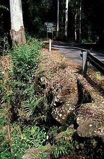
Tamborine Mountain is a 28 km2 (11 sq mi) plateau and locality in the Scenic Rim Region of South East Queensland, Australia. The name is of Aboriginal origin and is frequently misspelt as Tambourine but neither the name nor the place has any connection to the musical instrument. It is considered part of the Gold Coast hinterland and has a strong tourist industry.

Montville, Queensland Town in Queensland, Australia

Montville is a rural town and locality in the Sunshine Coast Region, Queensland, Australia. In the 2016 census, Montville had a population of 970 people.

Hampton, Queensland Town in Queensland, Australia

Hampton is a rural town and locality in the Toowoomba Region, Queensland, Australia. In the 2016 census, Hampton had a population of 356 people.

Beechmont, Queensland Suburb of Scenic Rim Region, Queensland, Australia

Beechmont is a rural town and locality in the Scenic Rim Region, Queensland, Australia. In the 2016 census the locality of Beechmont had a population of 842 people.

Eagle Heights, Queensland Town in Queensland, Australia

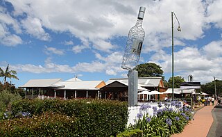
Eagle Heights is a town within the locality of Tamborine Mountain in South East Queensland, Australia.

Mount Tamborine, Queensland Town in Queensland, Australia

Mount Tamborine is a town within the locality of Tamborine Mountain in South East Queensland, Australia.

Springbrook, Queensland Town in Queensland, Australia

Springbrook is a mountain and plateau in the Gold Coast hinterland of South East Queensland, Australia. It is also the name of the associated rural town and locality within the City of Gold Coast. In the 2016 census, the locality of Springbrook had a population of 659 people.

Maroon, Queensland Town in Queensland, Australia

Maroon is a rural locality in the Scenic Rim Region, Queensland, Australia. In the 2016 census, Maroon had a population of 149 people.

Wonglepong, Queensland Suburb of Scenic Rim Region, Queensland, Australia

Wonglepong is a rural locality in the Scenic Rim Region, Queensland, Australia. In the 2016 census Wonglepong had a population of 341 people.

Witheren Suburb of Scenic Rim Region, Queensland, Australia

Witheren is a rural locality in the Scenic Rim Region, Queensland, Australia. In the 2016 census Witheren had a population of 496 people.

Boyland, Queensland Suburb of Scenic Rim Region, Queensland, Australia

Boyland is a rural locality in the Scenic Rim Region, Queensland, Australia. In the 2016 census Boyland had a population of 823 people.

Wongawallan, Queensland Suburb of City of Gold Coast, Queensland, Australia

Wongawallan is a rural locality in the City of Gold Coast, Queensland, Australia. In the 2016 census Wongawallan had a population of 1,273 people.

Tamborine, Queensland Suburb of Logan City, Queensland, Australia

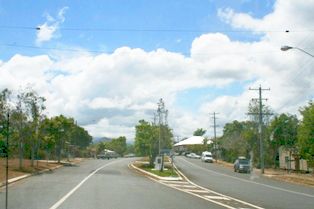
Tamborine is a town in the Scenic Rim Region and a locality split between the Scenic Rim Region and the City of Logan in Queensland, Australia. In the 2016 census the locality of Tamborine had a population of 3,950 people.

Tamborine Mountain Road

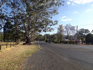
Tamborine Mountain Road is a heritage-listed road at Geissmann Drive, North Tamborine, Scenic Rim Region, Queensland, Australia. It was built from 1922 to 1925. It is also known as Tamborine Station-Tamborine Mountain Road and Geissmann Drive. It was added to the Queensland Heritage Register on 5 August 2003.

Benobble, Queensland Suburb of Scenic Rim Region, Queensland, Australia

Benobble is a rural locality in the Scenic Rim Region, Queensland, Australia. In the 2016 census Benobble had a population of 43 people.

References

  1. "North Tamborine – town in Scenic Rim Region (entry 24723)". Queensland Place Names. Queensland Government . Retrieved 29 December 2020.
  2. 1 2 3 Queensland Environmental Protection Agency (2000). Heritage Trails of the Great South East. State of Queensland. p. 14. ISBN   0-7345-1008-X.
  3. Phoenix Auctions History. "Post Office List". Phoenix Auctions. Retrieved 21 February 2021.
  4. "Eagle Heights". Queensland Places. Centre for the Government of Queensland, University of Queensland. Retrieved 31 January 2016.
  5. "Tamborine Mountain Road/Geissmann Drive (entry 602365)". Queensland Heritage Register . Queensland Heritage Council. Retrieved 12 July 2013.

Commons-logo.svg Media related to North Tamborine, Queensland at Wikimedia Commons