Gleneagle, Queensland

Last updated

Gleneagle
Scenic Rim Region,  Queensland
Fields along Alan Creek Road at Gleneagle, Queensland 2.jpg
Fields along Alan Creek Road, 2016
Australia Queensland location map.svg
Red pog.svg
Gleneagle
Coordinates 27°56′26″S152°57′42″E / 27.9405°S 152.9616°E / -27.9405; 152.9616 (Gleneagle (centre of locality))
Population2,106 (2021 census) [1]
 • Density67.50/km2 (174.8/sq mi)
Postcode(s) 4285
Area31.2 km2 (12.0 sq mi)
Time zone AEST (UTC+10:00)
Location
LGA(s) Scenic Rim Region
State electorate(s) Scenic Rim
Federal division(s) Wright
Suburbs around Gleneagle:
Allenview Veresdale Veresdale
Allenview Gleneagle Veresdale
Bromelton Bromelton Beaudesert

Gleneagle is a rural locality in the Scenic Rim Region, Queensland, Australia. [2] In the 2021 census, Gleneagle had a population of 2,106 people. [1]

Contents

Geography

The Logan River and the Mount Lindesay Highway pass through eastern parts of locality. Large sections of land are rural with some parts used for irrigated agriculture. A housing estate was established to the east of the highway. In the centre of Gleneagle is a large man-made dam called Lake Brabazon. The western boundary follows the Sydney–Brisbane railway line.Gin Gin, Queensland.[ citation needed ]

History

The locality takes its name from a cotton farm called Glen Eagles established in the 1860s by William Tutin Walker (1833-1920). Walker began as a manager on Townsvale established by Robert Towns who pioneered cotton growing in the Logan River valley. Townsvale was in the area of the present-day localities of Gleneagle and Veresdale. After Towns' death, Walker took over Townsvale. [3] [4]

St Joseph's Catholic Church was the first Catholic church in the Logan River valley and was opened in 1876 on a 4-acre (1.6 ha) site, then known as Tullamore Hill, later as Veresdale, and now within Gleneagle. The site for the church was donated by William Rafter, whose residence was called Tullamore after his home town Tullamore in Ireland. Tullamore was the major centre of the district (prior to the rise of Beaudesert as the major centre). A cemetery was established behind the church. On 2 June 1889 Roman Catholic Archbishop Robert Dunne blessed the Catholic cemetery (now known as the Gleneagle Catholic Cemetery). In 1936 the church was lined and ceiled for the first time. By the early 1950s the smal church was in poor repair and it had a very small congregation (St Mary's Catholic Church in Beaudesert was very large and by then the major town of the district). [5] [6] At that time, Mass was being held regularly at the O'Reilly Guesthouse in Goblin Wood, the private home of Bernard O'Reilly. So it was decided to relocate St Joseph's to the O'Reilly Guesthouse as a permanent church. It was dismantled, transported and re-assembled. On 27 November 1955, Father Steele presided over the first Mass in the relocated church ( 28°13′51″S153°08′06″E / 28.2309°S 153.1351°E / -28.2309; 153.1351 (St Joseph's Church, O'Reilly's) ) and Archbishop James Duhig performed the opening ceremony. Although privately owned by the O'Reilly family, it is still strongly associated with the Beaudesert Catholic parish. [7] In 1983 the Catholic cemetery at Waterford West was sold by the Catholic Church for re-development; graves marked with headstones were exhumed and relocated to Gleneagle Catholic Cemetery. [8]

Gleneagle railway station ( 27°56′07″S152°58′52″E / 27.9353°S 152.9811°E / -27.9353; 152.9811 (Gleneagle railway station) ) was on the disused Beaudesert railway line from Bethania to Beaudesert. [9] The line opened on 16 May 1888. [10]

Gleneagle Provisional School opened on 18 March 1891. It closed circa 1899. In 1902 it reopened as Gleneagle Provisional School and on 1 January 1909 became Gleneagle State School. [11]

Allen's Creek Provisional School opened on 4 October 1927 and closed on 18 September 1929. It was a railway camp school and provided schooling for children of workers building the Sydney–Brisbane rail corridor. [11] Allan's Creek (as it is currently spelled) crosses the railway line at the intersection of three present-day localities: Allenview, Bromelton and Gleneagle. [12]

Demographics

In the 2016 census, Gleneagle had a population of 1,877 people. [13] The locality contained 651 households, in which 48.9% of the population were males and 51.1% of the population were females with a median age of 33, 5 years below the national average. The average weekly household income was $1,332, $106 below the national average. 3.7% of Gleneagle's population was either of Aborigional or Torres Strait Islander descent. 62.4% of the population aged 15 or over was either registered or de facto married, while 37.6% of the population was not married. 31.9% of the population were attending some form of education. The most common nominated ancestries were Australian (36.3%), English (29.8%) and Scottish (7.9%), while the most common country of birth was Australia (83.5%), and the most commonly spoken language at home was English (91.4%). The most common nominated religions were No religion (27.4%), Catholic (22.0%) and Anglican (20.1%). The most common occupation was a technician/trades worker (17.2%) and the majority/plurality of residents worked 40 or more hours per week (43.9%). [13]

In the 2021 census, Gleneagle had a population of 2,106 people. [1]

Education

Gleneagle State School is a government primary (Prep-6) school for boys and girls at 126-146 Mount Lindesay Highway ( 27°56′16″S152°58′57″E / 27.9378°S 152.9824°E / -27.9378; 152.9824 (Gleneagle State School) ). [14] [15] In 2017, the school had an enrolment of 211 students with 17 teachers (14 full-time equivalent) and 9 non-teaching staff (5 full-time equivalent). [16]

There is no secondary school in Gleneagle; the nearest one is Beaudesert State High School in neighbouring Beaudesert. [12]

Amenities

The Gleneagle Catholic cemetery at 6659 Mount Lindesay Highway ( 27°56′47″S152°59′09″E / 27.9464°S 152.9857°E / -27.9464; 152.9857 (Gleneagle Catholic Cemetery) ) is operated by the Beaudesert Catholic parish. [12] [17]

Related Research Articles

<span class="mw-page-title-main">Rathdowney, Queensland</span> Town in Queensland, Australia

Rathdowney is a rural town and locality in the Scenic Rim Region, Queensland, Australia. In the 2016 census, Rathdowney had a population of 308 people.

<span class="mw-page-title-main">Beaudesert, Queensland</span> Town in Queensland, Australia

Beaudesert is a rural town and locality in the Scenic Rim Region, Queensland, Australia. In the 2016 census, Beaudesert had a population of 6,395 people.

<span class="mw-page-title-main">Mount Lindesay (Queensland)</span> Suburb of Scenic Rim Region, Queensland, Australia

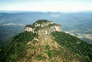
Mount Lindesay is a rural locality in the Scenic Rim Region, Queensland, Australia. It borders New South Wales. In the 2016 census, Mount Lindesay had a population of 3 people.

<span class="mw-page-title-main">O'Reilly's Rainforest Retreat</span> Building

O'Reilly's Rainforest Retreat is a tourist destination in the locality of O'Reilly, Scenic Rim Region, Queensland, Australia. It is situated in the heart of the Lamington National Park, two hours by road south of Brisbane and 90 minutes by road west of the Gold Coast. Access to the mountain resort is via Canungra. Guests began staying from Easter 1926. Gravel road to the door of the retreat was completed in early 1947, marking a distinct change in the site's accessibility.

<span class="mw-page-title-main">Tamrookum, Queensland</span> Suburb of Scenic Rim Region, Queensland, Australia

Tamrookum is a rural locality in the Scenic Rim Region, Queensland, Australia. In the 2016 census, Tamrookum had a population of 91 people.

<span class="mw-page-title-main">Kerry, Queensland</span> Town in Queensland, Australia

Kerry is a rural locality in the Scenic Rim Region, Queensland, Australia. In the 2016 census, Kerry had a population of 326 people.

<span class="mw-page-title-main">Barney View, Queensland</span> Suburb of Scenic Rim Region, Queensland, Australia

Barney View is a rural locality in the Scenic Rim Region, Queensland, Australia. In the 2021 census, Barney View had a population of 38 people.

<span class="mw-page-title-main">Cedar Grove, Queensland</span> Suburb of Logan City, Queensland, Australia

Cedar Grove is a mixed-use locality in the City of Logan, Queensland, Australia. In the 2021 census, Cedar Grove had a population of 1,992 people.

<span class="mw-page-title-main">Tamborine, Queensland</span> Suburb of Logan City, Queensland, Australia

Tamborine is a rural town in the Scenic Rim Region and a locality split between the Scenic Rim Region and the City of Logan in Queensland, Australia. In the 2016 census, the locality of Tamborine had a population of 3,950 people.

<span class="mw-page-title-main">Veresdale, Queensland</span> Suburb of Logan City, Queensland, Australia

Veresdale is a locality split between the City of Logan and the Scenic Rim Region, Queensland, Australia. In the 2016 census, Veresdale had a population of 392 people.

Veresdale Scrub is a locality split between the Scenic Rim Region and the City of Logan, both in Queensland, Australia. In the 2016 census, Veresdale Scrub had a population of 481 people.

<span class="mw-page-title-main">Woodhill, Queensland</span> Suburb of Logan City, Queensland, Australia

'Woodhill is a rural locality in the City of Logan, Queensland, Australia. In the 2021 census, Woodhill had a population of 1,231 people.

<span class="mw-page-title-main">Allenview, Queensland</span> Suburb of Scenic Rim Region, Queensland, Australia

Allenview is a rural locality in the Scenic Rim Region, Queensland, Australia. In the 2021 census, Allenview had a population of 209 people.

<span class="mw-page-title-main">Laravale, Queensland</span> Town in Queensland, Australia

Laravale is a rural locality in the Scenic Rim Region, Queensland, Australia. In the 2016 census, Laravale had a population of 189 people.

<span class="mw-page-title-main">Josephville, Queensland</span> Town in Queensland, Australia

Josephville is a rural locality in the Scenic Rim Region, Queensland, Australia. In the 2016 census, Josephville had a population of 166 people.

<span class="mw-page-title-main">Palen Creek, Queensland</span> Suburb of Scenic Rim Region, Queensland, Australia

Palen Creek is a rural locality in the Scenic Rim Region, Queensland, Australia. It borders New South Wales. In the 2016 census, Palen Creek had a population of 280 people.

<span class="mw-page-title-main">Wyaralong, Queensland</span> Suburb of Scenic Rim Region, Queensland, Australia

Wyaralong is a rural locality in the Scenic Rim Region, Queensland, Australia. In the 2016 census, Wyaralong had a population of 20 people.

<span class="mw-page-title-main">Innisplain, Queensland</span> Suburb of Scenic Rim Region, Queensland, Australia

Innisplain is a rural locality in the Scenic Rim Region, Queensland, Australia. In the 2021 census, Innisplain had a population of 79 people.

<span class="mw-page-title-main">Running Creek, Queensland</span> Suburb of Scenic Rim Region, Queensland, Australia

Running Creek is a rural locality in the Scenic Rim Region, Queensland, Australia. In the 2016 census, Running Creek had a population of 147 people. It borders New South Wales.

<span class="mw-page-title-main">Coulson, Queensland</span> Suburb of Scenic Rim Region, Queensland, Australia

Coulson is a rural locality in the Scenic Rim Region, Queensland, Australia. In the 2021 census, Coulson had a population of 168 people.

References

  1. 1 2 3 Australian Bureau of Statistics (28 June 2022). "Gleneagle (SAL)". 2021 Census QuickStats. Retrieved 28 February 2023. OOjs UI icon edit-ltr-progressive.svg
  2. "Gleneagle – locality in Scenic Rim Region (entry 45143)". Queensland Place Names. Queensland Government . Retrieved 16 November 2019.
  3. "Gleneagle". Queensland Places. Centre for the Government of Queensland, University of Queensland. Archived from the original on 20 December 2016. Retrieved 11 December 2016.
  4. "Veresdale". Logan City Council . Archived from the original on 18 March 2020. Retrieved 17 May 2020.
  5. "PUTTING THE CLOCK BACK". The Beaudesert Times . Queensland, Australia. 13 June 1941. p. 1. Archived from the original on 28 January 2021. Retrieved 17 May 2020 via Trove.
  6. "ROMAN CATHOLIC CHURCHES". The Beaudesert Times . Queensland, Australia. 8 May 1936. p. 1. Archived from the original on 28 January 2021. Retrieved 17 May 2020 via Trove.
  7. "St Joseph's, O'Reilly's". St Mary's Catholic Parish Beaudesert. Archived from the original on 17 May 2020. Retrieved 17 May 2020.
  8. "Waterford West Catholic Cemetery – now shops" (PDF). Logan City Council . 5 March 2019. Archived from the original on 5 March 2019. Retrieved 17 May 2020.{{cite web}}: CS1 maint: unfit URL (link)
  9. "Gleneagle – railway station in the Scenic Rim Region (entry 13961)". Queensland Place Names. Queensland Government . Retrieved 2 April 2020.
  10. Kerr, John (1990). Triumph of narrow gauge : a history of Queensland Railways. Boolarong Publications. p. 224. ISBN   978-0-86439-102-5.
  11. 1 2 Queensland Family History Society (2010), Queensland schools past and present (Version 1.01 ed.), Queensland Family History Society, ISBN   978-1-921171-26-0
  12. 1 2 3 "Queensland Globe". State of Queensland . Retrieved 14 November 2019.
  13. 1 2 Australian Bureau of Statistics (27 June 2017). "Gleneagle (SSC)". 2016 Census QuickStats. Retrieved 20 October 2018. OOjs UI icon edit-ltr-progressive.svg
  14. "State and non-state school details". Queensland Government. 9 July 2018. Archived from the original on 21 November 2018. Retrieved 21 November 2018.
  15. "Gleneagle State School". Archived from the original on 20 April 2013. Retrieved 21 November 2018.
  16. "ACARA School Profile 2017". Archived from the original on 22 November 2018. Retrieved 22 November 2018.
  17. "Private Cemeteries Scenic Rim Region and Surrounds". Scenic Rim Regional Council . Archived from the original on 17 May 2020. Retrieved 17 May 2020.