Roadvale, Queensland

Last updated

Map all coordinates using: OpenStreetMap  
Download coordinates as: KML
Roadvale
Queensland
StateLibQld 1 69627 Badke family of Roadvale, 1928.jpg
Badke family of Roadvale, 1928
Australia Queensland location map.svg
Red pog.svg
Roadvale
Coordinates 27°55′14″S152°42′10″E / 27.9205°S 152.7027°E / -27.9205; 152.7027 Coordinates: 27°55′14″S152°42′10″E / 27.9205°S 152.7027°E / -27.9205; 152.7027
Population286 (2016 census) [1]
 • Density16.34/km2 (42.33/sq mi)
Postcode(s) 4310
Area17.5 km2 (6.8 sq mi)
Time zone AEST (UTC+10:00)
Location
LGA(s) Scenic Rim Region
State electorate(s) Scenic Rim
Federal division(s) Blair
Localities around Roadvale:
Blantyre Anthony Milbong
Obum Obum Roadvale Wyaralong
Kulgun Teviotville Coulson

Roadvale is a rural locality in the Scenic Rim Region, Queensland, Australia. [2]

Contents

Geography

Roadvale is 14 kilometres (8.7 mi) north of the town Boonah and 79 kilometres (49 mi) south-west of the state capital Brisbane.[ citation needed ]

The main street is Gray Street, which is also the Roadvale-Kalbar Road.[ citation needed ]

Roadvale is a growing centre for many of the small crop products sold in South East Queensland and other areas.[ citation needed ]

Ipswich – Boonah Road (State Route 93) runs through from north to south. [3]

History

The locality takes its name from its former railway station which was named by the Queensland Railways Department in 1887, because of its location at a road junction. [2]

The Fassifern railway line (Queensland's first branch railway line) opened from Ipswich to Harrisville on 10 July 1882. On 12 September 1887 the line was extended to Dugundan with the Roadvale district being served by Roadvale railway station on the corner of Wilsons Plains Road and Redhill Road ( 27°54′59″S152°41′02″E / 27.9164°S 152.6839°E / -27.9164; 152.6839 (Roadvale railway station) ). The line closed in June 1964. [4] [5]

Milbong (St Luke's) Lutheran Church and cemetery, circa 1930 Milbong Lutheran Church and cemetery, ca. 1930.jpg
Milbong (St Luke's) Lutheran Church and cemetery, circa 1930

Milbong Lutheran Church (also known as St Luke's Lutheran Church) opened on 23 September 1885. A new church (built on the site of the original church) was opened on 10 April 1906, while the old church was removed to be use as a barn but was later burned down. [6] The church closed in 1974 and the church building was removed, but the cemetery remains. [7] The church site and cemetery is on the Ispwich Boonah Road ( 27°55′56″S152°42′53″E / 27.9322°S 152.7147°E / -27.9322; 152.7147 (Milbong (St Luke's) Lutheran church (former) and cemetery) ). [8]

St Andrew's Anglican Church was dedicated on 11 May 1912 by Venerable Henry Le Fanu, the Archdeacon of Toowoomba. In 1926, the church closed and the building was relocated to Camp Hill in Brisbane to become the Anglican Church of the Annunciation. [9] [10]

In 1915 most of the town was destroyed by fire. [11] Despite rebuilding many businesses, the town has never recovered from the devastating fire.[ citation needed ]

At the 2006 census, Roadvale and the surrounding area had a population of 559. [12]

In the 2016 census, Roadvale had a population of 286 people. [1]

Heritage listings

The heritage-listed sites in Roadvale include:

Facilities

It has a pub and a small general store in the main street.[ citation needed ]

See also

Related Research Articles

<span class="mw-page-title-main">Boonah, Queensland</span> Town in Queensland, Australia

Boonah is a rural town and locality in the Scenic Rim Region, Queensland, Australia. In the 2016 census, the locality of Boonah had a population of 2,484 people.

<span class="mw-page-title-main">Aratula</span> Town in Queensland, Australia

Aratula is a rural town and locality in the Scenic Rim Region, Queensland, Australia. In the 2016 census, the locality of Aratula had a population of 532 people.

<span class="mw-page-title-main">Kalbar, Queensland</span> Town in Queensland, Australia

Kalbar is a rural town and locality in the Scenic Rim Region, Queensland, Australia. In the 2016 census, the locality of Kalbar had a population of 1,093 people.

<span class="mw-page-title-main">Dugandan, Queensland</span> Suburb of Boonah, Queensland, Australia

Dugandan is a rural town and locality in the Scenic Rim Region, Queensland, Australia. In the 2016 census, Dugandan had a population of 593 people.

<span class="mw-page-title-main">Purga, Queensland</span> Suburb of City of Ipswich, Queensland, Australia

Purga is a rural locality in the City of Ipswich, Queensland, Australia. In the 2016 census, Purga had a population of 576 people.

<span class="mw-page-title-main">Maroon, Queensland</span> Suburb of Scenic Rim Region, Queensland, Australia

Maroon is a rural locality in the Scenic Rim Region, Queensland, Australia. In the 2016 census, Maroon had a population of 149 people.

<span class="mw-page-title-main">Rosevale, Queensland</span> Town in Queensland, Australia

Rosevale is a rural locality in the Scenic Rim Region, Queensland, Australia. In the 2016 census, Rosevale had a population of 208 people.

<span class="mw-page-title-main">Harrisville, Queensland</span> Town in Queensland, Australia

Harrisville is a rural town and locality in the Scenic Rim Region, Queensland, Australia. In the 2016 census, the locality of Harrisville had a population of 613 people.

<span class="mw-page-title-main">Peak Crossing, Queensland</span> Suburb of City of Ipswich, Queensland, Australia

Peak Crossing is a rural locality split between the City of Ipswich and the Scenic Rim Region of Queensland, Australia. In the 2016 census, Peak Crossing had a population of 965 people.
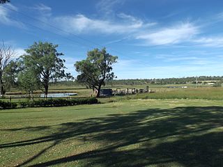
<span class="mw-page-title-main">Munbilla, Queensland</span> Town in Queensland, Australia

Munbilla is a rural town and locality in the Scenic Rim Region, Queensland, Australia. In the 2016 census, the locality of Munbilla had a population of 100 people.
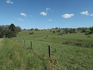
<span class="mw-page-title-main">Templin, Queensland</span> Suburb of Scenic Rim Region, Queensland, Australia

Templin is a rural locality in the Scenic Rim Region, Queensland, Australia. In the 2016 census, Templin had a population of 86 people.

<span class="mw-page-title-main">Hoya, Queensland</span> Suburb of Scenic Rim Region, Queensland, Australia

Hoya is a rural locality in the Scenic Rim Region, Queensland, Australia. In the 2016 census, Hoya had a population of 220 people.

<span class="mw-page-title-main">Fassifern, Queensland</span> Suburb of Scenic Rim Region, Queensland, Australia

Fassifern is a rural locality in the Scenic Rim Region, Queensland, Australia. In the 2016 census, Fassifern had a population of 21 people.

<span class="mw-page-title-main">Fassifern Valley, Queensland</span> Suburb of Scenic Rim Region, Queensland, Australia

Fassifern Valley is a rural locality in the Scenic Rim Region, Queensland, Australia. In the 2016 census, Fassifern Valley had a population of 91 people.
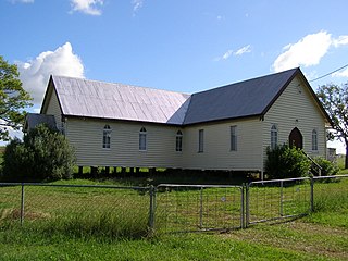
<span class="mw-page-title-main">Milbong, Queensland</span> Suburb of Scenic Rim Region, Queensland, Australia

Milbong is a rural locality in the Scenic Rim Region, Queensland, Australia. In the 2016 census, Milbong had a population of 161 people.

Kulgun is a locality in the Scenic Rim Region, Queensland, Australia. In the 2016 census, Kulgun had a population of 67 people.

Morwincha is a rural locality in the Scenic Rim Region, Queensland, Australia. In the 2016 census, Morwincha had a population of 30 people.

Radford is a rural locality in the Scenic Rim Region, Queensland, Australia. In the 2016 census, Radford had a population of 41 people.

Ipswich–Boonah–Rathdowney Road is a continuous 87.8 kilometres (54.6 mi) road route in the Ipswich and Scenic Rim regions of Queensland, Australia. It has two official names, Ipswich–Boonah Road and Boonah–Rathdowney Road. The entire route is signed as State Route 93, and much of it is also part of Tourist Drive 16.

Beaudesert–Boonah–Fassifern Road is a non-continuous 49.9 kilometres (31.0 mi) road route in the Scenic Rim region of Queensland, Australia. It has two official names, Beaudesert–Boonah Road and Boonah–Fassifern Road. The route is signed as State Route 90. These roads are joined by a 6.8 kilometres (4.2 mi) section of Ipswich-Boonah Road. Beaudesert–Boonah Road is a state-controlled regional road, and Boonah–Fassifern Road is also a state-controlled regional road. As part of State Route 90 it provides an alternate route between the Cunningham Highway and the Gold Coast.

References

  1. 1 2 Australian Bureau of Statistics (27 June 2017). "Roadvale (SSC)". 2016 Census QuickStats. Retrieved 20 October 2018. OOjs UI icon edit-ltr-progressive.svg
  2. 1 2 "Roadvale – locality in Scenic Rim Region (entry 48335)". Queensland Place Names. Queensland Government . Retrieved 17 November 2019.
  3. Roadvale, Queensland (Map). Google Maps. Archived from the original on 31 December 2021. Retrieved 4 October 2021.
  4. Kerr, John (1990). Triumph of narrow gauge : a history of Queensland Railways. Boolarong Publications. pp. 57–58, 224. ISBN   978-0-86439-102-5.
  5. "Flinders" (Map). Queensland Government. 1927. Archived from the original on 29 May 2020. Retrieved 29 May 2020.
  6. "GOLDEN JUBILEE". Queensland Times . Vol. LXXVI, no. 15, 239. Queensland, Australia. 17 September 1935. p. 4. Archived from the original on 31 December 2021. Retrieved 31 December 2021 via National Library of Australia.
  7. "Flashback Friday". Fassifern Guardian. 18 July 2014. Archived from the original on 31 December 2021. Retrieved 31 December 2021.
  8. Google (31 December 2021). "Former Milbong Lutheran Church (formally known as St Luke's Lutheran Church)" (Map). Google Maps . Google. Retrieved 31 December 2021.
  9. "Closed Anglican Churches". Anglican Church South Queensland. Archived from the original on 3 April 2019. Retrieved 29 June 2020.
  10. "The Church of The Annunciation Anglican Church". Churches Australia. Archived from the original on 29 June 2020. Retrieved 29 June 2020.
  11. Queensland Environmental Protection Agency (2000). Heritage Trails of the Great South East. State of Queensland. p. 39. ISBN   0-7345-1008-X.
  12. Australian Bureau of Statistics (25 October 2007). "Roadvale (Boonah Shire) (State Suburb)". 2006 Census QuickStats. Retrieved 21 July 2009.
  13. "Roadvale State School (entry 650095)". Queensland Heritage Register . Queensland Heritage Council. Retrieved 15 October 2021.